
MyTopo
Classic USGS Alamo Mountain New Mexico 7.5'x7.5' Topo Map
Regular price
$16.95
Regular price
Sale price
$16.95
Unit price
per
Couldn't load pickup availability
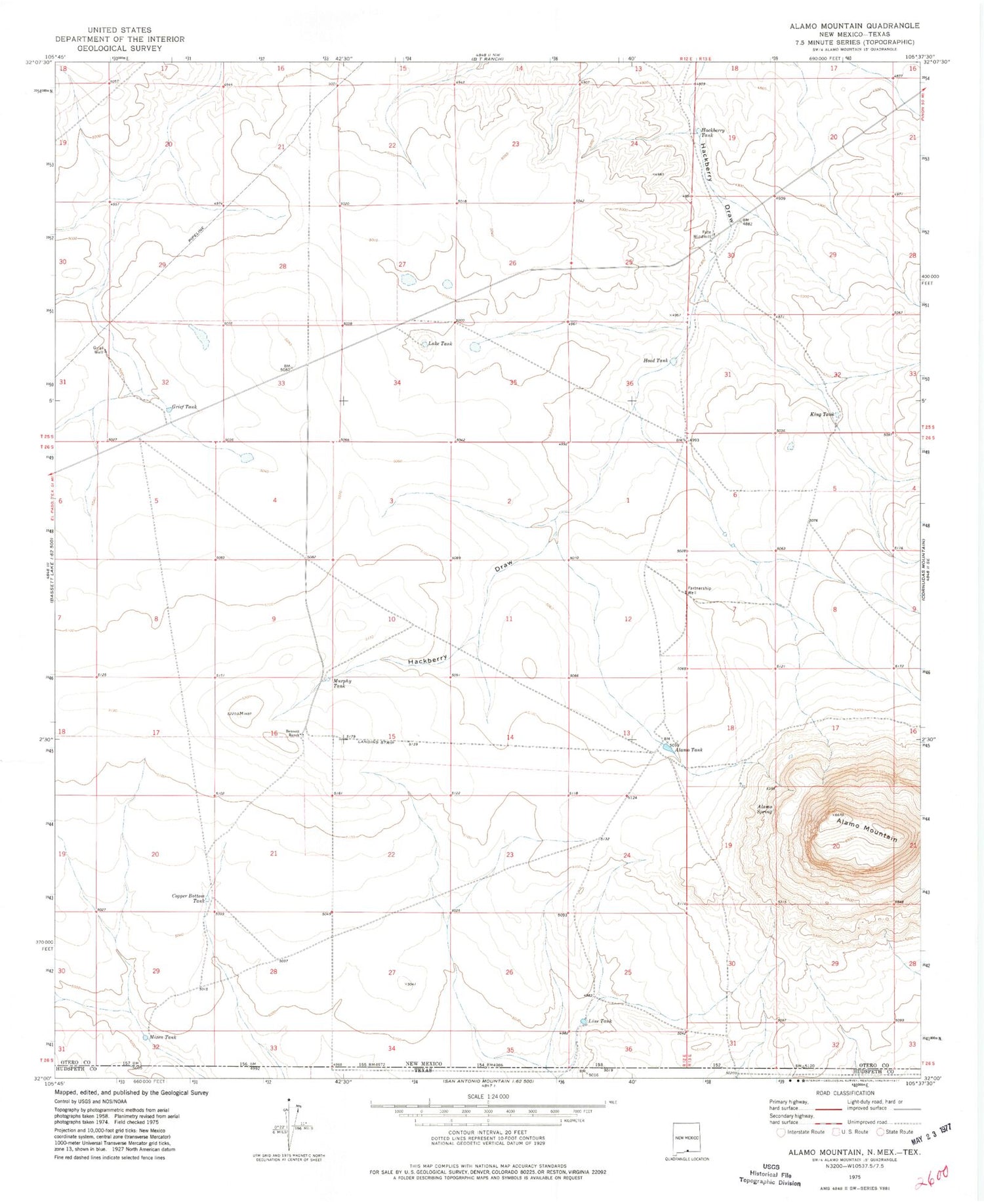
Historical USGS topographic quad map of Alamo Mountain in the state of New Mexico. Map scale may vary for some years, but is generally around 1:24,000. Print size is approximately 24" x 27"
This quadrangle is in the following counties: Hudspeth, Otero.
The map contains contour lines, roads, rivers, towns, and lakes. Printed on high-quality waterproof paper with UV fade-resistant inks, and shipped rolled.
Contains the following named places: Alamo Mountain, Alamo Spring, Alamo Springs Stage Station Historic Site, Alamo Tank, Bennett Ranch, Copper Bottom Tank, Grief Tank, Grief Well, Hackberry Tank, Hood Tank, King Tank, Lake Tank, Line Tank, Mixen Tank, Murphy Tank, Partnership Well, Pate Windmill


