MyTopo
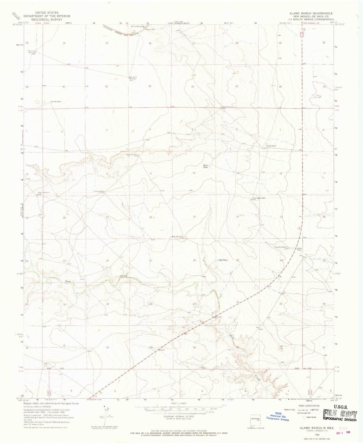
Classic USGS Alamo Ranch New Mexico 7.5'x7.5' Topo Map
Couldn't load pickup availability
Historical USGS topographic quad map of Alamo Ranch in the state of New Mexico. Map scale may vary for some years, but is generally around 1:24,000. Print size is approximately 24" x 27"
This quadrangle is in the following counties: De Baca.
The map contains contour lines, roads, rivers, towns, and lakes. Printed on high-quality waterproof paper with UV fade-resistant inks, and shipped rolled.
Contains the following named places: 10019 Water Well, 10081 Water Well, 10082 Water Well, 10083 Water Well, 10084 Water Well, 10085 Water Well, 10086 Water Well, 10087 Water Well, 10089 Water Well, 10166 Water Well, 10176 Water Well, 10177 Water Well, 10178 Water Well, Alamo Ranch, Buck Tank, Buck Windmill, Highway Windmill, Line Windmill, Miles Windmill, Old South Windmill, Orchard Windmill, Pennington Well, Rabbit Windmill, Red Sand Windmill, Red Tank, Star Windmill