MyTopo
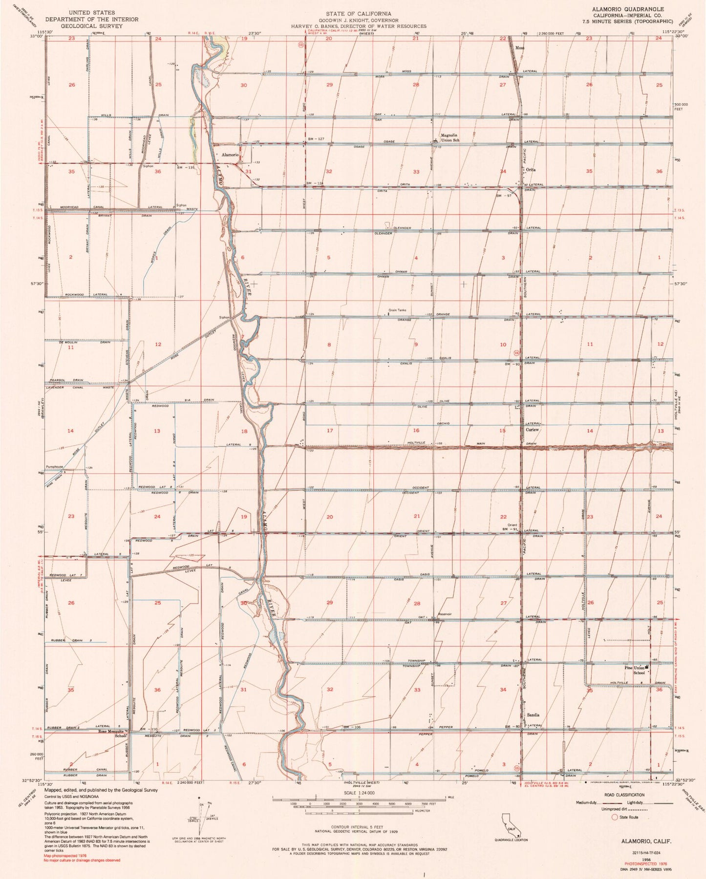
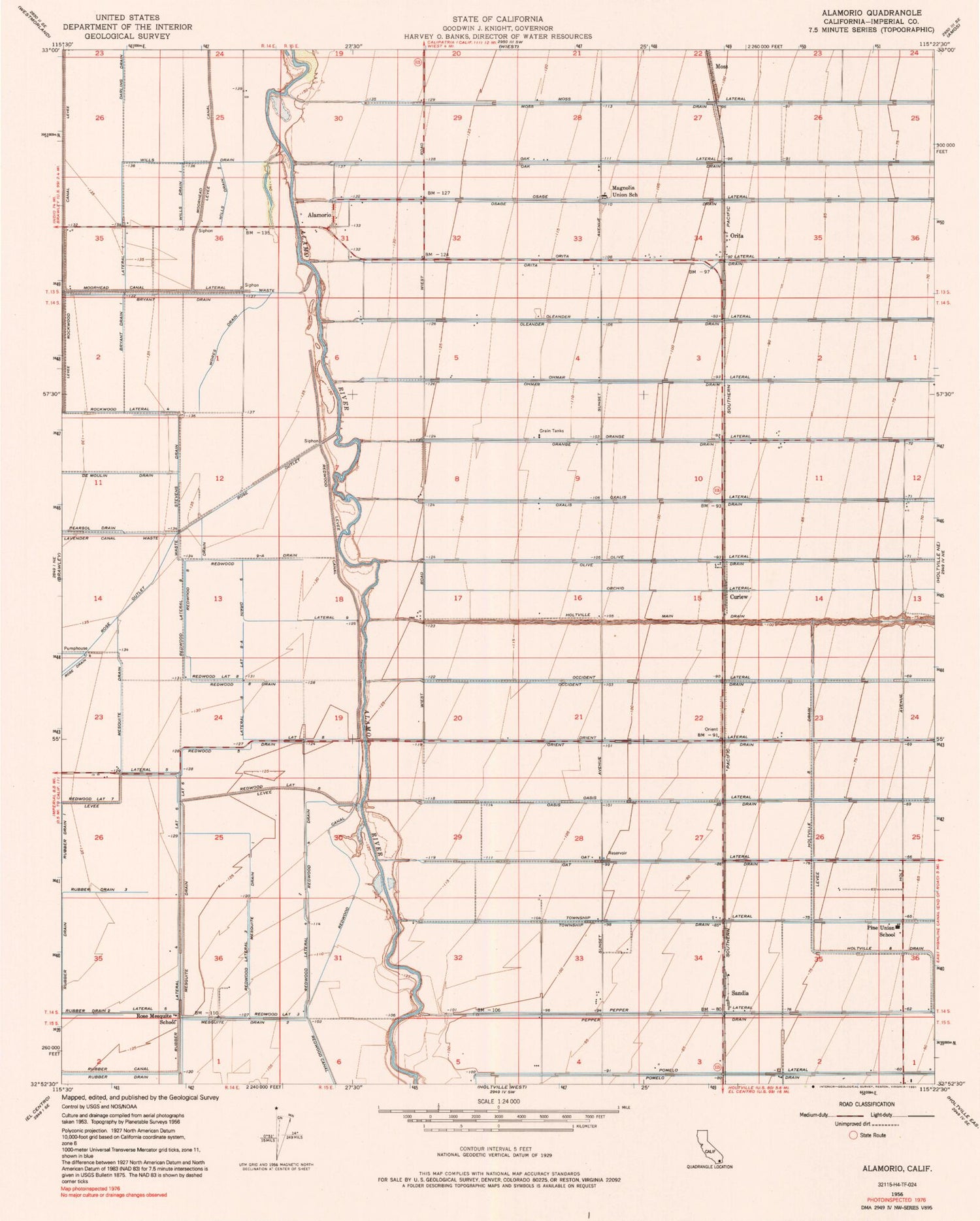
Classic USGS Alamorio California 7.5'x7.5' Topo Map
Couldn't load pickup availability
Historical USGS topographic quad map of Alamorio in the state of California. Map scale may vary for some years, but is generally around 1:24,000. Print size is approximately 24" x 27"
This quadrangle is in the following counties: Imperial.
The map contains contour lines, roads, rivers, towns, and lakes. Printed on high-quality waterproof paper with UV fade-resistant inks, and shipped rolled.
Contains the following named places: Alamorio, Brawley Division, Bryant Drain, Bryant Drain One, Curlew, De Moulin Drain, Lateral Eight, Lateral Eight-A, Lateral Five, Lateral Nine, Lateral One, Lateral Six, Lateral Two, Magnolia Union Elementary School, Mesquite Drain, Mesquite Drain One, Mesquite Drain Two, Moss, Moss Drain, Moss Lateral, Olive Lateral, Orita, Pine Elementary School, Pomelo Drain, Redwood Eight Drain, Redwood Five Drain, Redwood Four Drain, Redwood Lateral Eight, Redwood Lateral Five, Redwood Lateral Four, Redwood Lateral Three, Redwood Nine Drain, Redwood Nine-A Drain, Rockwood Lateral Four, Rose Mesquite School, Rose Outlet, Rubber Canal, Rubber Drain Three, Rubber Drain Two, Rubber Lateral, Sandia, Stevens Drain, Sunset Springs School, Wills Drain, Wills Drain One, Wills Drain Two, Wores Drain