MyTopo
Classic USGS Albany NE Georgia 7.5'x7.5' Topo Map
Couldn't load pickup availability
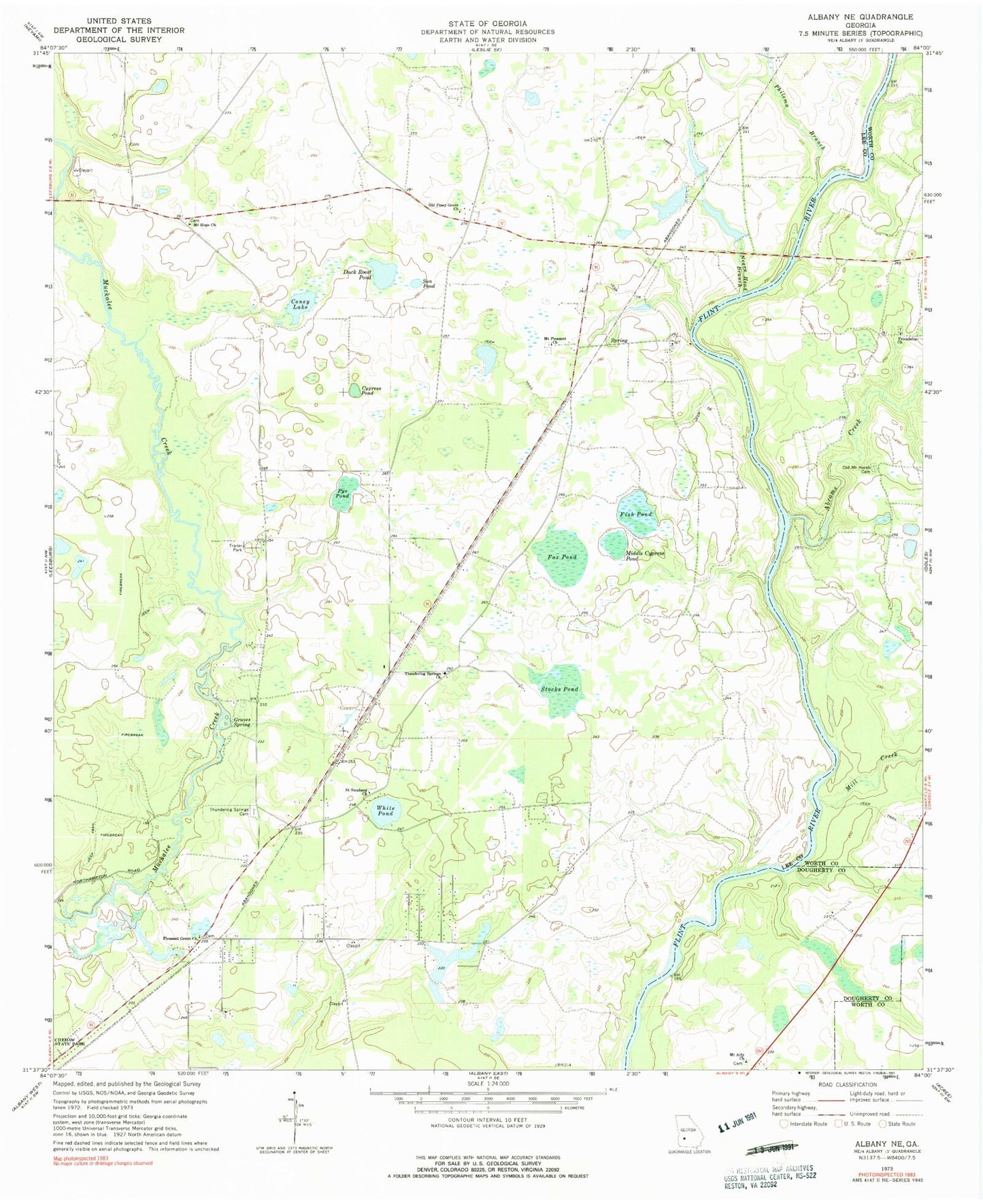
Historical USGS topographic quad map of Albany NE in the state of Georgia. Map scale may vary for some years, but is generally around 1:24,000. Print size is approximately 24" x 27"
This quadrangle is in the following counties: Dougherty, Lee, Worth.
The map contains contour lines, roads, rivers, towns, and lakes. Printed on high-quality waterproof paper with UV fade-resistant inks, and shipped rolled.
Contains the following named places: Abrams Creek, Beloit, Chehaw, Coney Lake, Cypress Pond, Duck Roost Pond, Fish Pond, Forrester Bridge, Fox Pond, Friendship Cemetery, Friendship Church, Gin Branch, Graves Spring, Hartley Farm, Lee County Emergency Medical Services Redbone Station, Lee County Fire Department Station 5 Redbone, Middle Cypress Pond, Mill Creek, Mount Aily Church, Mount Hope Church, Mount Horeb Church, Mount Pleasant Church, Negro Head Branch, Nutview, Old Mount Horeb Cemetery, Old Piney Grove Church, Philema Branch, Pleasant Green Church, Pye Pond, Redbone School, Saint Stephens Church, Stocks, Stocks Pond, Sun Pond, Thundering Spring, Thundering Springs Cemetery, Thundering Springs Church, White Pond, Worthy Manor Volunteer Fire Department Station 2, WUNV-FM (Albany)