MyTopo
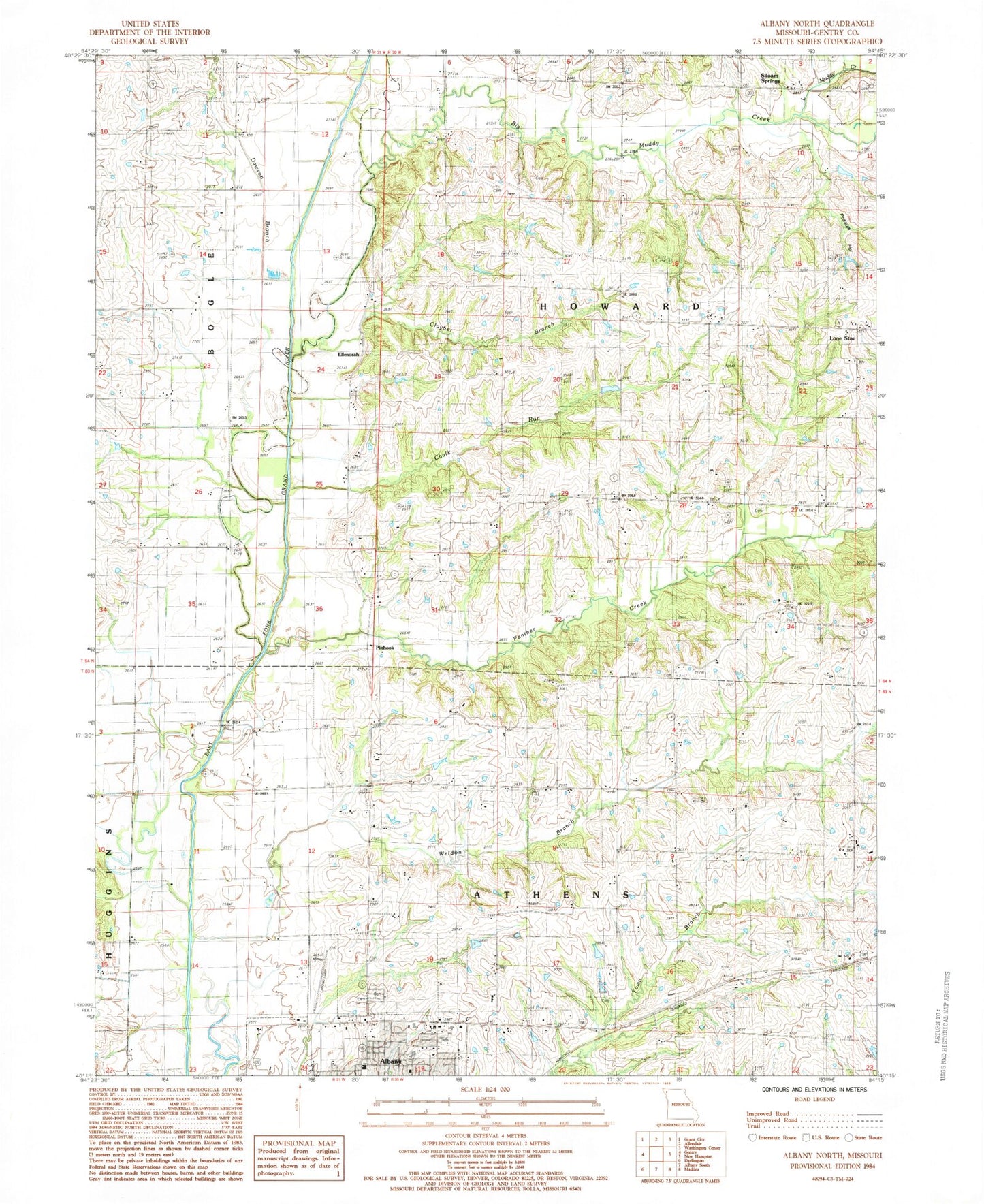
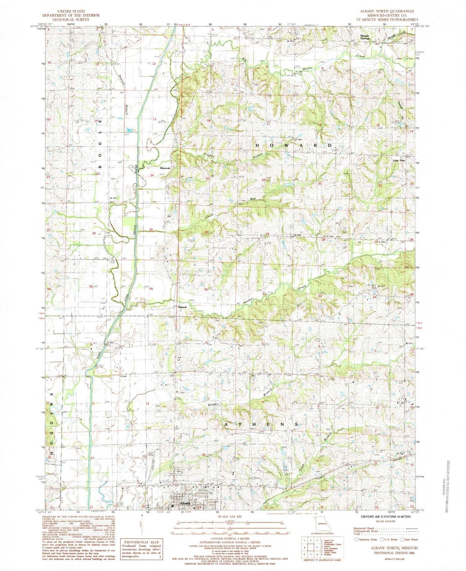
Classic USGS Albany North Missouri 7.5'x7.5' Topo Map
Couldn't load pickup availability
Historical USGS topographic quad map of Albany North in the state of Missouri. Map scale may vary for some years, but is generally around 1:24,000. Print size is approximately 24" x 27"
This quadrangle is in the following counties: Gentry.
The map contains contour lines, roads, rivers, towns, and lakes. Printed on high-quality waterproof paper with UV fade-resistant inks, and shipped rolled.
Contains the following named places: Albany Community Fire Protection District, Albany High School, Albany Middle School, Albany Municipal Airport, Big Muddy Creek, Bulla Cemetery, Bulla School, Carter Cemetery, Chalk Run, Clayber Branch, Colvin School, Dawson Branch, Dawson School, Dorsey School, Ellenorah, Grandview Cemetery, Henton Cemetery, Hill Chapel, Little Muddy Creek, Lone Star, Lone Star School, Magee Cemetery, Missouri Department of Conservation Forestry Northwest Regional Field Fire Office Albany, Mize Cemetery, Needels School, Northwest Medical Center, Panther Creek, Pinhook, Pleasant Grove School, Pleasant Valley School, Possum Hollow, Siloam School, Siloam Springs, Township of Howard, Wayman School, Weldon Branch, West Grandview Cemetery, Wilson Cemetery, ZIP Code: 64402