MyTopo
Classic USGS Albany Ohio 7.5'x7.5' Topo Map
Couldn't load pickup availability
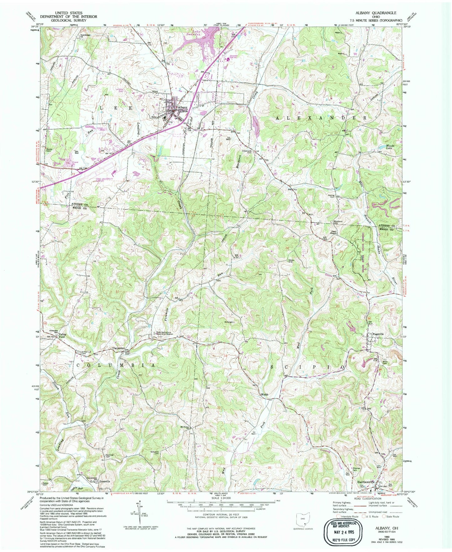
Historical USGS topographic quad map of Albany in the state of Ohio. Map scale may vary for some years, but is generally around 1:24,000. Print size is approximately 24" x 27"
This quadrangle is in the following counties: Athens, Meigs.
The map contains contour lines, roads, rivers, towns, and lakes. Printed on high-quality waterproof paper with UV fade-resistant inks, and shipped rolled.
Contains the following named places: Albany, Albany Area Volunteer Fire Department, Albany Baptist Church, Albany Post Office, Alexander Elementary School, Alexander High School, Boyd Allen Dairy Farm, Carpenter, Carpenter Freewill Baptist Church, Carpenter Post Office, Columbia Elementary School, Columbia Township Volunteer Fire and Emergency Medical Services Department, Crossroads Cemetery, Diamond Number 1 Quarry, Diamond Stone Quarry, Dyesville, Dyesville Community Church, Dyesville Post Office, Fivemile Run, Goose Creek, Gotschall Cemetery, Haning Cemetery, Harrisonville, Harrisonville Elementary School, Harrisonville Post Office, Harrisonville Presbyterian Church, Lake Snowden, Margaret Creek Watershed Project Number One Dam, Martin Cemetery, Mount Union Church, North Branch Margaret Creek, Ogden Cemetery, Ogden Run, Ohio State Agriculture Station, Ohio University Airport, Pageville, Pearl Chapel, Rawlings Cemetery, School Lot Cemetery, Scipio High School, Scipio Township Volunteer Fire Department, Scipio Township Volunteer Fire Department Station 2, Shipman Cemetery, Sisson Run, Southeast Ohio Emergency Medical Services Station 5 Albany, Southeastern Ohio Test Farm, Town House Cemetery, Townhouse Church, Township of Alexander, Township of Lee, Township of Scipio, Valley Ford, Valleyford Post Office, Village of Albany, Wells Cemetery, Welsh, Welsh Post Office, Woods Lake, Woodyard, Woodyard Cemetery, ZIP Code: 45710


