MyTopo
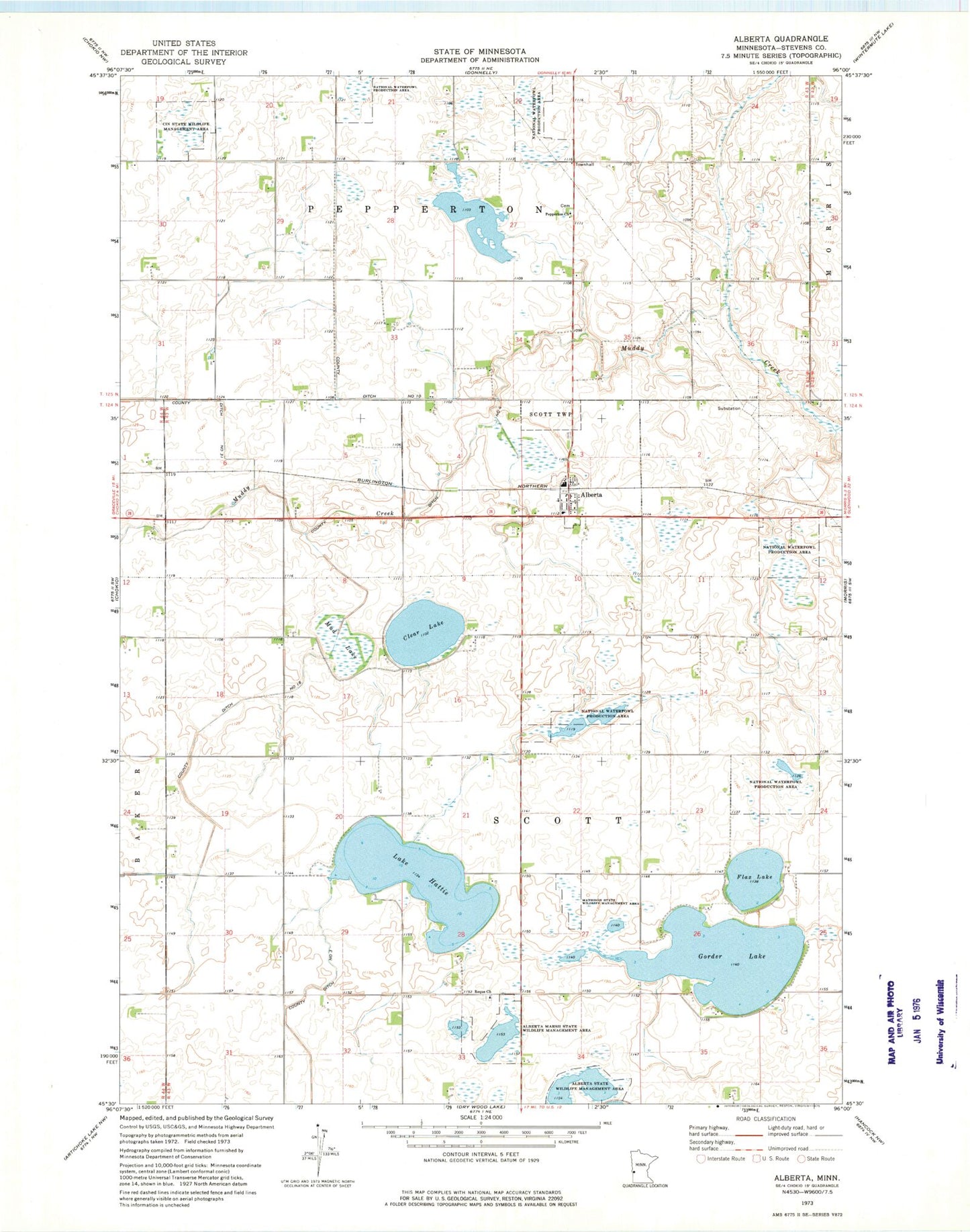
Classic USGS Alberta Minnesota 7.5'x7.5' Topo Map
Couldn't load pickup availability
Historical USGS topographic quad map of Alberta in the state of Minnesota. Map scale may vary for some years, but is generally around 1:24,000. Print size is approximately 24" x 27"
This quadrangle is in the following counties: Stevens.
The map contains contour lines, roads, rivers, towns, and lakes. Printed on high-quality waterproof paper with UV fade-resistant inks, and shipped rolled.
Contains the following named places: Alberta, Alberta Marsh State Wildlife Management Area, Alberta Post Office, Chokio-Alberta High School, Church of the Nazarene, Cin State Wildlife Management Area, City of Alberta, Clear Lake, County Ditch Number Eighteen, County Ditch Number Four, County Ditch Number Ten, County Ditch Number Thirtyone, Flax Lake, Frog Lake Cemetery, Good Shepherd Lutheran Church, Gorder Lake, Horseshoe Lake, Lake Hattie, Mathison State Wildlife Management Area, Mud Lake, Pepperton Church, Pepperton Methodist Cemetery, Reque Church, School Number 13, School Number 18, School Number 19, School Number 24, School Number 25, School Number 59, Stevens County, Township of Scott, Trinity Lutheran Church