MyTopo
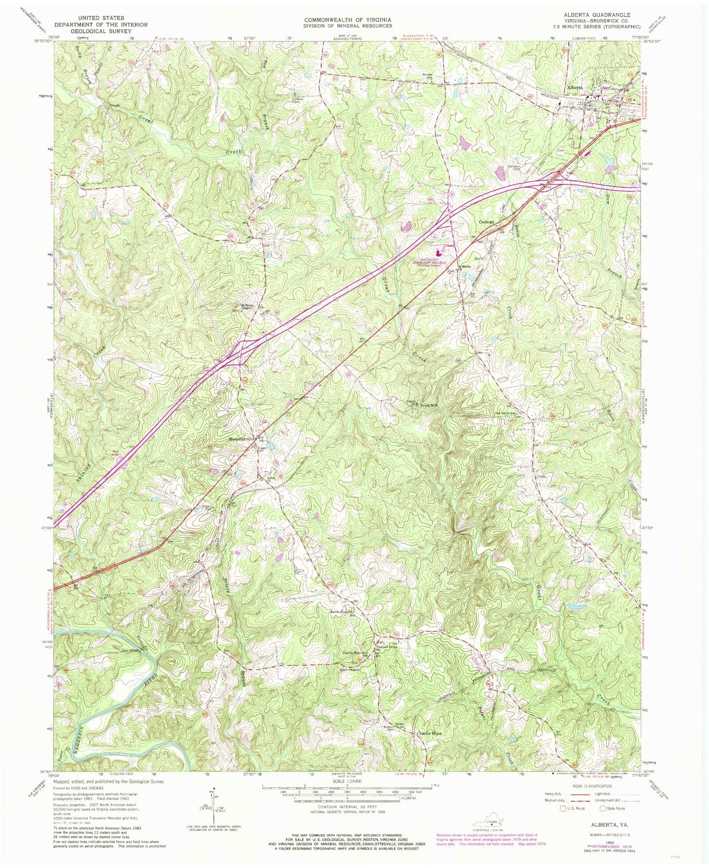
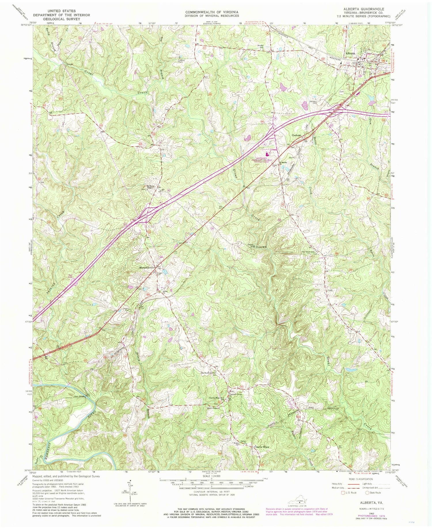
Classic USGS Alberta Virginia 7.5'x7.5' Topo Map
Couldn't load pickup availability
Historical USGS topographic quad map of Alberta in the state of Virginia. Map scale may vary for some years, but is generally around 1:24,000. Print size is approximately 24" x 27"
This quadrangle is in the following counties: Brunswick.
The map contains contour lines, roads, rivers, towns, and lakes. Printed on high-quality waterproof paper with UV fade-resistant inks, and shipped rolled.
Contains the following named places: Alberta, Alberta Police Department, Alberta Post Office, Alberta Volunteer Fire Department Company 1, Becky Branch, Brooks School, Charlie Hope, Charlie Hope Number 1 School, Charlie Hope Number 2 School, Cochran, Dugger Cemetery, Epperson Dam, Gees Bridge, Grandy, Green Chapel, Gum Branch, Johnson Cemetery, L M Epperson Dam, Laffoon Cemetery, Meredithville, Meredithville Post Office, Oak Grove School, Ogden Church, Orgain Cemetery, Pleasant Grove Church, Powell Creek, Price Mill, Saint Marks Cemetery, Saint Marks Church, Saint Pauls Chapel, Salem Church, Shining Creek, Southside Virginia Community College - Christanna Campus, Taylors Creek, Tea Branch, Totaro District, Town of Alberta, Walden Cemetery, Woodsdale School