MyTopo
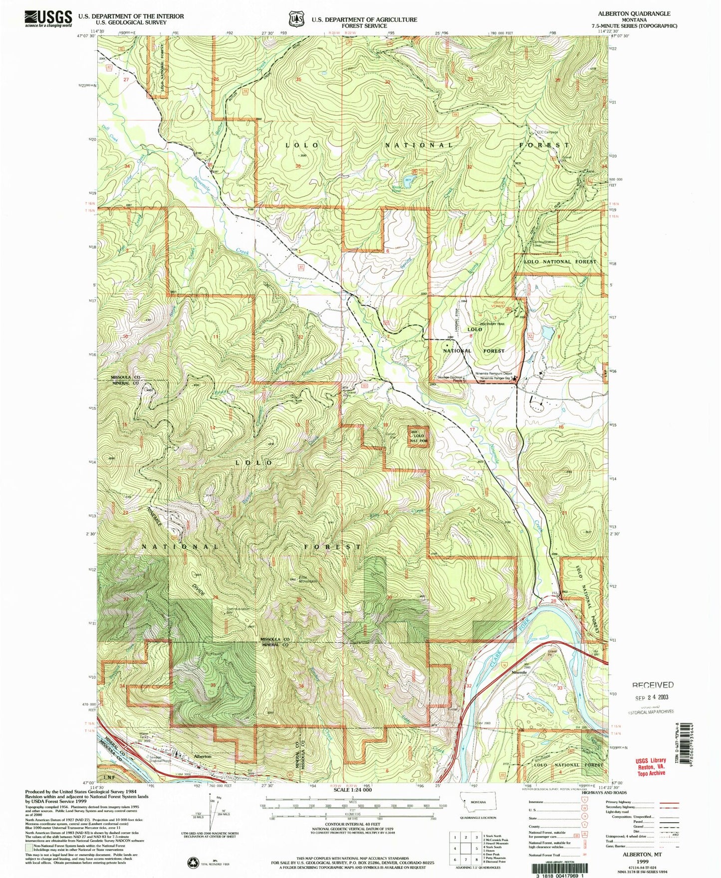
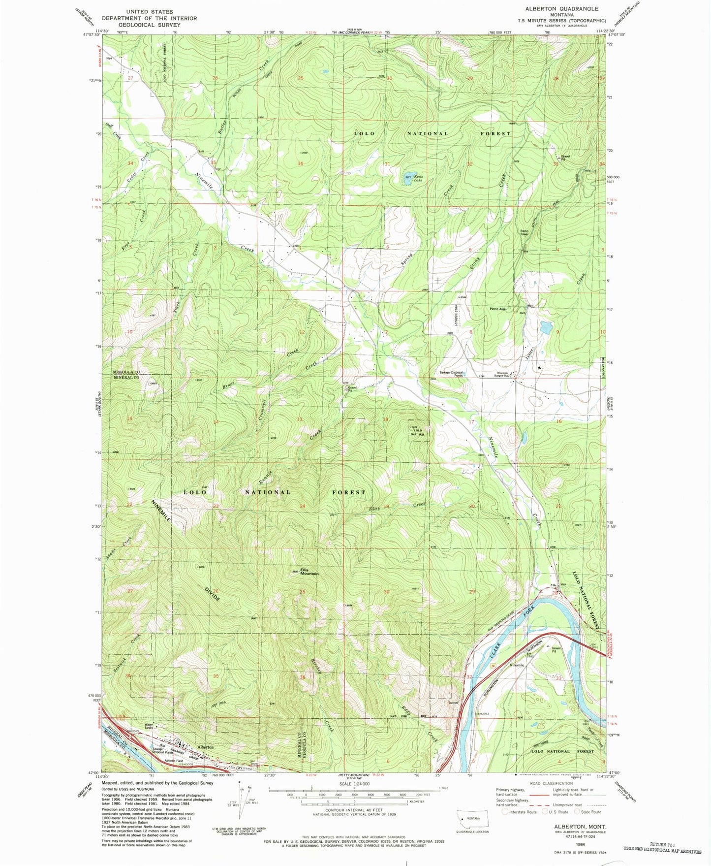
Classic USGS Alberton Montana 7.5'x7.5' Topo Map
Couldn't load pickup availability
Historical USGS topographic quad map of Alberton in the state of Montana. Map scale may vary for some years, but is generally around 1:24,000. Print size is approximately 24" x 27"
This quadrangle is in the following counties: Mineral, Missoula.
The map contains contour lines, roads, rivers, towns, and lakes. Printed on high-quality waterproof paper with UV fade-resistant inks, and shipped rolled.
Contains the following named places: 15N22W07DCAB01 Well, 15N22W28BADC01 Well, 15N22W33BAC_01 Well, 15N22W33BAC_02 Well, 15N22W33BDDD01 Well, 15N22W33DBCC01 Well, 15N23W01ADAA01 Well, 15N23W01BDCB01 Well, 15N23W12ABCA01 Well, 15N23W12ABDD01 Well, 15N23W12ACCA01 Well, Alberton, Alberton Branch Library, Alberton Community Church, Alberton Post Office, Alberton Public Schools, Butler Creek, CCC Camp Site Point of Interest, Cedar Creek, Cromwell Creek, Duff Creek, Eddy Creek, Ellis Creek, Ellis Mountain, Free Creek, Frenchtown Rural Fire District Station 4, Frenchtown Rural Fire District Station 8, Frenchtown-Wye Division, Grand Menard Recreation Site, Issac Creek, Kennedy Creek, Kreis Pond, Longpre Dam, Nine Mile, Nine Mile Airport, Nine Mile School, Ninemile, Ninemile Community Hall, Ninemile Creek, Ninemile Post Office, Ninemile Ranger Station, Ninemile Remount Deport Point of Interest, Rennic Creek, River Edge Resort, Rock Creek, Saint Alberts Catholic Church, Soudan, Spring Creek, Spring Creek Dam, Spring Creek Reservoir, Stark Creek, Stony Creek, Tank Creek, Ted Luark Private Stolport, Town of Alberton