MyTopo
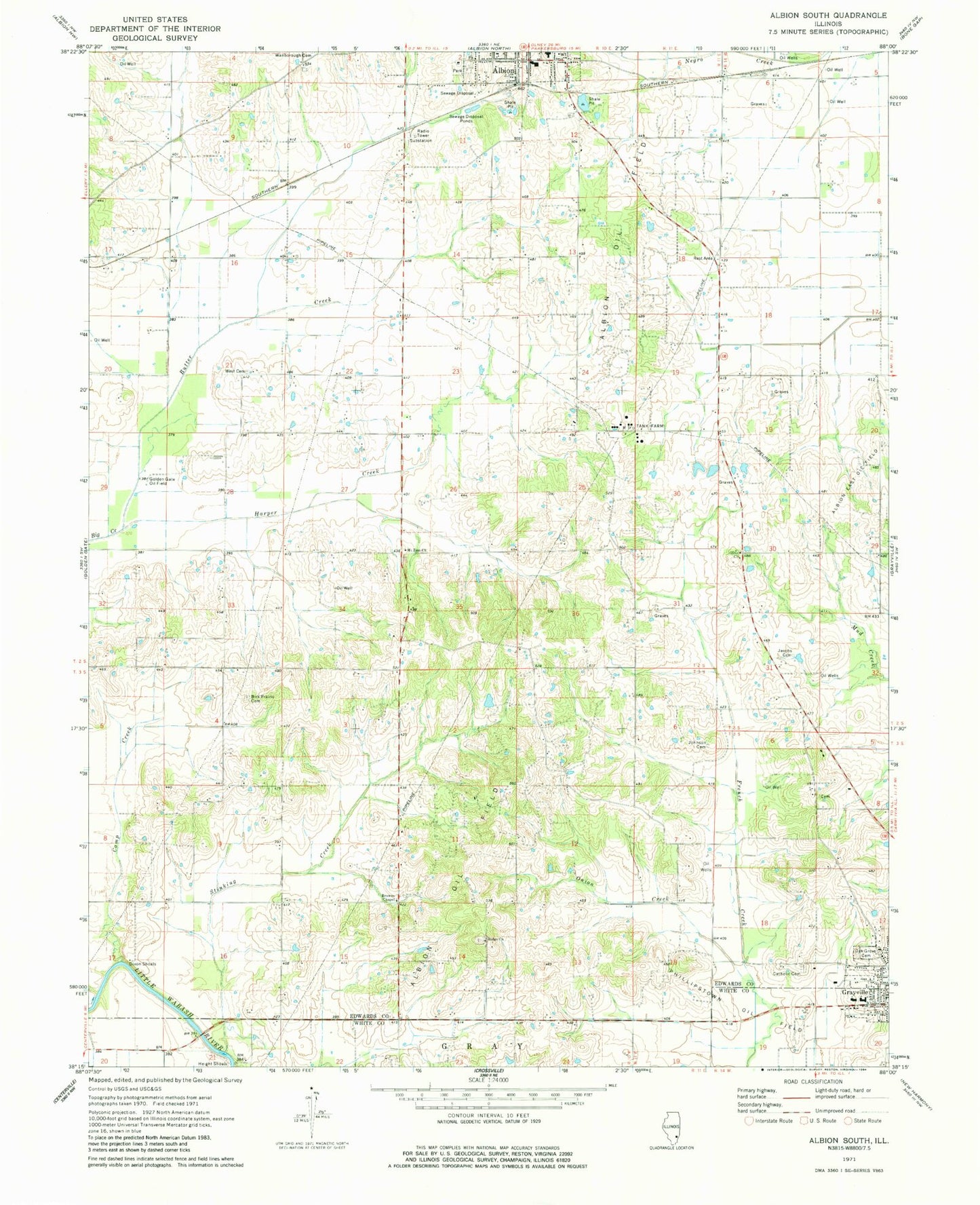
Classic USGS Albion South Illinois 7.5'x7.5' Topo Map
Couldn't load pickup availability
Historical USGS topographic quad map of Albion South in the state of Illinois. Map scale may vary for some years, but is generally around 1:24,000. Print size is approximately 24" x 27"
This quadrangle is in the following counties: Edwards, White.
The map contains contour lines, roads, rivers, towns, and lakes. Printed on high-quality waterproof paper with UV fade-resistant inks, and shipped rolled.
Contains the following named places: Albion East Oil Field, Albion Number 3 Election Precinct, Albion Oil Field, Birk Prairie Cemetery, Birk Prairie Church, Browns Chapel, Butter Creek, Camp Creek, Coles Cemetery, Dixon Election Precinct, Dixon School, Dixon Shoals, Dunk School, English Prairie, Flower School, French Creek Election Precinct, Gill School, Glover School, Gravet Cemetery, Grayville High School, Harper Creek, Height Shoals, Height Shoals Bridge, Holy Name Catholic Church Cemetery, Jacobs Cemetery, James Hean Family Cemetery, Johnson Cemetery, Judge School, Little Wabash Fire Protection District, Long Prairie, Mount Zion Cemetery, Mount Zion United Methodist Church, Northside Baptist Church, Oak Grove Cemetery, Olive Congregational Christian Church, Olive School, Onion Creek, Red Top, Red Top School, Ridge Baptist Church, Ridge Cemetery, Ridge School, Smith School, Stinking Creek, Vallette School, Wells Elementary School, West Cemetery, ZIP Code: 62844