MyTopo
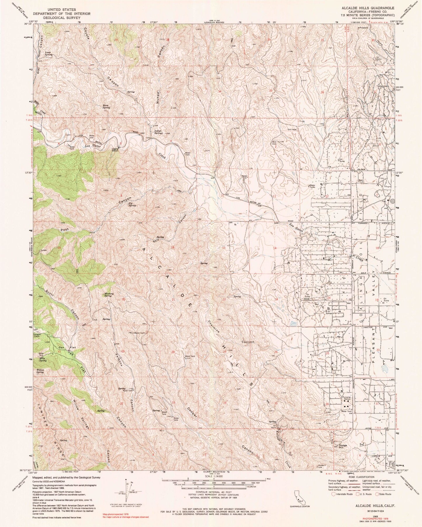
Classic USGS Alcalde Hills California 7.5'x7.5' Topo Map
Couldn't load pickup availability
Historical USGS topographic quad map of Alcalde Hills in the state of California. Map scale may vary for some years, but is generally around 1:24,000. Print size is approximately 24" x 27"
This quadrangle is in the following counties: Fresno.
The map contains contour lines, roads, rivers, towns, and lakes. Printed on high-quality waterproof paper with UV fade-resistant inks, and shipped rolled.
Contains the following named places: Alcalde Hills, Barn Spring, Camp 25-D, Camp 7-C, Claremont School, Coalinga Division, Coalmine Canyon, Coyote Canyon, Dodge Hill, Dutch Oven Flat, Fig Spring, Indian Springs, Lane Spring, Mills Spring, Mustang Spring, Nunez Canyon, Oak Flat, Parsons Canyon, Post Canyon, Salt Canyon, Scott Canyon, Sprague Cabin, White Creek, Willow Spring, ZIP Code: 93210