MyTopo
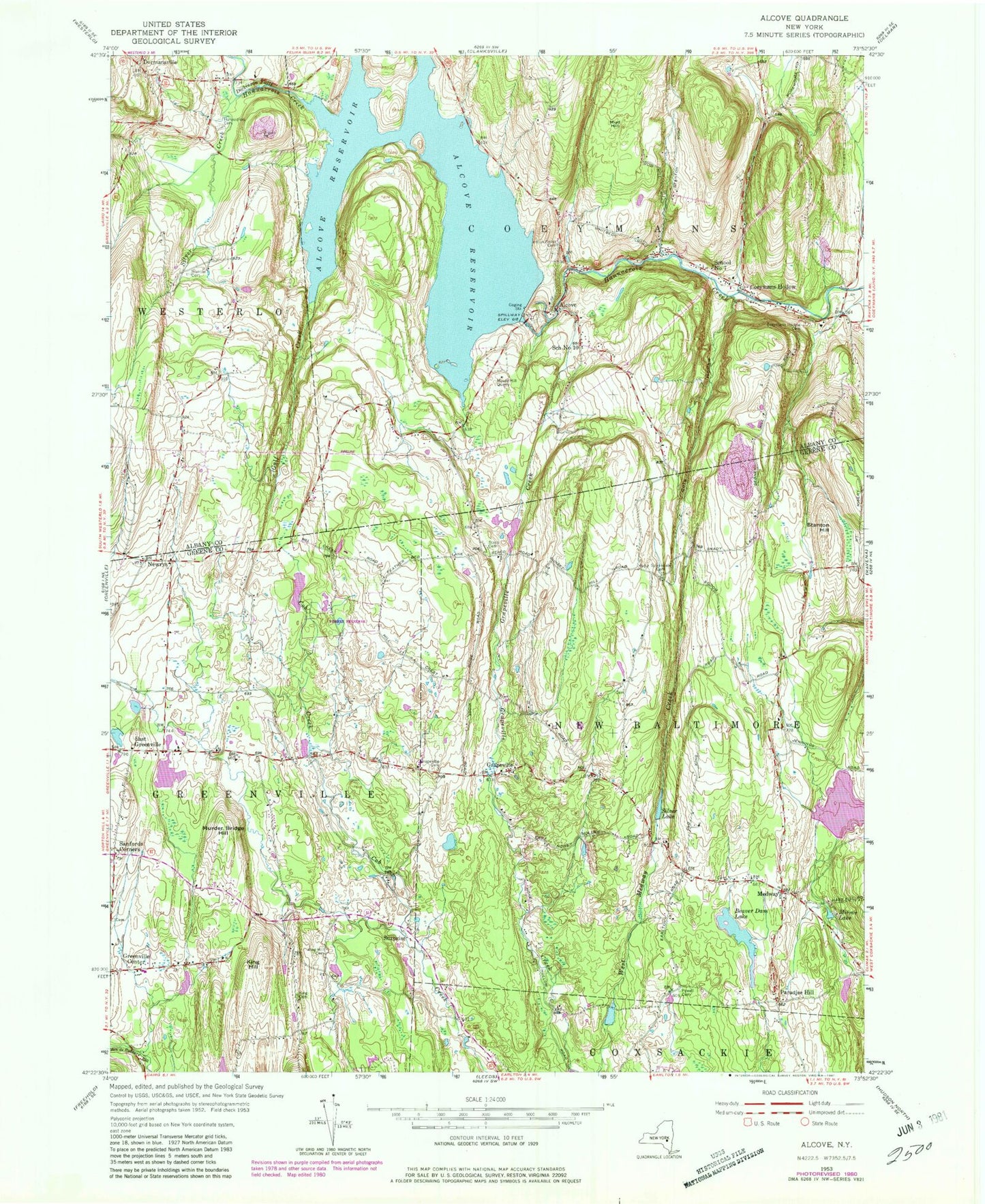
Classic USGS Alcove New York 7.5'x7.5' Topo Map
Couldn't load pickup availability
Historical USGS topographic quad map of Alcove in the state of New York. Typical map scale is 1:24,000, but may vary for certain years, if available. Print size: 24" x 27"
This quadrangle is in the following counties: Albany, Greene.
The map contains contour lines, roads, rivers, towns, and lakes. Printed on high-quality waterproof paper with UV fade-resistant inks, and shipped rolled.
Contains the following named places: Alcove, Alcove Reservoir, Beaver Dam Lake, Coeymans Hollow, Coeymans Hollow Cemetery, Cole Hollow, Dickinson Falls, Dormansville, East Greenville, Grapeville, Grapeville Cemetery, Gulf Creek, Hannacroix Rural Cemetery, Indian Fields Cemetery, King Cemetery, King Hill, King Hill Cemetery, Medway, Mirror Lake, Mossy Hill Quarry, Mud Hill, Murder Bridge Hill, Powell Cemetery, Sanfords Corners, Silver Creek, Silver Lake, Staco Cemetery, Stanton Cemetery, Stanton Hill, Hillside Cemetery, Newrys, Paradise Hill, Surprise, School Number 10 (historical), School Number 7 (historical), Town of Coeymans, Alcove Cemetery, Indian Fields (historical), School Number 12 (historical), Ravena Reservoir (historical), Butler School (historical), School Number 15 (historical), School Number 12 (historical), School Number 13 (historical), School Number 10 (historical), School Number 6 (historical), School Number 7 (historical), Staco School (historical), Rocking R Farm, Greenville Center Cemetery, Medway Hill Cemetery, Medway Congregational Christian Cemetery, Travis Cemetery, The Church of Jesus Christ of Latter Day Saints, Grapeville Christian School, Coeymans Hollow Volunteer Fire Department, Medway Grapeville Volunteer Fire Company, Alcove Post Office, Coeymans Hollow Post Office