
MyTopo
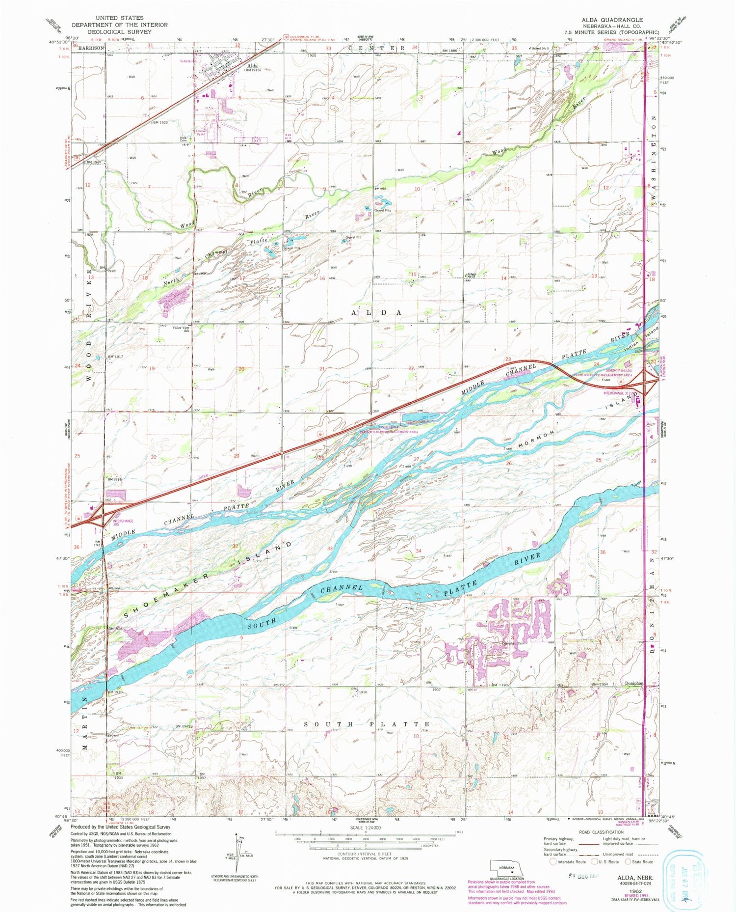
Classic USGS Alda Nebraska 7.5'x7.5' Topo Map
Couldn't load pickup availability
Historical USGS topographic quad map of Alda in the state of Nebraska. Map scale may vary for some years, but is generally around 1:24,000. Print size is approximately 24" x 27"
This quadrangle is in the following counties: Hall.
The map contains contour lines, roads, rivers, towns, and lakes. Printed on high-quality waterproof paper with UV fade-resistant inks, and shipped rolled.
Contains the following named places: Alda, Alda Cemetery, Alda Post Office, Alda Public School, Alda Volunteer Fire Department Station 1 Headquarters, Alda Volunteer Fire Department Station 2, Campbell Cemetery, Campbell Gravesite and Monument, Cedar Hollow Public School, Conflict of 1867 Historical Marker, Crane Meadows Nature Center, KRGI-FM (Grand Island), KTVG-TV (Grand Island), Lautenschlager Dam, Lautenschlager Reservoir, Loch Linda State Wildlife Management Area, Martin Brothers Historical Marker, Martin Brothers Memorial, North Channel Platte River, Old Fort Kearney Road Historical Marker, Sandhill Cranes Historical Marker, School Number 23, School Number 3, Township of Alda, United Methodist Church, Valley View School, Village of Alda, Wood River Crossing, ZIP Code: 68810


