MyTopo
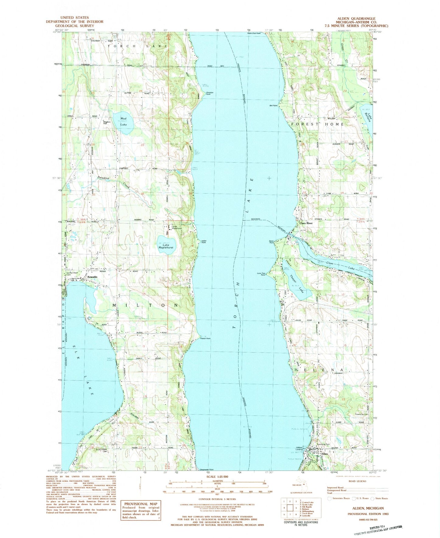
Classic USGS Alden Michigan 7.5'x7.5' Topo Map
Couldn't load pickup availability
Historical USGS topographic quad map of Alden in the state of Michigan. Map scale may vary for some years, but is generally around 1:24,000. Print size is approximately 24" x 27"
This quadrangle is in the following counties: Antrim.
The map contains contour lines, roads, rivers, towns, and lakes. Printed on high-quality waterproof paper with UV fade-resistant inks, and shipped rolled.
Contains the following named places: Alden, Alden Census Designated Place, Alden Depot Museum, Alden Depot Park, Alden Post Office, Alden Station, Alden United Methodist Church, Ball Point, Camp Fairwood, Camp Maplehurst, Christian Point, Clam Lake School, Clam River, Clam River Post Office, Deepwater Point, French Point, Grass Creek, Helena Township Cemetery, Helena Township Library, Helena Township Park, Indian Point, Kewadin, Kewadin Indian Cemetery, Kewadin Indian Mission, Kewadin Post Office, Kewadin United Methodist Church, Lake Maplehurst, Lone Tree Point, Milton Township Fire Department Station 1 Headquarters, Milton Township Park, Mud Lake, Sacred Heart Cemetery, South Milton Cemetery, South Milton Post Office, Spencer Creek, Stony Point, Thayer Lake, Torch Lake, Township of Forest Home, Township of Helena, Township of Milton, Valleau Landing, ZIP Code: 49648