MyTopo
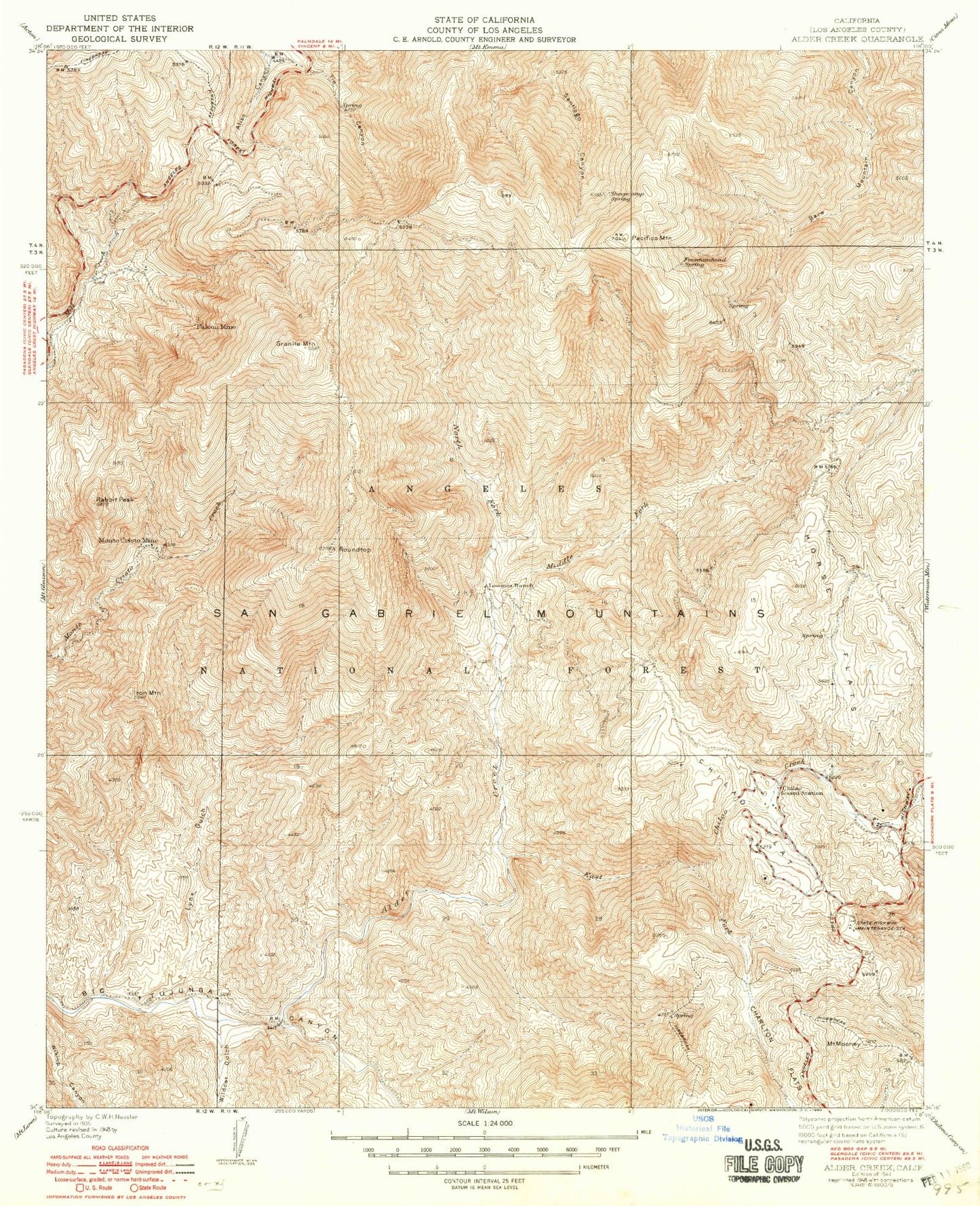
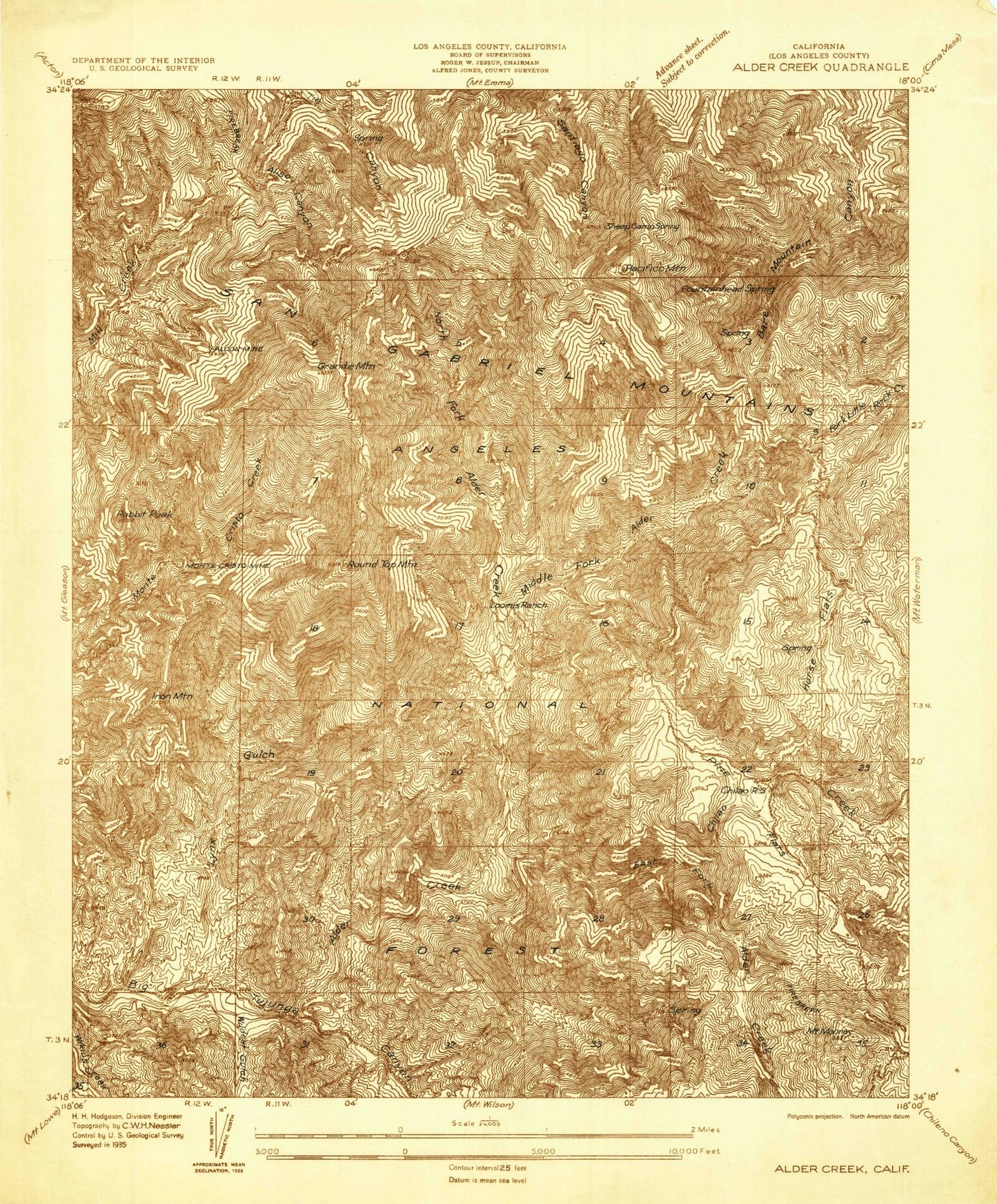
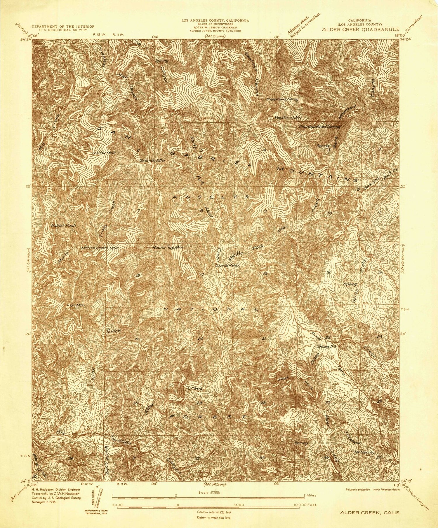
Classic USGS Alder Creek California 7.5'x7.5' Topo Map
Couldn't load pickup availability
Historical USGS topographic quad map of Alder Creek in the state of California. Typical map scale is 1:24,000, but may vary for certain years, if available. Print size: 24" x 27"
This quadrangle is in the following counties: Los Angeles.
The map contains contour lines, roads, rivers, towns, and lakes. Printed on high-quality waterproof paper with UV fade-resistant inks, and shipped rolled.
Contains the following named places: Loomis Mine, Loomis Ranch, Lynx Gulch, Middle Fork Alder Creek, Monte Cristo Mine, Mule Fork, Newcomb Ranch, Old Camp, Rabbit Peak, Roundtop, Wildcat Gulch, Upper Big Tujunga Canyon, Alder Creek, Alder Saddle, Aliso Spring, Black Cargo Mine, Black Crow Mine, Camp Hidden Valley, Camp Rosenita, Chilao Campground, Chilao Creek, Chilao Flat, Chilao Station, East Fork Alder Creek, Falcon Mine, Fountainhead Spring, Gold Bar Mine, Gold Queen Mine, Mount Hillyer, Horse Flats Campground, Lower Pacifico Campground, Mill Creek Summit, North Fork Alder Creek, Pacifico Mountain, Tie Canyon, Tie Summit Station, Upper Pacifico Campground, West Fork Alder Creek, Aliso Spring Picnic Area, Roundtop Ridge, Mill Creek Summit Picnic Ground, Bandido Campground, Chilao Visitors Center, Lynx Target Shooting Area, Granite Mountain, Iron Mountain, Mount Mooney, Horse Flats, Sheep Camp Spring, Silver Moccasin Trail, Transverse Ranges