MyTopo
Classic USGS Alder Gulch Montana 7.5'x7.5' Topo Map
Regular price
$16.95
Regular price
Sale price
$16.95
Unit price
per
Couldn't load pickup availability
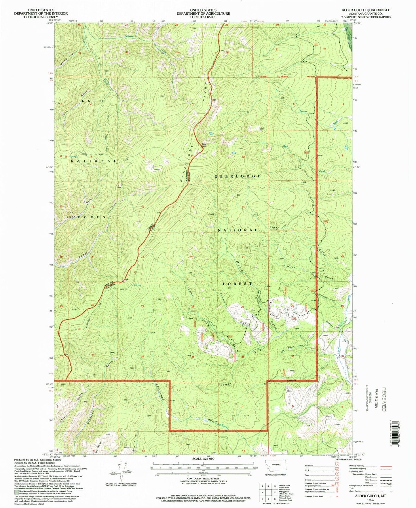
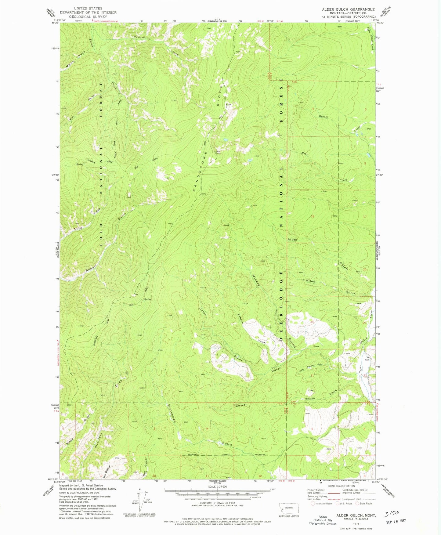
Historical USGS topographic quad map of Alder Gulch in the state of Montana. Typical map scale is 1:24,000, but may vary for certain years, if available. Print size: 24" x 27"
This quadrangle is in the following counties: Granite.
The map contains contour lines, roads, rivers, towns, and lakes. Printed on high-quality waterproof paper with UV fade-resistant inks, and shipped rolled.
Contains the following named places: Baboon Gulch, Coles Gulch, Cowan Gulch, Cub Gulch, Horse Canyon Creek, Little Sawpit Gulch, Martin Gulch, Miners Gulch, Niles Gulch, Ramona Creek, Ranch Creek Trail, Sandstone Ridge, Sandstone Ridge Trail, Sawpit Gulch, Swensen Gulch, Deadwood Gulch (not official)