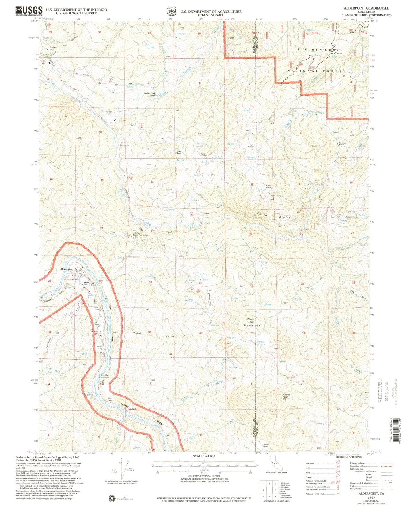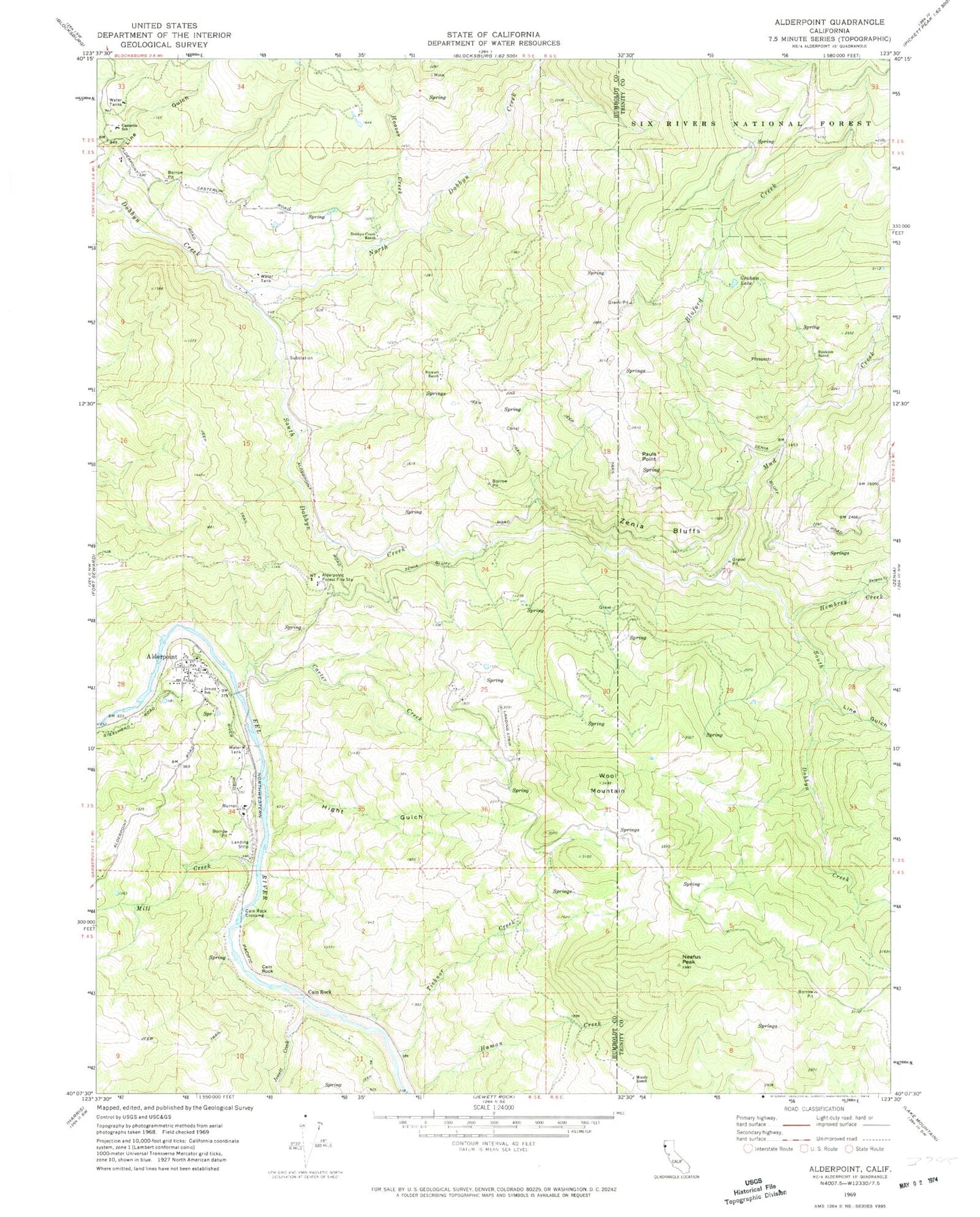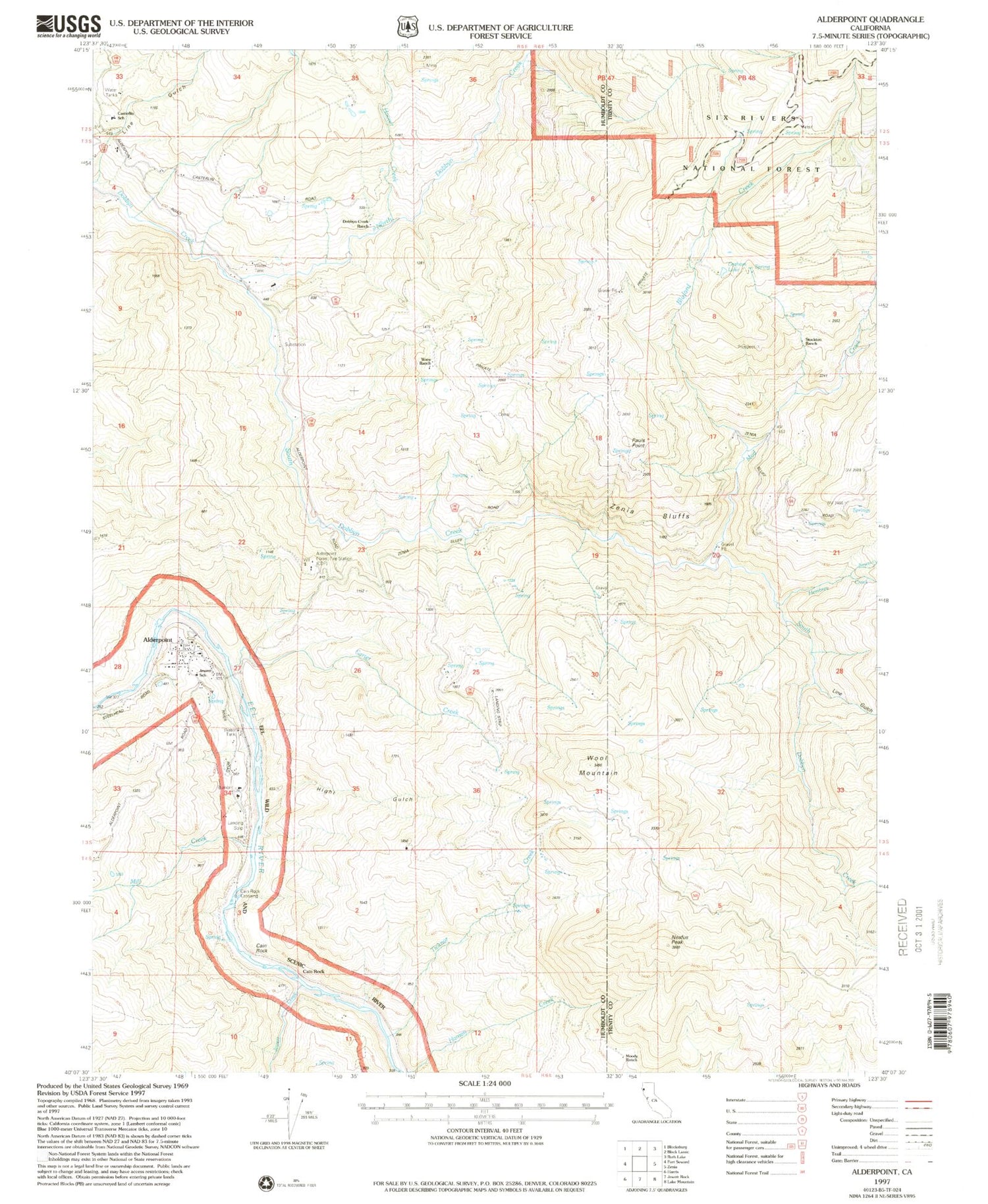
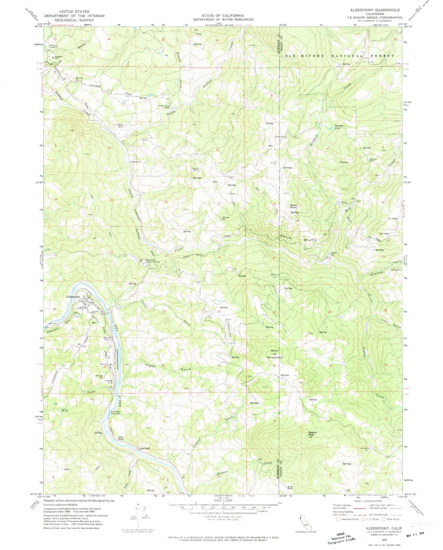
MyTopo
Classic USGS Alderpoint California 7.5'x7.5' Topo Map
Couldn't load pickup availability
Historical USGS topographic quad map of Alderpoint in the state of California. Map scale may vary for some years, but is generally around 1:24,000. Print size is approximately 24" x 27"
This quadrangle is in the following counties: Humboldt, Trinity.
The map contains contour lines, roads, rivers, towns, and lakes. Printed on high-quality waterproof paper with UV fade-resistant inks, and shipped rolled.
Contains the following named places: Alderpoint, Alderpoint Census Designated Place, Alderpoint Post Office, Blocksburg Ranger Station, Bluford Creek, Burgess Creek, Cain Rock, Cain Rock Crossing, California Department of Forestry and Fire Protection Alderpoint Station, Carter Creek, Casterlin Elementary School, Dobbyn Creek Ranch, Graham Lake, Hembrey Creek, Hight Gulch, Hoover Creek, Jewett Creek, Jewett School, Line Gulch, Mill Creek, Moody Ranch, Mud Creek, Neafus Peak, North Dobbyn Creek, Pauls Point, South Dobbyn Creek, Stewart Ranch, Stockton Ranch, Ticknor Creek, Wool Mountain, Zenia Bluffs