
MyTopo
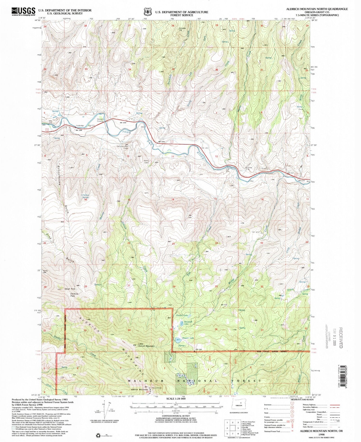
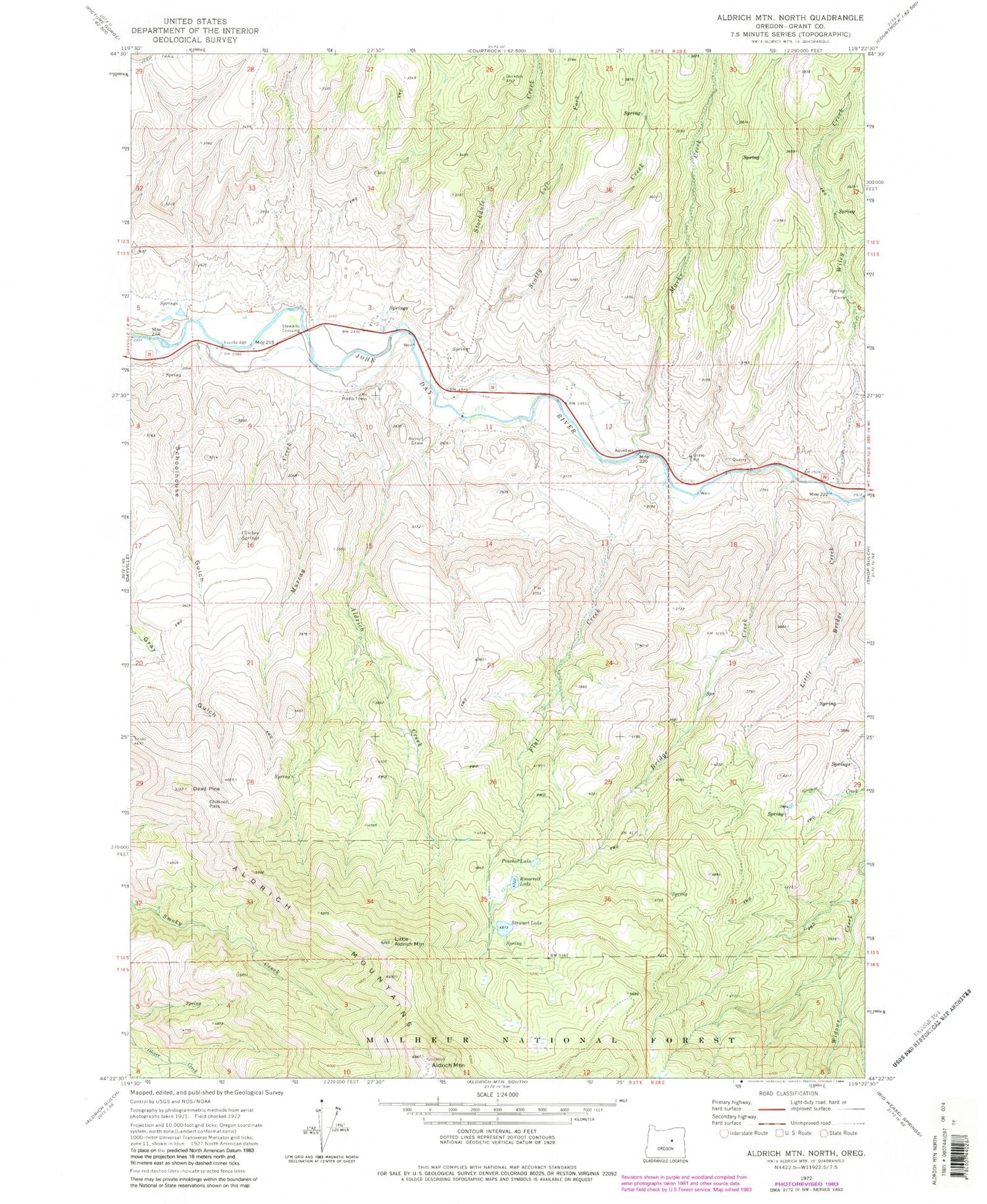
Classic USGS Aldrich Mountain North Oregon 7.5'x7.5' Topo Map
Couldn't load pickup availability
Historical USGS topographic quad map of Aldrich Mountain North in the state of Oregon. Map scale may vary for some years, but is generally around 1:24,000. Print size is approximately 24" x 27"
This quadrangle is in the following counties: Grant.
The map contains contour lines, roads, rivers, towns, and lakes. Printed on high-quality waterproof paper with UV fade-resistant inks, and shipped rolled.
Contains the following named places: Aldrich Creek, Aldrich Grave, Aldrich Mountain, Bridge Creek, Chicken Springs, Chilkoot Pass, Dead Pine, Flat Creek, Left Fork Scotty Creek, Lick Spring, Little Aldrich Mountain, Little Bridge Creek, Marks Creek, Murray Creek, Pinchot Lake, Roosevelt Lake, Schoolhouse Gulch, Scotty Creek, Stewart Ditch, Stewart Lake, Stewarts Crossing, Stockdale Creek, Wyllie Creek, ZIP Code: 97825


