MyTopo
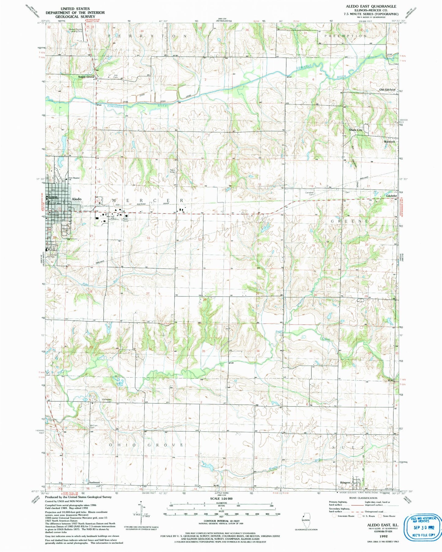
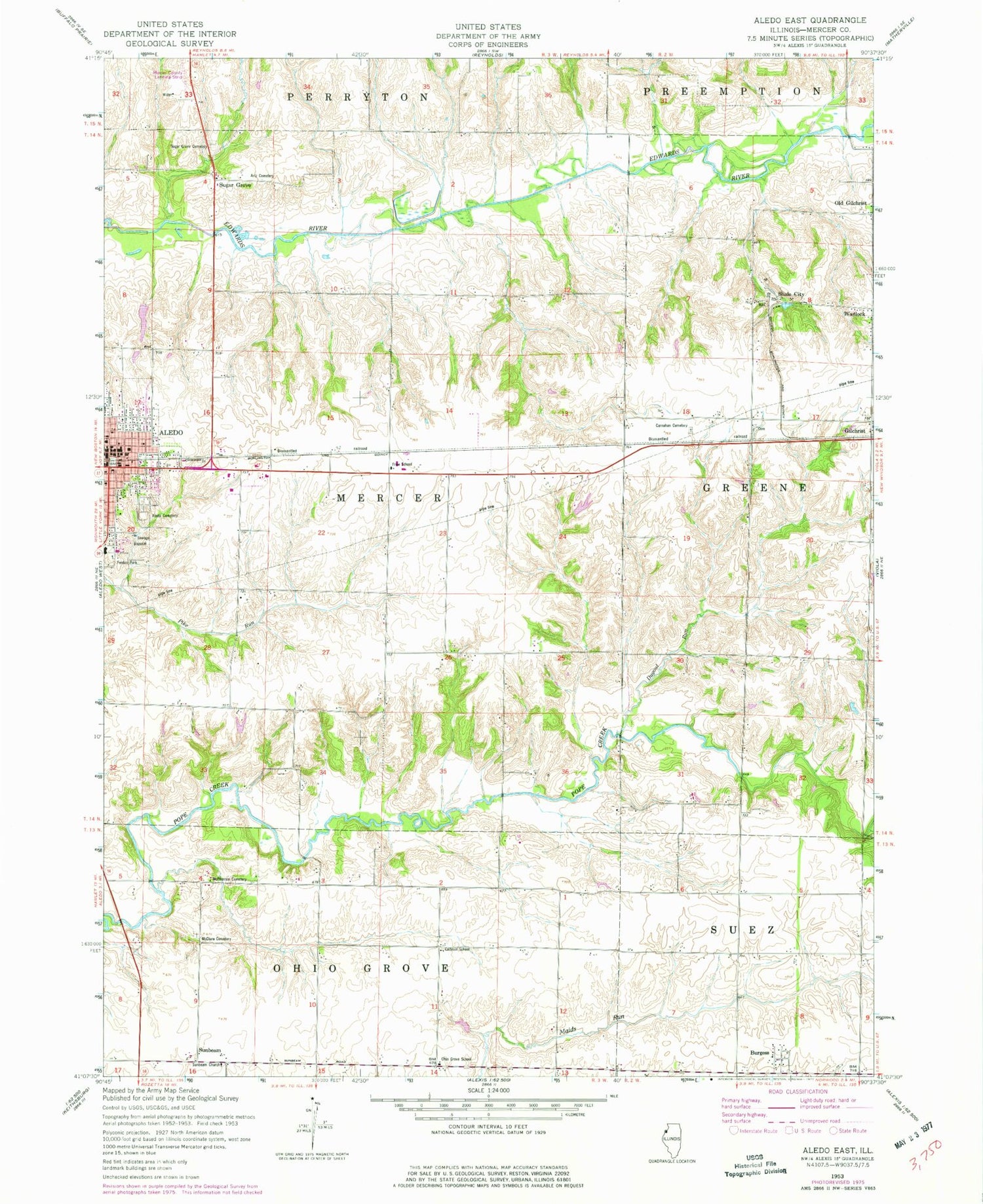
Classic USGS Aledo East Illinois 7.5'x7.5' Topo Map
Couldn't load pickup availability
Historical USGS topographic quad map of Aledo East in the state of Illinois. Map scale may vary for some years, but is generally around 1:24,000. Print size is approximately 24" x 27"
This quadrangle is in the following counties: Mercer.
The map contains contour lines, roads, rivers, towns, and lakes. Printed on high-quality waterproof paper with UV fade-resistant inks, and shipped rolled.
Contains the following named places: Aledo, Aledo Cemetery, Aledo City Hall, Aledo Fire Department, Aledo High School, Aledo Junior High School, Aledo Police Department, Aledo Post Office, Artz Cemetery, Brownsville School, Burgess, Calhoun School, Carbon High School, Carnahan Cemetery, Central Park, City of Aledo, College Avenue Presbyterian Church, Dellitt Lake, Dellitt Lake Dam, Dugout Run, Fenton Park, First Baptist Church, First Methodist Church, First United Presbyterian Church, Fools Lake, Fools Lake Dam, Frew School, Graham Cemetery, Harroun School, Irwin Lake, Irwin Lake Dam, Maple Grove School, Martin, Mcclure Cemetery, McKee School, Mcpherren Cemetery, Mercer Carnegie Library, Mercer County, Mercer County Courthouse, Mercer County Farm, Mercer County Jail, Messiah Lutheran Church, New Life Assembly of God Church, Ohio Grove Church, Ohio Grove School, Old Gilchrist, Old Gilchrist School, Pleasant View School, Prairie Rose School, Saint Catherines Church, Saint Catherines Hall, Shale City, Stony Point School, Sugar Grove, Sugar Grove Cemetery, Sunbeam, Sunbeam School, Sunbeam United Presbyterian Church, Swearingen Lake, Swearingen Lake Dam, Township of Mercer, Wanlock, ZIP Code: 61231