MyTopo
Classic USGS Alexander New York 7.5'x7.5' Topo Map
Couldn't load pickup availability
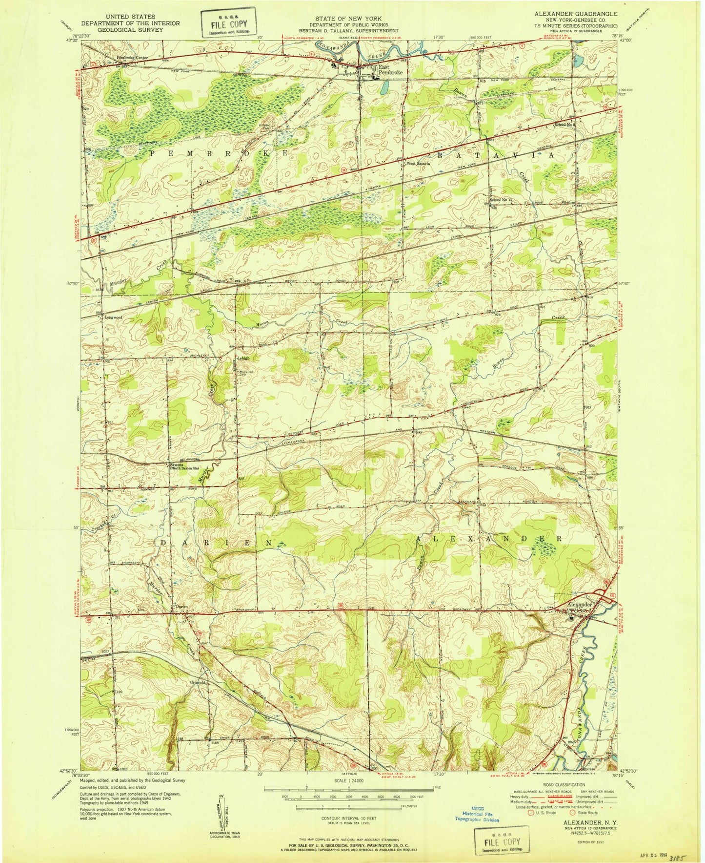
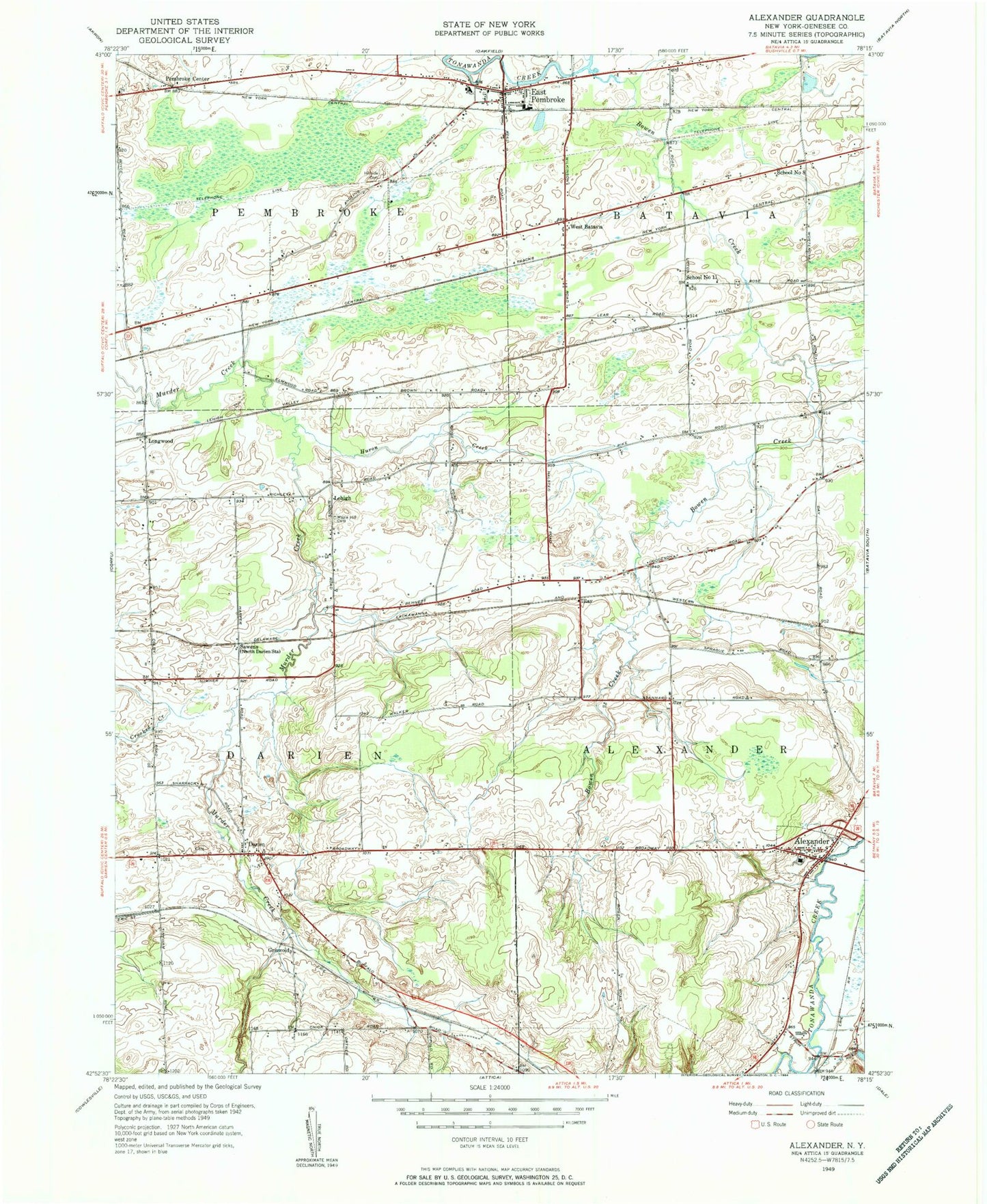
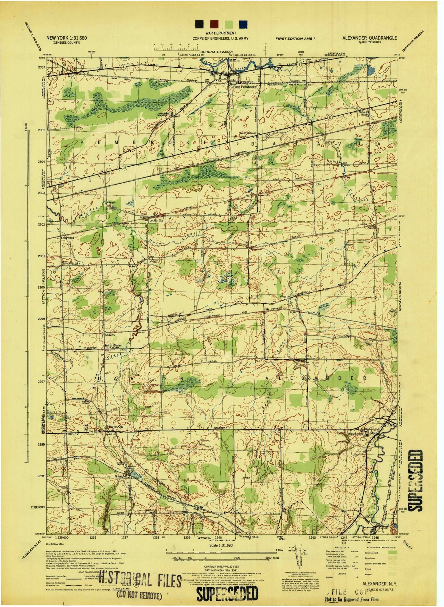
Historical USGS topographic quad map of Alexander in the state of New York. Map scale may vary for some years, but is generally around 1:24,000. Print size is approximately 24" x 27"
This quadrangle is in the following counties: Genesee.
The map contains contour lines, roads, rivers, towns, and lakes. Printed on high-quality waterproof paper with UV fade-resistant inks, and shipped rolled.
Contains the following named places: Alexander, Alexander Classical School, Alexander Elementary School, Alexander Fire Department, Alexander Middle School - High School, Alexander Post Office, Alexander United Methodist Church, Atherton Farms, Baker Brook, Bowen Creek, Darien, Darien Cemetery, East Pembroke, East Pembroke Fire Department, East Pembroke Post Office, Griswold, Hillside Cemetery, Huron Creek, Lehigh, Lehigh Station, Longwood, Maple Hill Cemetery, North Darien, North Darien Baptist Church, Northland Farm, Pembroke Center, Ray, Sawens, School Number 11, School Number 16, School Number 8, Skyline Camping Resort, Town of Alexander, Village of Alexander, West Bank Mobile Home Park, West Batavia, ZIP Code: 14005