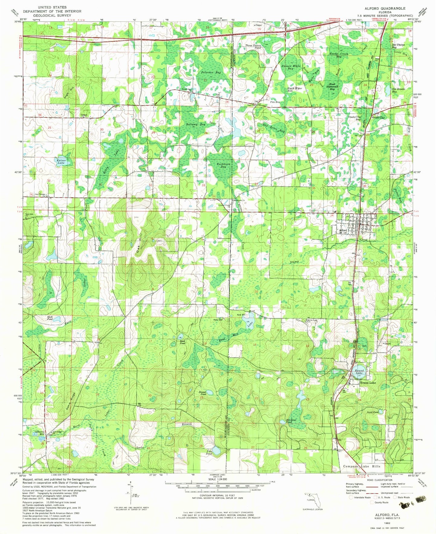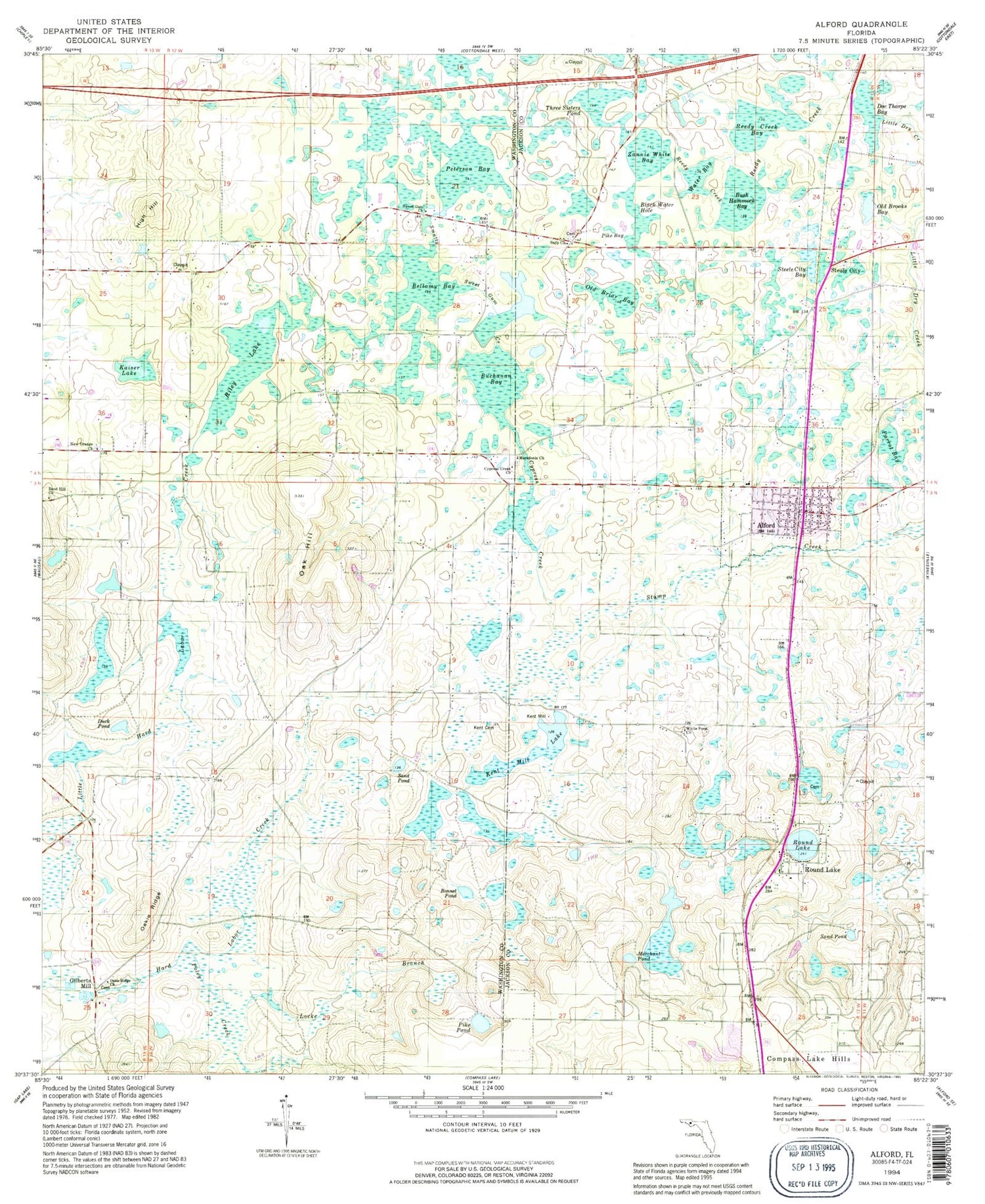

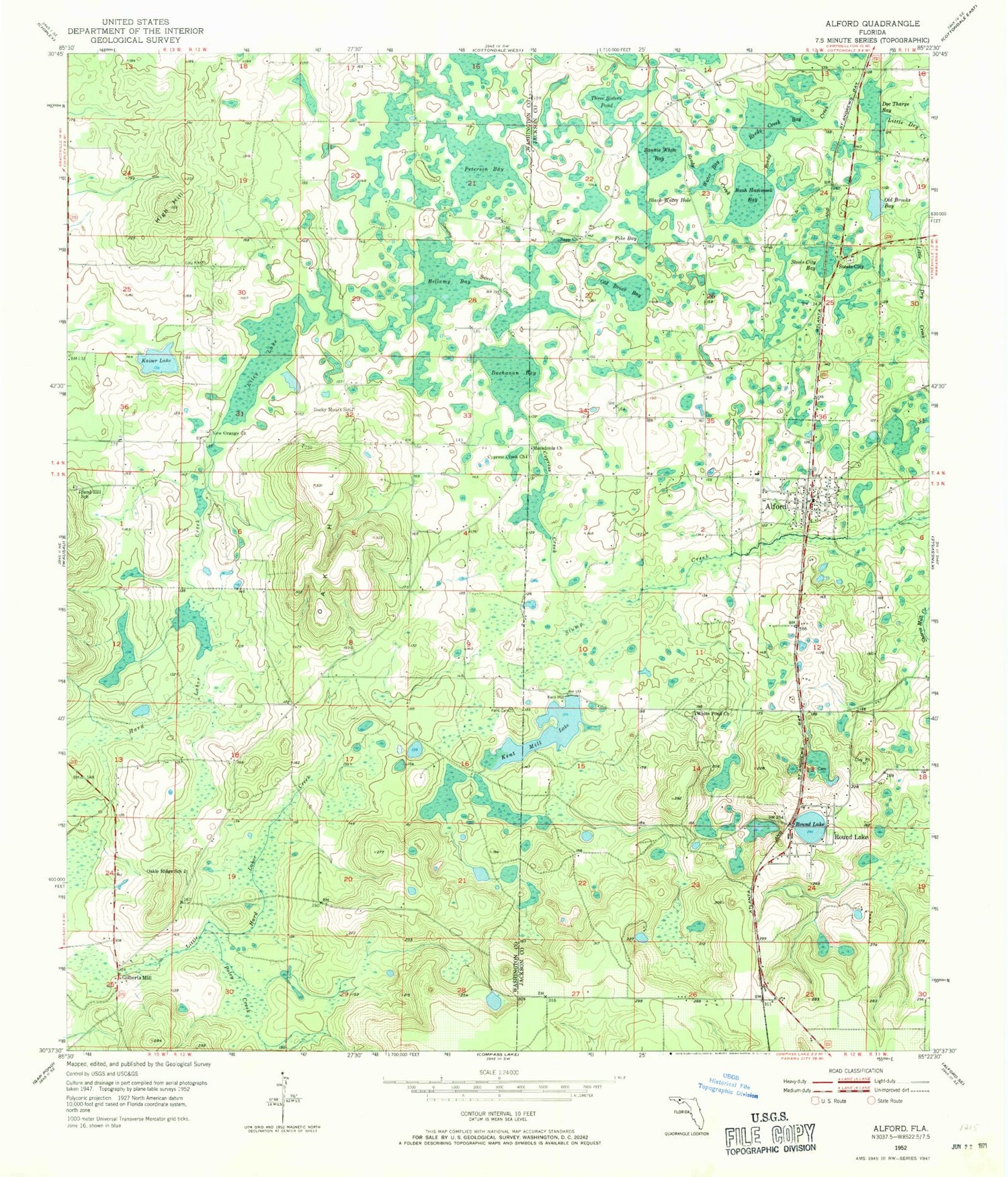
MyTopo
Classic USGS Alford Florida 7.5'x7.5' Topo Map
Couldn't load pickup availability
Historical USGS topographic quad map of Alford in the state of Florida. Map scale may vary for some years, but is generally around 1:24,000. Print size is approximately 24" x 27"
This quadrangle is in the following counties: Jackson, Washington.
The map contains contour lines, roads, rivers, towns, and lakes. Printed on high-quality waterproof paper with UV fade-resistant inks, and shipped rolled.
Contains the following named places: Alford, Alford Elementary School, Alford Post Office, Bellamy Bay, Black Water Hole, Bonnet Pond, Buchanan Bay, Bush Hammock Bay, Cypress Creek, Cypress Creek Church, Doc Tharpe Bay, Gilberts Mill, High Hill, Jackson County Fire and Rescue, Kaiser Lake, Kent Cemetery, Kent Mill, Kent Mill Lake, Macedonia Church, Merchant Pond, Morris Pond, New Orange Church, Oakie Ridge School, Old Briar Bay, Old Brooks Bay, Orange Hill Volunteer Fire Department, Peterson Bay, Pike Bay, Pike Pond, Poley Creek, Reedy Creek, Reedy Creek Bay, Ridgetop Railroad Station, Riley Lake, Rocky Mount School, Round Lake, Salem Church, Sand Hill School, Sand Pond, Sapp Church, Smutty Sweet Gum Creek, Steele City, Steele City Bay, Three Sisters Pond, Town of Alford, Water Bay, White Pond Church, Zannie White Bay, ZIP Code: 32420