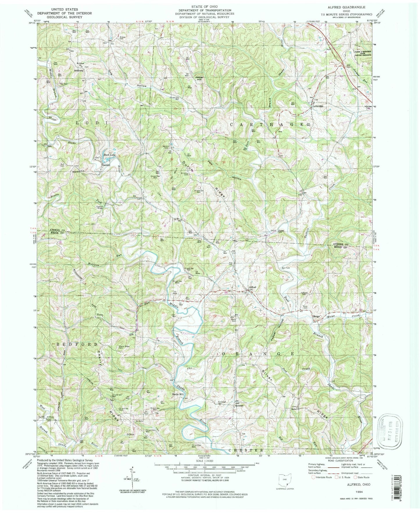
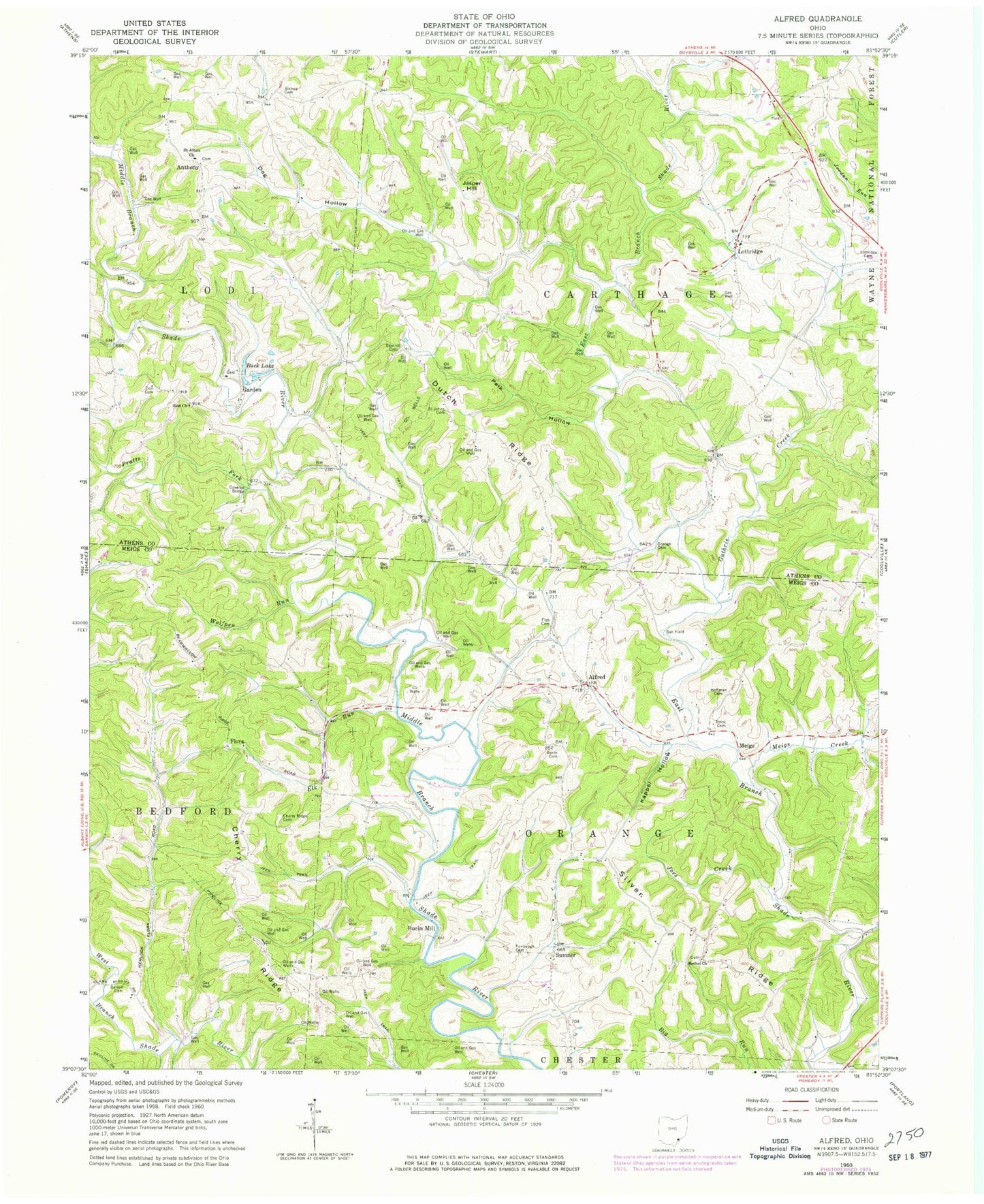
MyTopo
Classic USGS Alfred Ohio 7.5'x7.5' Topo Map
Couldn't load pickup availability
Historical USGS topographic quad map of Alfred in the state of Ohio. Map scale may vary for some years, but is generally around 1:24,000. Print size is approximately 24" x 27"
This quadrangle is in the following counties: Athens, Meigs.
The map contains contour lines, roads, rivers, towns, and lakes. Printed on high-quality waterproof paper with UV fade-resistant inks, and shipped rolled.
Contains the following named places: Alfred, Alfred Post Office, Alfred United Methodist Church, Anthony, Anthony Post Office, Barnhill Cemetery, Barton Cemetery, Bearwallow Church, Bearwallow Church of Christ, Bearwallow Ridge, Bentz Cemetery, Bethel Church, Big Run, Bishop Cemetery, Blackwood Bridge, Brick Cemetery, Buck Lake, Bucks Mill, Cherry Ridge, Cherry Ridge Cemetery, Dog Hollow, Dutch Ridge, Elk Run, Fish Cemetery, Flora, Flora Post Office, Garden, Garden Cemetery, Garden Post Office, Guthrie Creek, Hoffman Cemetery, Jasper Hill, Jasper Hill School, Joes Creek, Kappel Hollow, Keebaugh Cemetery, Lottridge, Lottridge Cemetery, Lottridge Post Office, Meigs, Meigs Creek, Miller Airport, Orange Cemetery, Palk Hollow, Pratts Fork, Saint Johns Cemetery, Saint Johns Church, Silver Ridge, Sumner, Sumner Post Office, Township of Carthage, Township of Orange, Wolfpen Run, Zion Cemetery, Zion Church