MyTopo
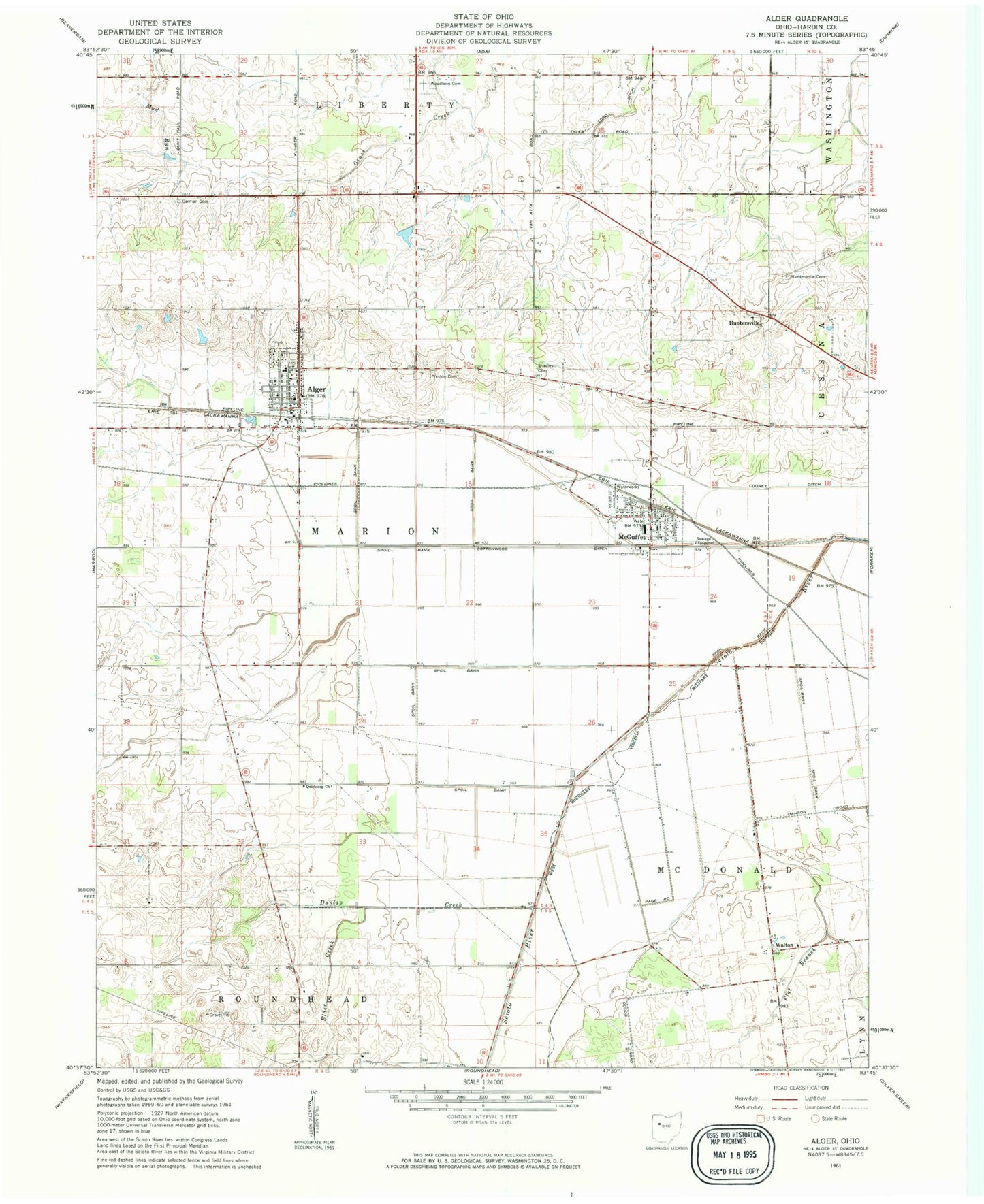
Classic USGS Alger Ohio 7.5'x7.5' Topo Map
Couldn't load pickup availability
Historical USGS topographic quad map of Alger in the state of Ohio. Map scale may vary for some years, but is generally around 1:24,000. Print size is approximately 24" x 27"
This quadrangle is in the following counties: Hardin.
The map contains contour lines, roads, rivers, towns, and lakes. Printed on high-quality waterproof paper with UV fade-resistant inks, and shipped rolled.
Contains the following named places: Alger, Alger Community Fire Association, Alger Elementary School, Alger Post Office, Amherst Greenhouse, Belmont Court, Carman Cemetery, College School, Cooney Ditch, Cottonwood Ditch, Dunlap Creek, Elder Creek, Elder Creek School, Eureka School, Flat Branch, Huntersville, Huntersville Cemetery, Huntersville Post Office, Kingsley School, Klinger School, Lone Oak School, McGuffey, McGuffey Post Office, McGuffey Volunteer Fire Company, Mustard School, Pleasant Valley School, Preston Cemetery, Quickstep, Quickstep Pentecostal Church of God, Rice School, Rising Sun School, Scioto Marsh, Shadley Cemetery, Shadyvale School, Thompson School, Township of Marion, Twin Branches, Upper Scioto Valley Ambulance District Alger Station, Upper Scioto Valley Ambulance District McGuffey Station, Upper Scioto Valley High School, Village of Alger, Village of McGuffey, Walton, Woodlawn Cemetery, Woodlawn School, ZIP Codes: 45812, 45859