MyTopo
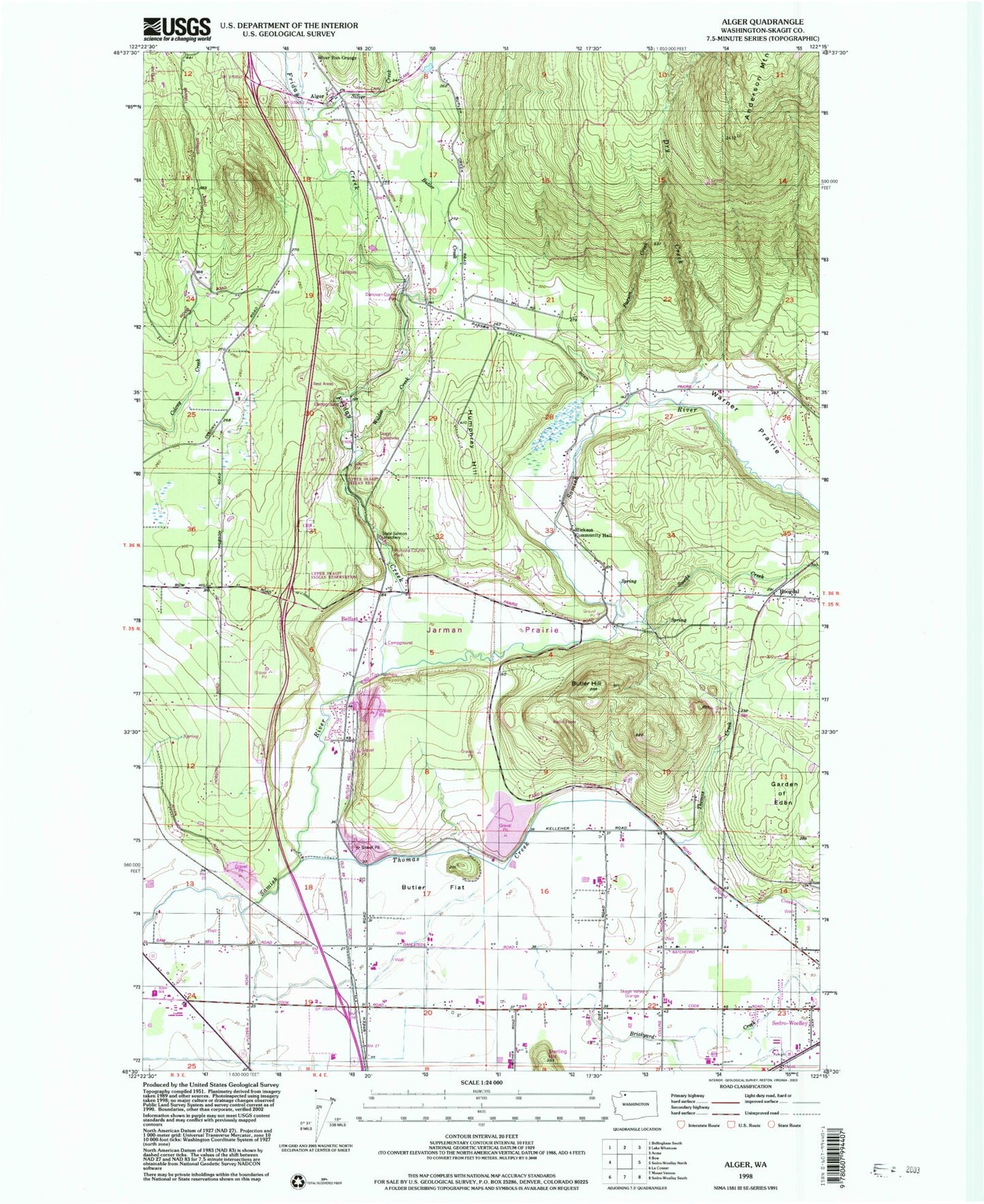
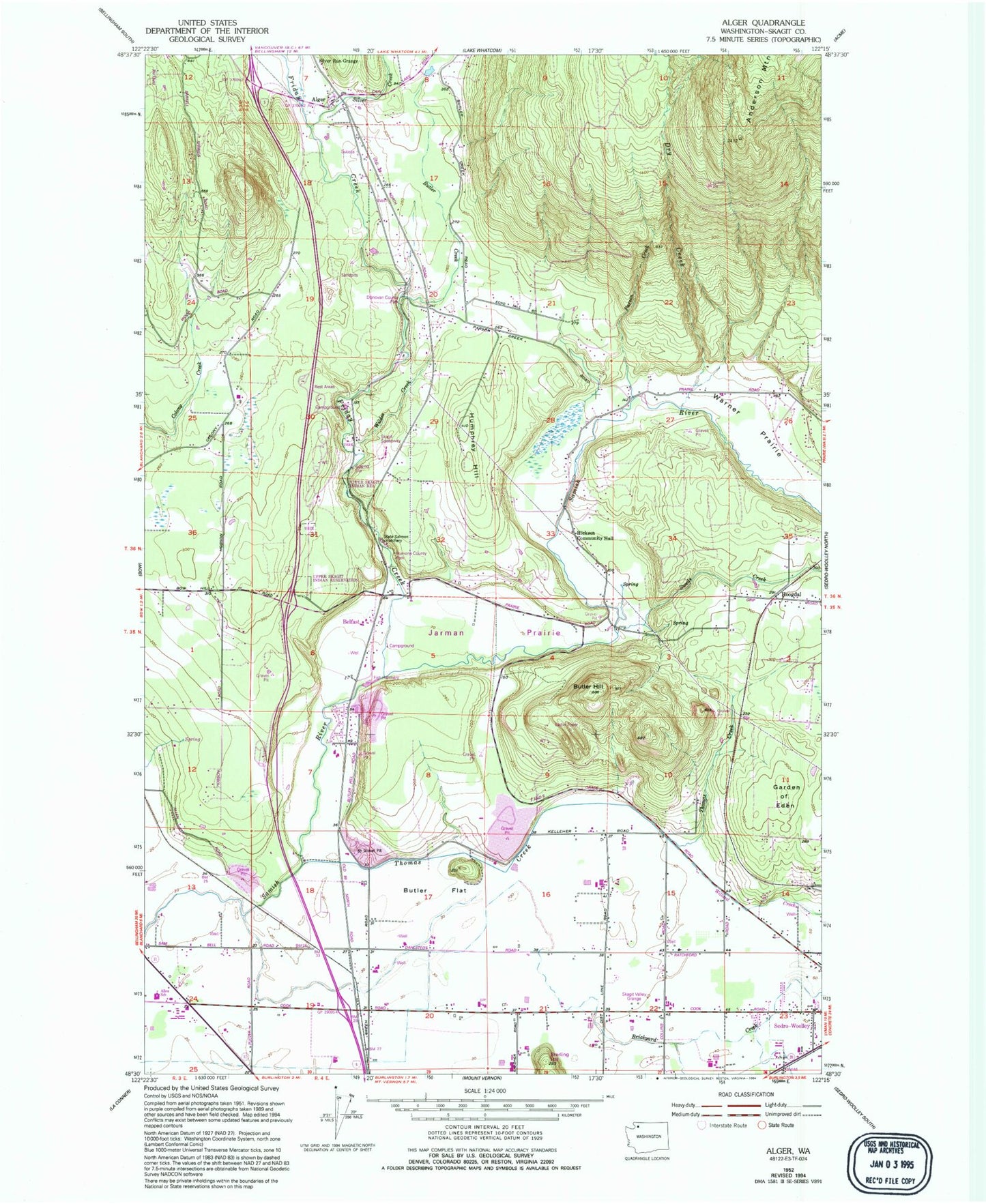
Classic USGS Alger Washington 7.5'x7.5' Topo Map
Couldn't load pickup availability
Historical USGS topographic quad map of Alger in the state of Washington. Map scale may vary for some years, but is generally around 1:24,000. Print size is approximately 24" x 27"
This quadrangle is in the following counties: Skagit.
The map contains contour lines, roads, rivers, towns, and lakes. Printed on high-quality waterproof paper with UV fade-resistant inks, and shipped rolled.
Contains the following named places: Alger, Alger Census Designated Place, Alger Christian Reformed Church, Allen Elementary School, Anderson Mountain, Avalon Golf Club, Belfast, Belfast Gravel Quarry, Belfast School, Belleville, Belleville Quarry, Brickyard Creek, Butler Creek, Butler Flat, Butler Hill, Butler North Quarry, Butler Pit, Butler Quarry, Cook Road Park and Ride, Dans Dairy, De Boer Dairy, Donovan State Park, Dry Creek, Friday Creek, Garden of Eden, Hickson Community Hall, Hoogdal, Humphrey Hill, Jarman Prairie, Parson Creek, Samish Hatchery, Samish River Bridge, Samish River Quarry, Sedro - Woolley School District 101 Office, Silver Creek, Silver Run Grange, Skagit County Fire District 14 Alger Fire Department, Skagit County Fire District 8 Hickson, Skagit Quarry, Skagit Speedway, Swede Creek, Thomas Creek, Two Bobs Dairy, Upper Skagit Reservation, Warner Prairie, Wildes Creek, Willard Creek, ZIP Code: 98233