
MyTopo
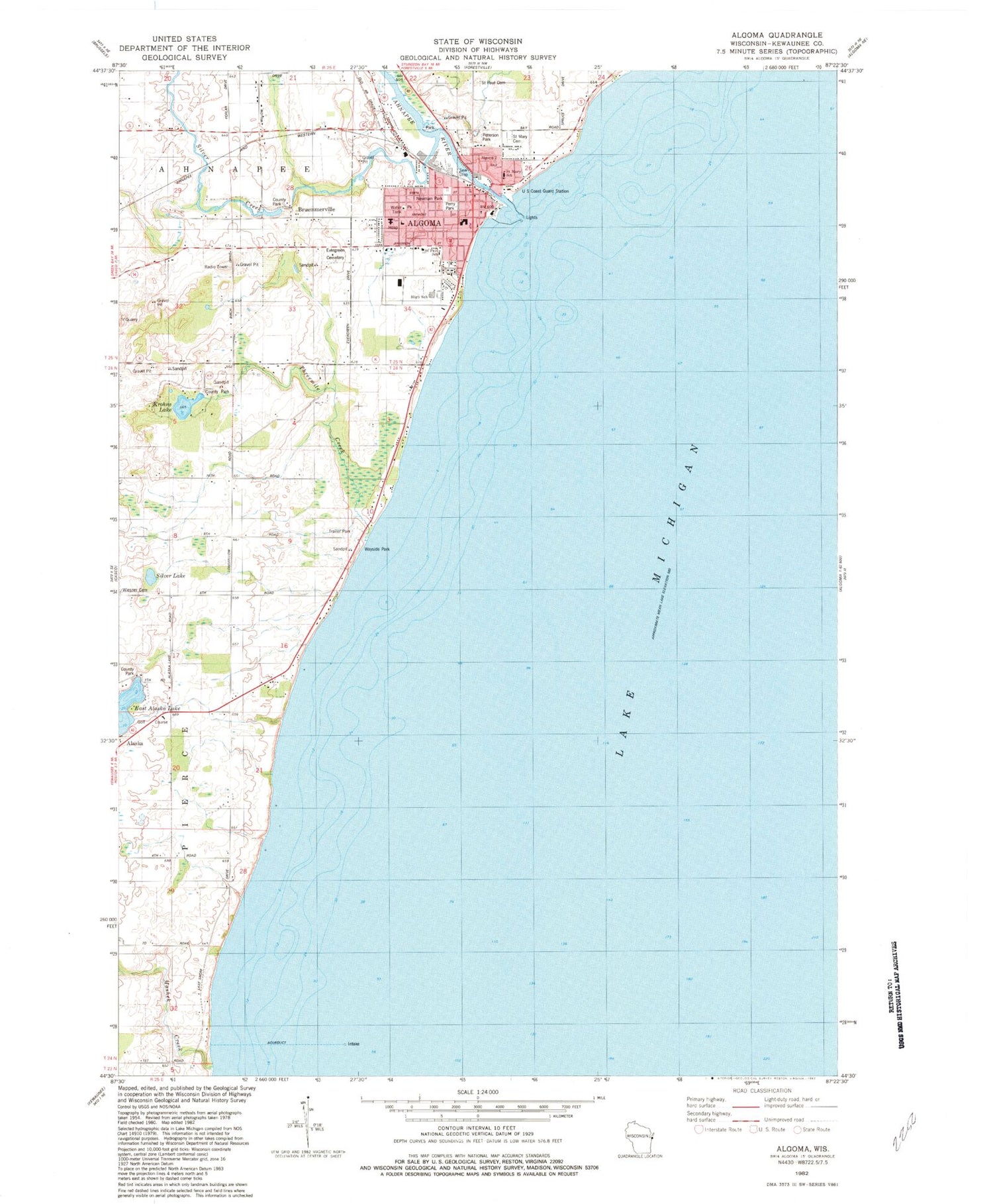
Classic USGS Algoma Wisconsin 7.5'x7.5' Topo Map
Couldn't load pickup availability
Historical USGS topographic quad map of Algoma in the state of Wisconsin. Map scale may vary for some years, but is generally around 1:24,000. Print size is approximately 24" x 27"
This quadrangle is in the following counties: Kewaunee.
The map contains contour lines, roads, rivers, towns, and lakes. Printed on high-quality waterproof paper with UV fade-resistant inks, and shipped rolled.
Contains the following named places: 61 Reservoir, Ahnapee River, Alapma Boat Club, Algoma, Algoma Elementary School, Algoma Fire Department - Algoma Rescue Squad, Algoma High School, Algoma Marina Incorporated, Algoma Police Department, Algoma Post Office, Algoma United Methodist Church, Algoma Utilities Commission, Algoma Wastewater Treatment Plant, Bruemmerville, Calvary Assembly of God Church, City of Algoma, East Alaska Lake, Episcopal Church of Saint Agnes by the Lake, Evergreen Cemetery, Henry Iwen Dam, K and D Greenhouse, Kewaunee County Park, Krohns Lake, Mashek Creek, Newman Park, Perry Park, Peterson Park, Saint Mary School, Saint Mary's Catholic Cemetery, Saint Marys Catholic Church, Saint Paul Cemetery, Saint Pauls Evangelical Lutheran Church, Saint Paul's Evangelical Lutheran School, Silver Creek, Silver Creek School, Silver Lake, Threemile Creek, Town of Pierce, Wiesner Cemetery, Wings of Eagles Christian Academy, ZIP Code: 54201


