MyTopo
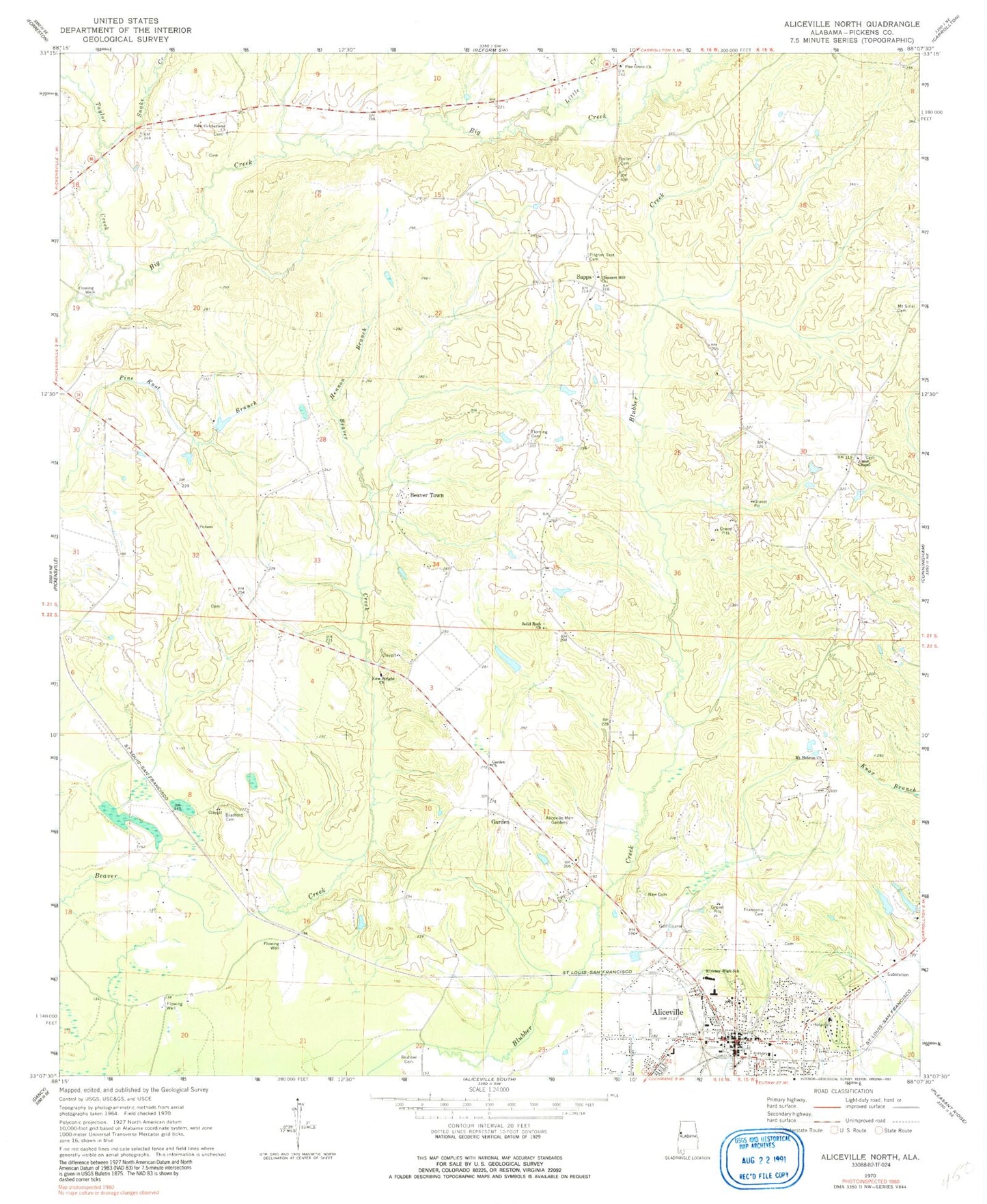
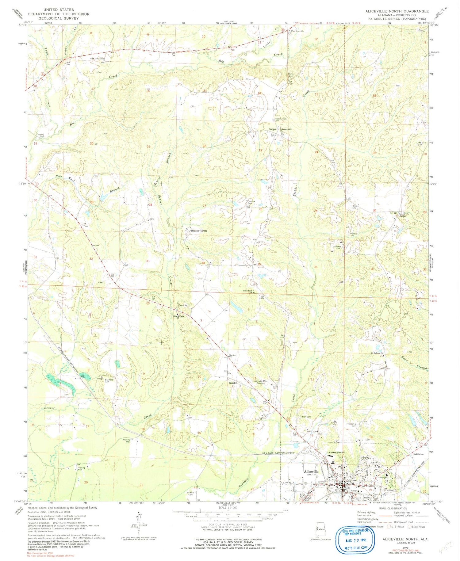
Classic USGS Aliceville North Alabama 7.5'x7.5' Topo Map
Couldn't load pickup availability
Historical USGS topographic quad map of Aliceville North in the state of Alabama. Map scale may vary for some years, but is generally around 1:24,000. Print size is approximately 24" x 27"
This quadrangle is in the following counties: Pickens.
The map contains contour lines, roads, rivers, towns, and lakes. Printed on high-quality waterproof paper with UV fade-resistant inks, and shipped rolled.
Contains the following named places: Aliceville, Aliceville Baptist Church, Aliceville County Club, Aliceville Graded School, Aliceville Memorial Gardens, Aliceville Police Department, Aliceville Post Office, Aliceville Presbyterian Church, Aliceville Volunteer Fire Department, Beaver Town, Blubber Cemetery, Bradford Cemetery, Federal Correctional Institution Aliceville, Fleming Cemetery, Franconia, Franconia Cemetery, Garden, Garden Baptist Church, Garden Cemetery, Garden Spot, Hennon Branch, Kirksey High School, Little Creek, McMullen, Mount Hebron Cemetery, Mount Hebron Church, Mount Sinai Church, Mount Sinal Cemetery, New Cemetery, New Cumberland Cemetery, New Cumberland Church, New Wright Church, Oak Grove Church, Oak Hill Cemetery, Pilgrim Rest Cemetery, Pilgrims Rest Church, Pine Grove Church, Pleasant Hill Church, Sanders Dam, Sanders Lake, Sapps, Sapps - Union Chapel Volunteer Fire Department, Snake Creek, Solid Rock Church, Spiller Cemetery, Spirit and Truth Church, Taylor Creek, Town of McMullen, True Vine Church, Union Chapel, Union Chapel Cemetery, Westervelt Game Reserve