MyTopo
Classic USGS Alivio New Mexico 7.5'x7.5' Topo Map
Regular price
$16.95
Regular price
Sale price
$16.95
Unit price
per
Couldn't load pickup availability
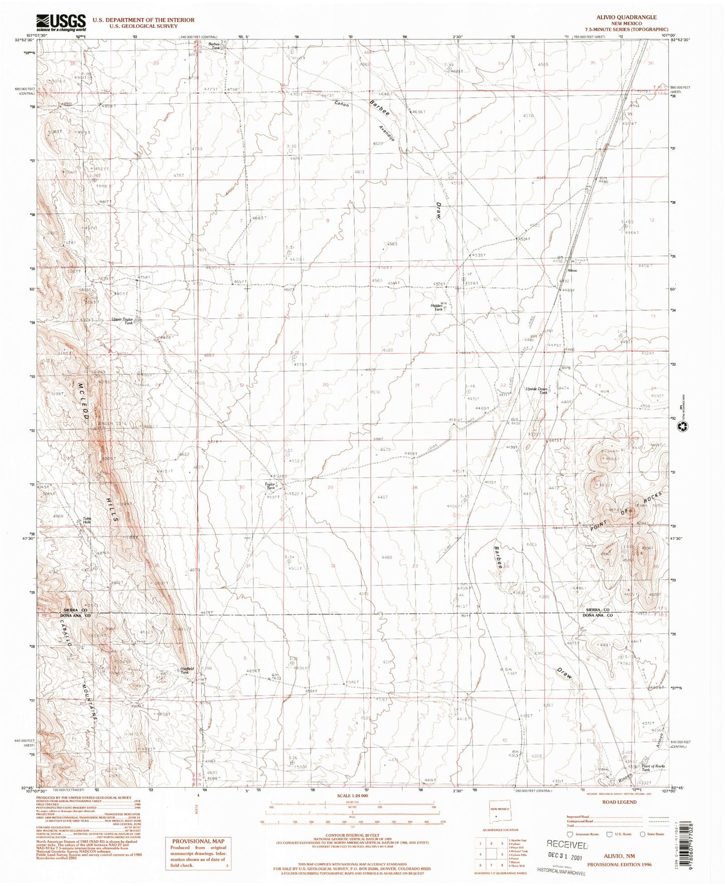
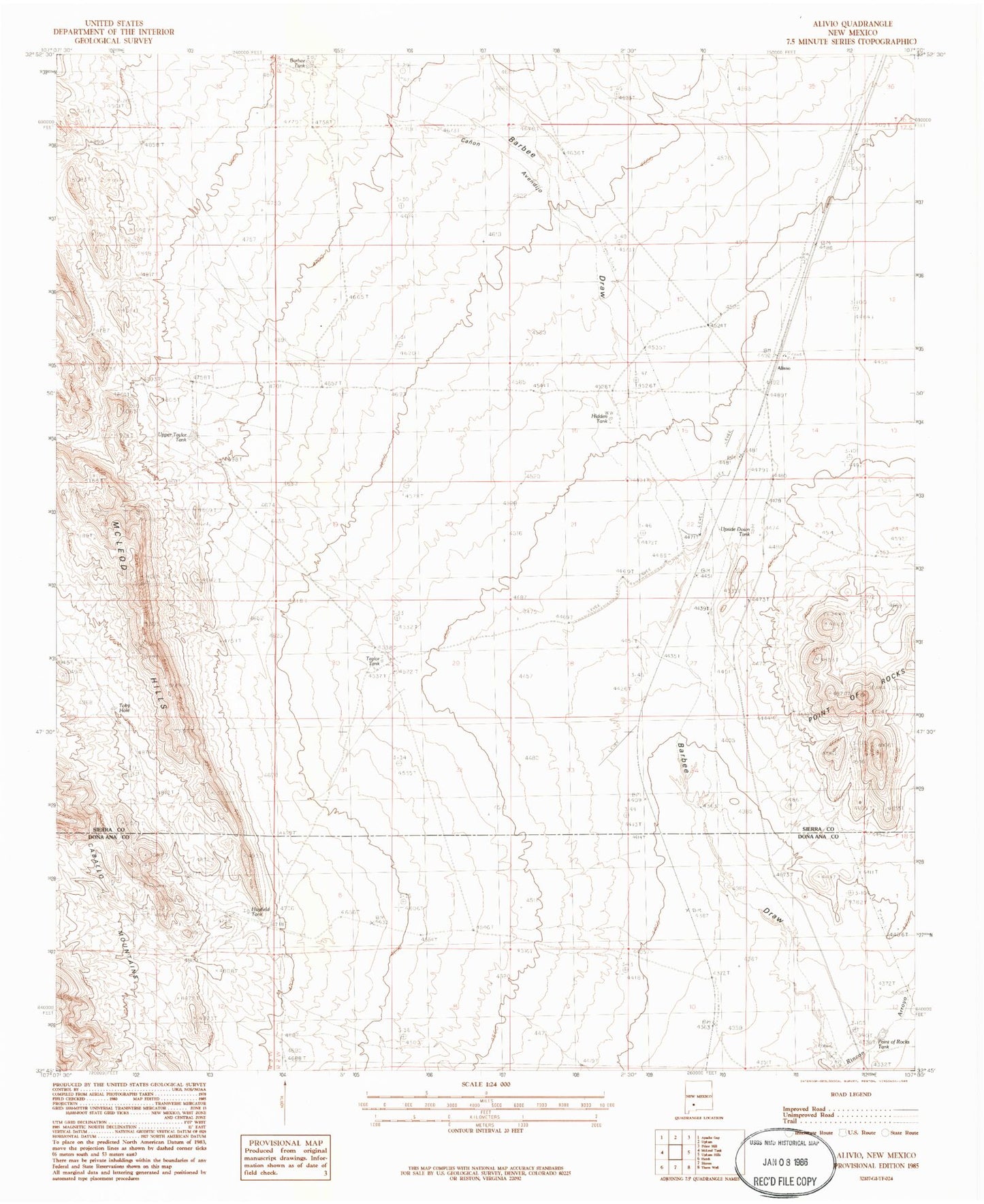
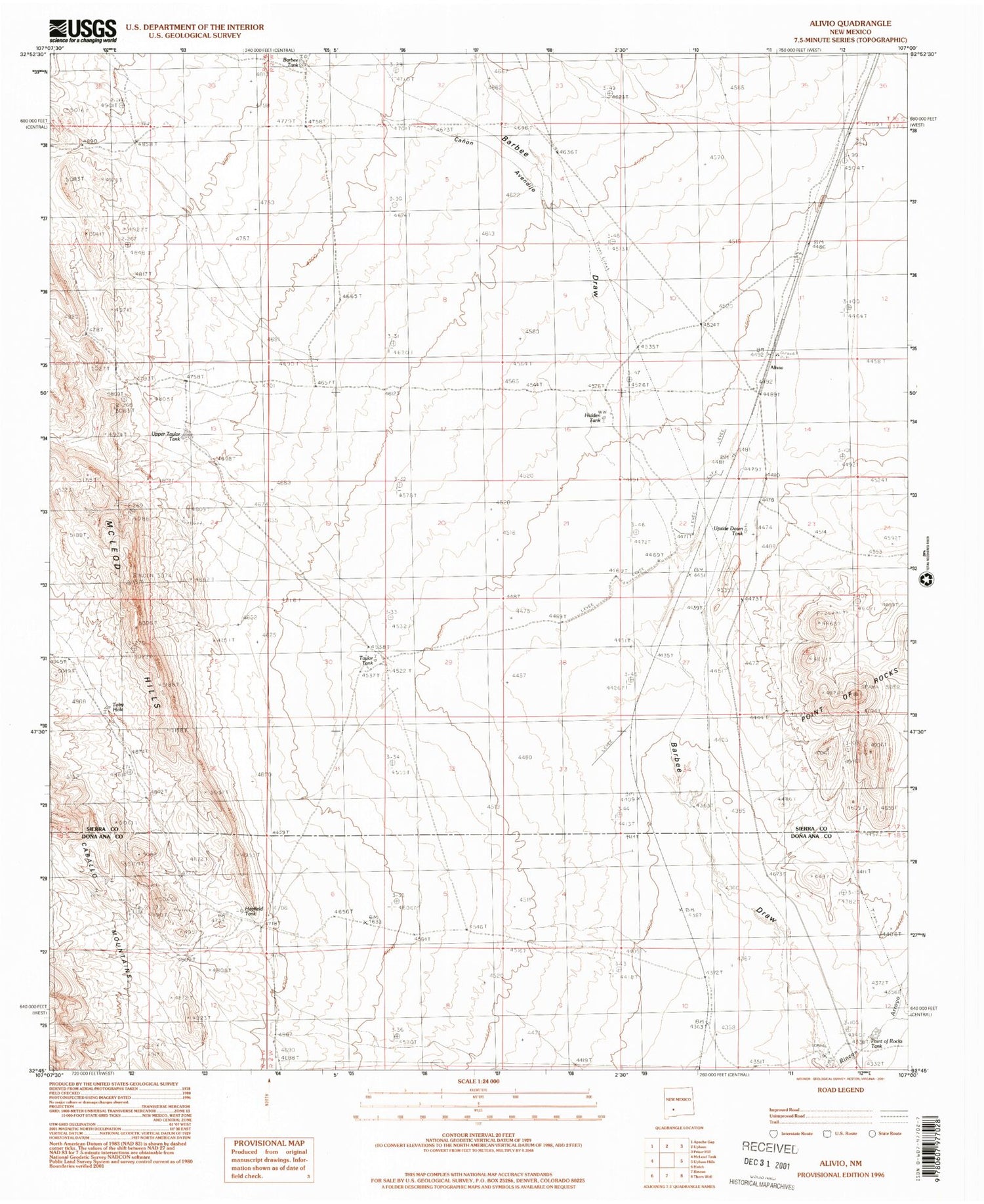
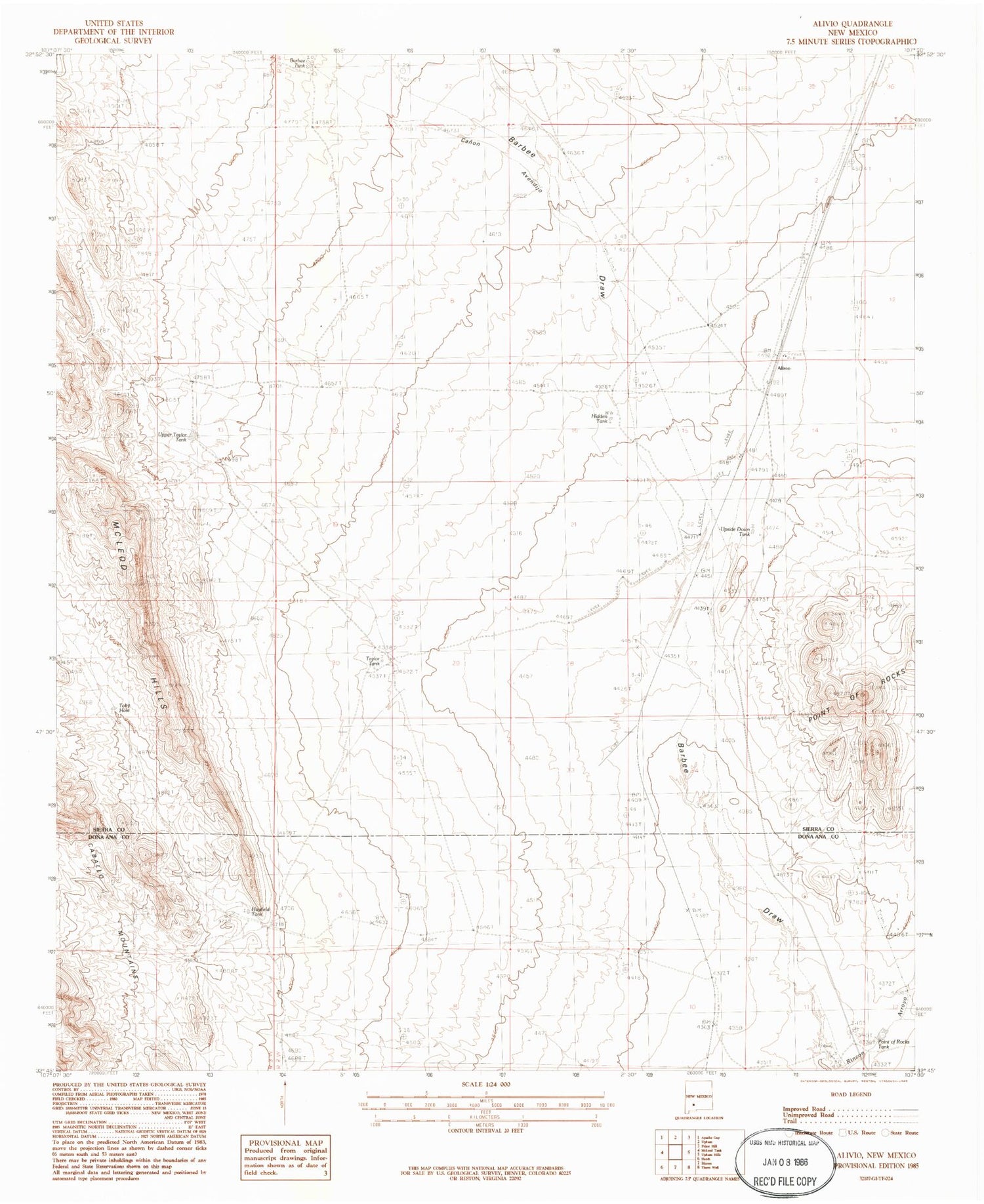
Historical USGS topographic quad map of Alivio in the state of New Mexico. Map scale may vary for some years, but is generally around 1:24,000. Print size is approximately 24" x 27"
This quadrangle is in the following counties: Do��a Ana, Sierra.
The map contains contour lines, roads, rivers, towns, and lakes. Printed on high-quality waterproof paper with UV fade-resistant inks, and shipped rolled.
Contains the following named places: Alivio, Barbee Tank, Canon Avendijo, Hayfield Tank, Hidden Tank, Horseshoe Deposit, Point of Rocks Tank, Point of Rocks Windmill, Railroad Windmill, Rincon Dikes, Taylor Tank, Taylor Well, Toby Hole, Upper Taylor Tank, Upside Down Tank