MyTopo
Classic USGS Alkali Lake Nebraska 7.5'x7.5' Topo Map
Regular price
$16.95
Regular price
Sale price
$16.95
Unit price
per
Couldn't load pickup availability
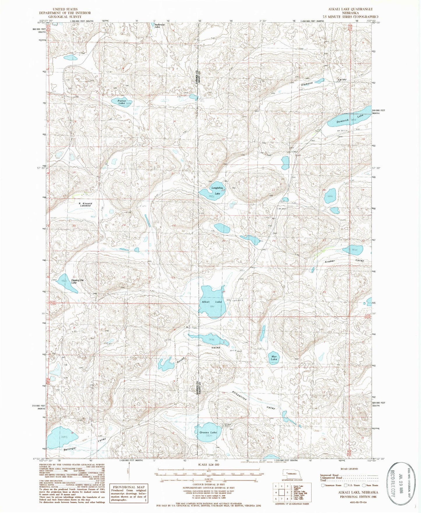
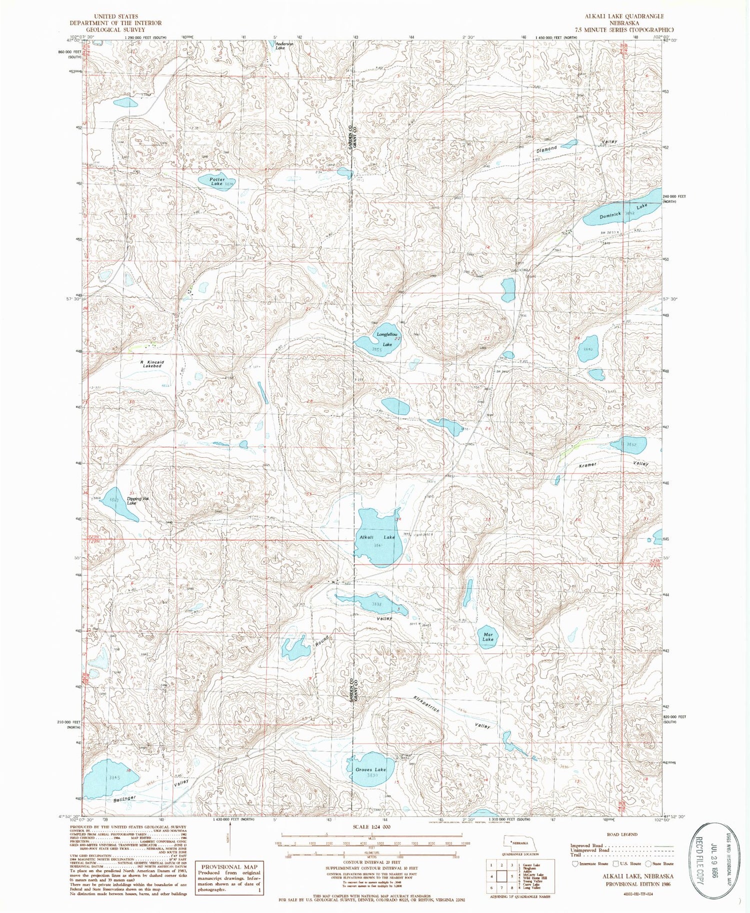
Historical USGS topographic quad map of Alkali Lake in the state of Nebraska. Map scale may vary for some years, but is generally around 1:24,000. Print size is approximately 24" x 27"
This quadrangle is in the following counties: Garden, Grant.
The map contains contour lines, roads, rivers, towns, and lakes. Printed on high-quality waterproof paper with UV fade-resistant inks, and shipped rolled.
Contains the following named places: Alkali Lake, Ballinger Valley, Diamond Valley, Dipping Vat Lake, Dominick Lake, Groves Lake, Kirkpatrick Valley, Kramer Valley, Longfellow Lake, Mar Lake, Potter Lake, R Kincaid Lake, Round Valley