MyTopo
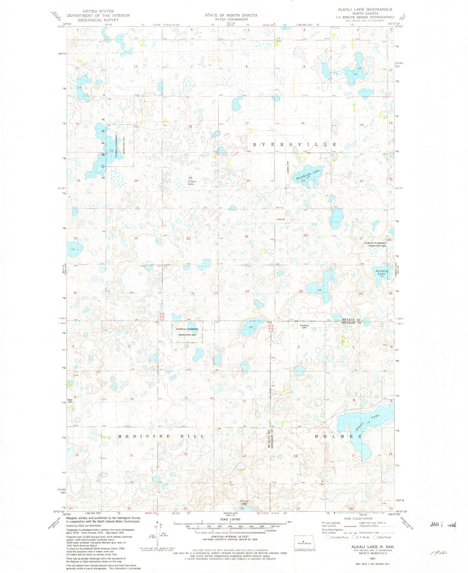
Classic USGS Alkali Lake North Dakota 7.5'x7.5' Topo Map
Couldn't load pickup availability
Historical USGS topographic quad map of Alkali Lake in the state of North Dakota. Map scale may vary for some years, but is generally around 1:24,000. Print size is approximately 24" x 27"
This quadrangle is in the following counties: McLean, Sheridan.
The map contains contour lines, roads, rivers, towns, and lakes. Printed on high-quality waterproof paper with UV fade-resistant inks, and shipped rolled.
Contains the following named places: Alkali Lake, Aurena School Number 2, Aurena School Number 3, Byersville School Number 1, Byersville School Number 2, Byersville School Number 4, Emmanuel Lutheran Cemetery, Harchenko Field, Immanuel Church, Medicine Hill School Number 3, Seventh Day Adventist Cemetery, Tabor Cemetery, Township of Byersville, Township of Holmes, Township of Medicine Hill