MyTopo
Classic USGS Allamoore Texas 7.5'x7.5' Topo Map
Regular price
$16.95
Regular price
Sale price
$16.95
Unit price
per
Couldn't load pickup availability
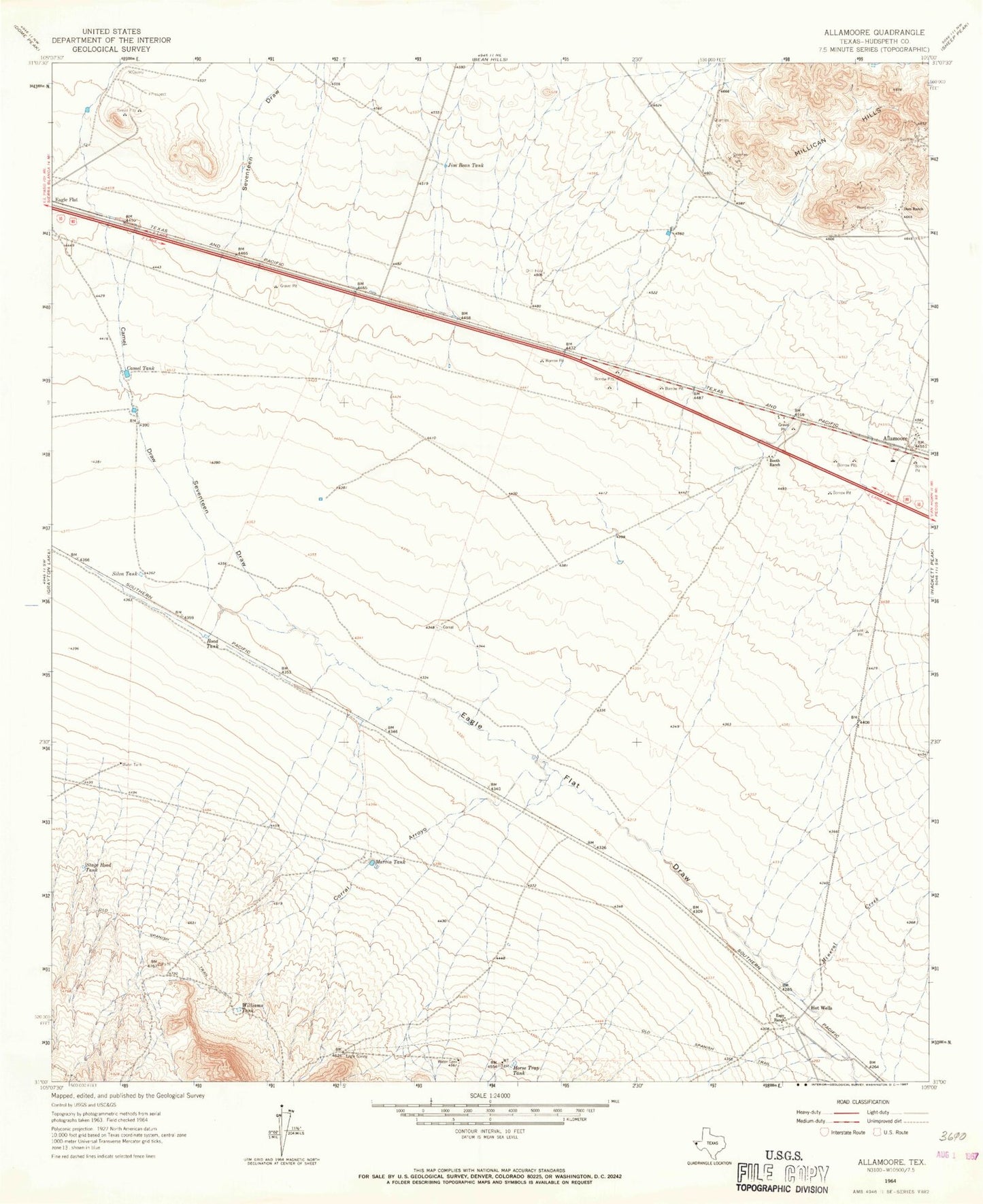
Historical USGS topographic quad map of Allamoore in the state of Texas. Map scale may vary for some years, but is generally around 1:24,000. Print size is approximately 24" x 27"
This quadrangle is in the following counties: Hudspeth.
The map contains contour lines, roads, rivers, towns, and lakes. Printed on high-quality waterproof paper with UV fade-resistant inks, and shipped rolled.
Contains the following named places: Allamoore, Allamoore Cemetery, Booth Ranch, Camel Draw, Camel Tank, Corral Arroyo, Dees Ranch, Espy Ranch, Goat Canyon, Horse Trap Tank, Hot Wells, Jim Bean Tank, Martin Tank, Mineral Creek, Road Tank, Seventeen Draw, Silva Tank, Stage Road Tank, Williams Tank