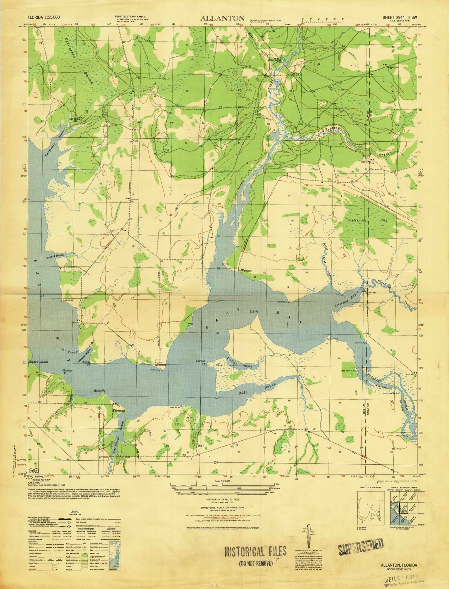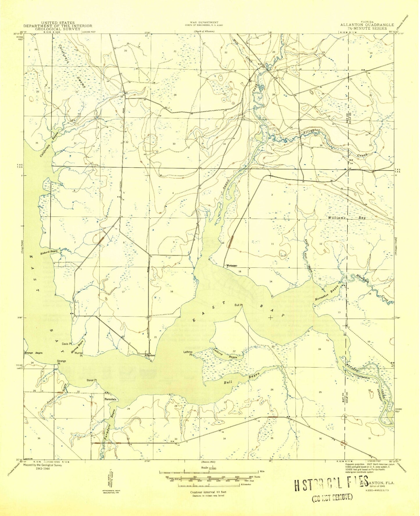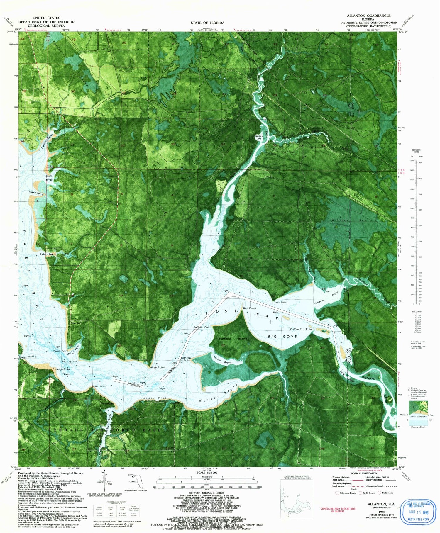
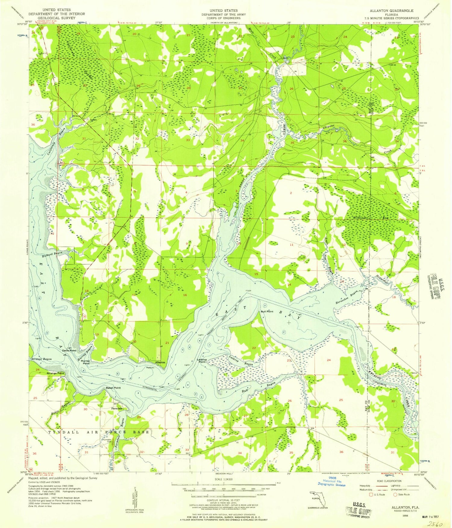
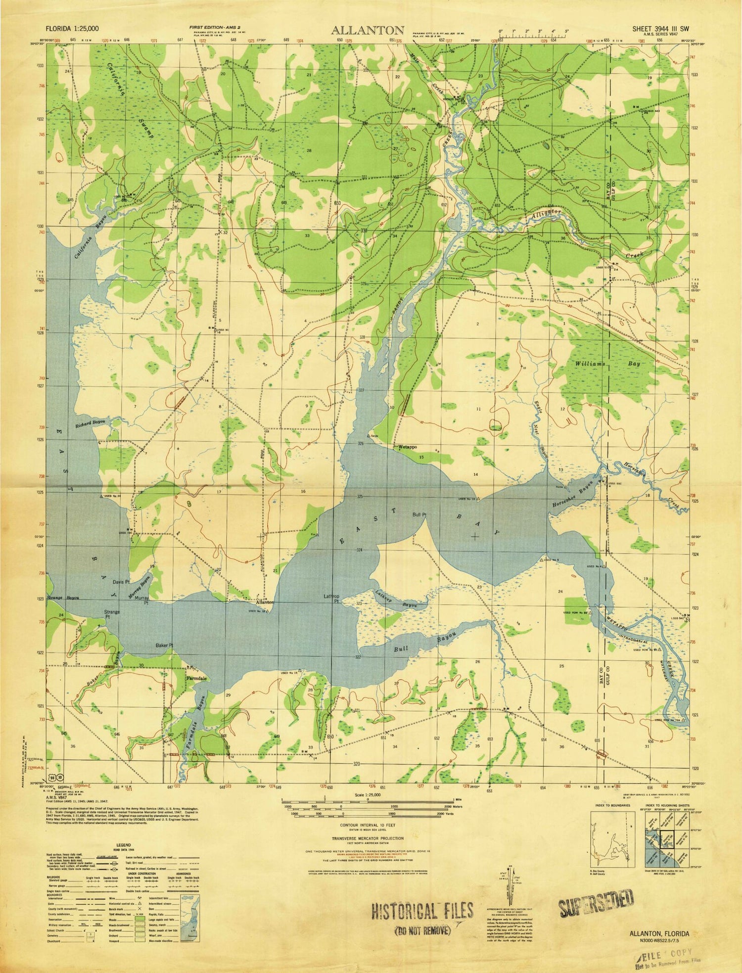
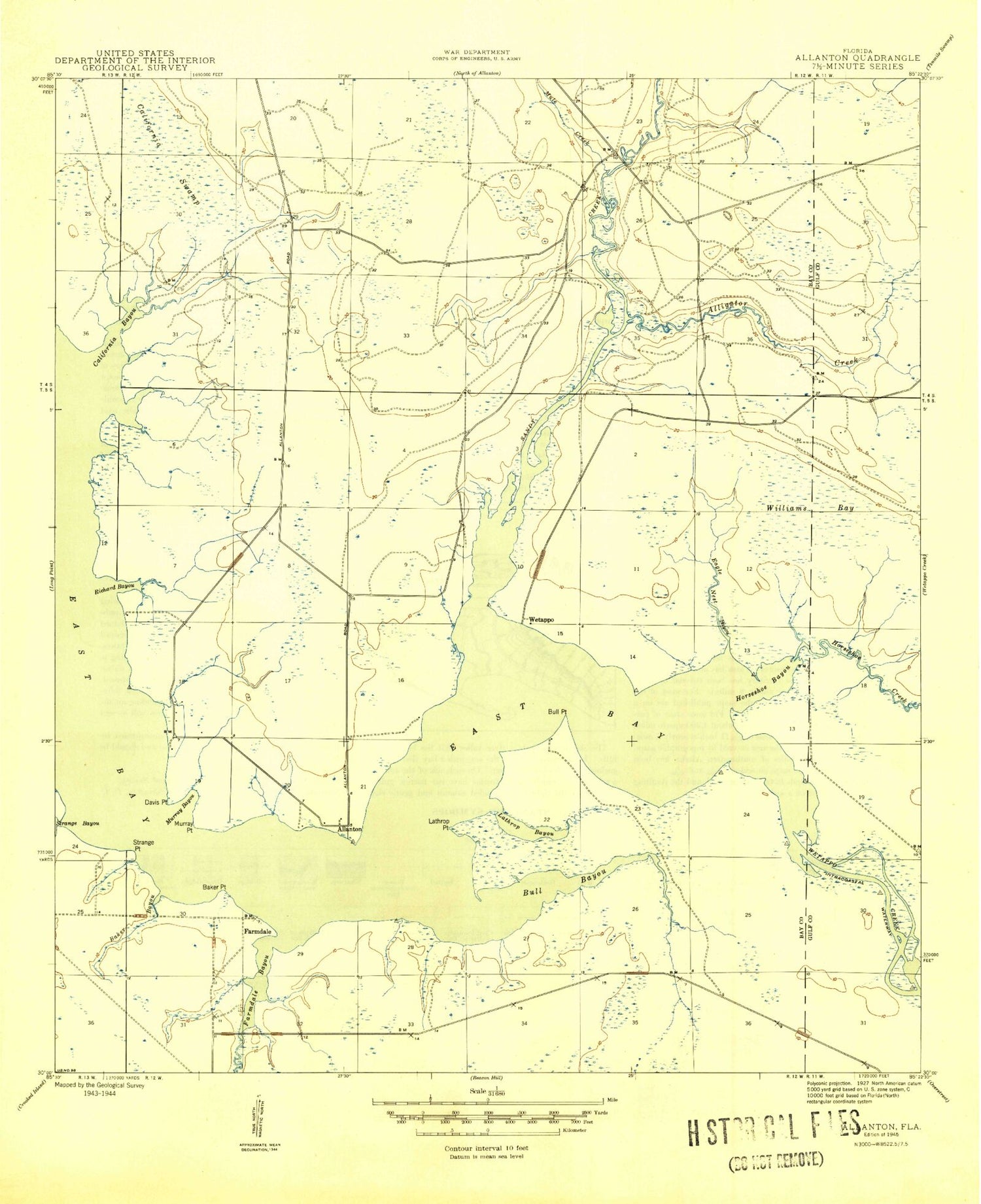
MyTopo
Classic USGS Allanton Florida 7.5'x7.5' Topo Map
Couldn't load pickup availability
Historical USGS topographic quad map of Allanton in the state of Florida. Map scale may vary for some years, but is generally around 1:24,000. Print size is approximately 24" x 27"
This quadrangle is in the following counties: Bay, Gulf.
The map contains contour lines, roads, rivers, towns, and lakes. Printed on high-quality waterproof paper with UV fade-resistant inks, and shipped rolled.
Contains the following named places: Allan Point, Allanton, Baker Bayou, Baker Point, Big Cove, Bull Point, Burkett Bayou, California Bayou, California Swamp, Coffee Pot Point, Danley Lake, Davis Point, Deep Point, Eagle Nest Bayou, Farmdale, Farmdale Bayou, Farmdale Cemetery, Horseshoe Bayou, Horseshoe Creek, Lathrop Bayou, Lathrop Point, Little Sandy Creek, Mule Creek, Murray Bayou, Murray Point, Nesser Flat, Raffield Island, Richard Bayou, Sandy Creek, Sandy Creek Airpark, Smith Bayou, Strange Bayou, Strange Point, Turtle Slough, Walker Bayou, Wetappo, Wetappo Creek, Williams Bay