MyTopo
Classic USGS Allen Bend Texas 7.5'x7.5' Topo Map
Couldn't load pickup availability
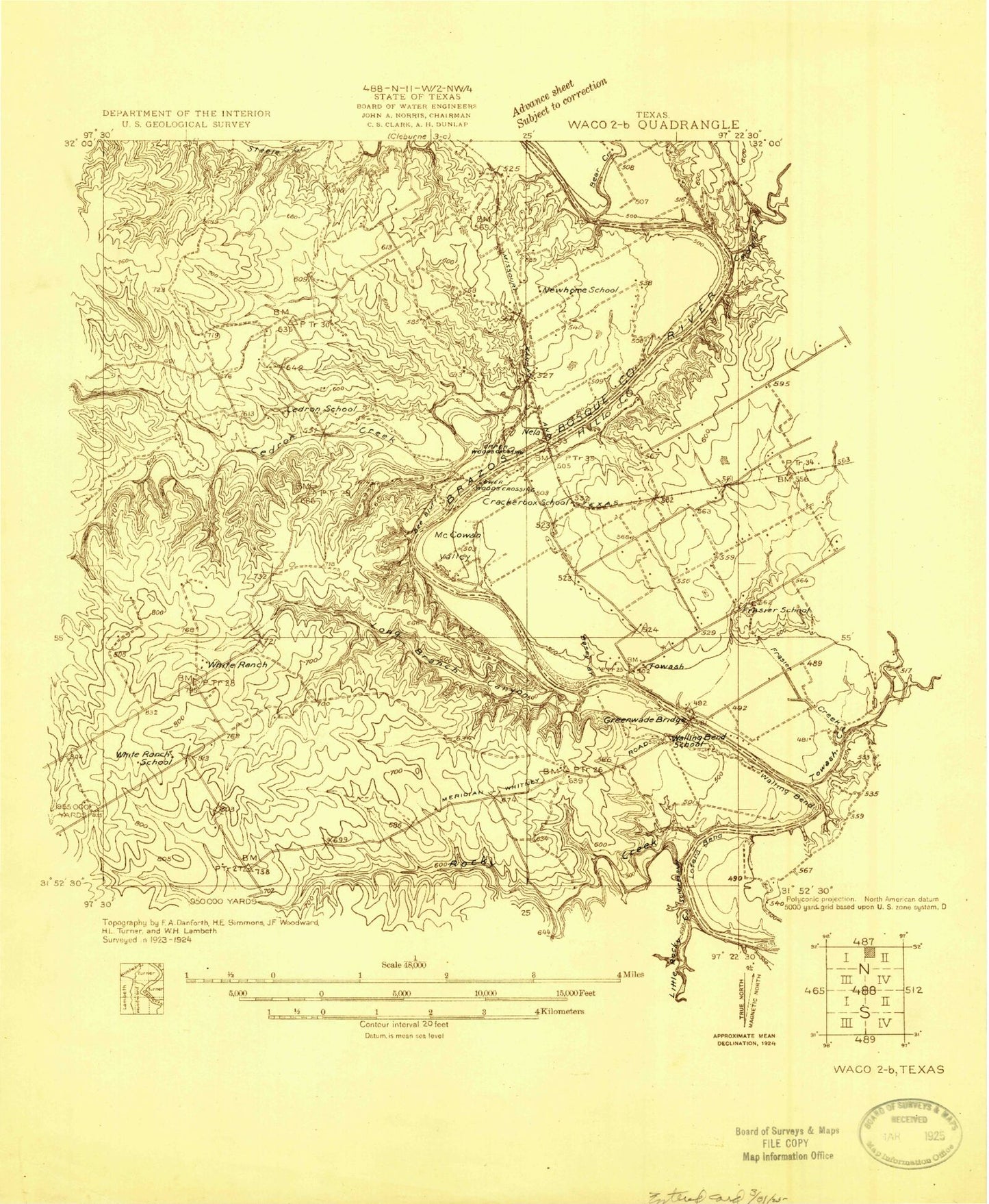
Historical USGS topographic quad map of Allen Bend in the state of Texas. Map scale may vary for some years, but is generally around 1:24,000. Print size is approximately 24" x 27"
This quadrangle is in the following counties: Bosque, Hill.
The map contains contour lines, roads, rivers, towns, and lakes. Printed on high-quality waterproof paper with UV fade-resistant inks, and shipped rolled.
Contains the following named places: Allen Bend, Bee Bluff, Cedar Creek, Cedar Shores, Cedron Cemetery, Cedron Creek, Cedron Creek Park, Falls Branch, Frazier Creek, Katy Bridge, King Creek, Lakeview Volunteer Fire Department, Lakewood Harbor, Long Branch, McCowan Valley, McCowan Valley Park, McCown Valley Park, Pioneer Cove, Rocky Creek, Steele Creek Acres Volunteer Fire Department, Steiner Church, Walling Bend, Walling Bend Park