
MyTopo
Classic USGS Allen Springs Kentucky 7.5'x7.5' Topo Map
Couldn't load pickup availability
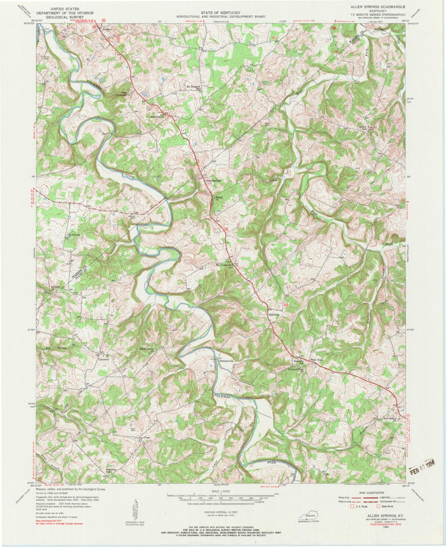
Historical USGS topographic quad map of Allen Springs in the state of Kentucky. Typical map scale is 1:24,000, but may vary for certain years, if available. Print size: 24" x 27"
This quadrangle is in the following counties: Allen, Warren.
The map contains contour lines, roads, rivers, towns, and lakes. Printed on high-quality waterproof paper with UV fade-resistant inks, and shipped rolled.
Contains the following named places: Agee Cemetery, Alvaton, Antioch Church, Bailey School, Beech Grove General Baptist Church, Boucher Branch, Fairview Church, Friendship Church, Halfway School, Harmony School, Johns Creek, Lancaster Branch, Mount Pleasant School, Mount Union General Baptist Church, New Bethel Methodist Church, Old Liberty Church, Pope Cemetery, Sherry Cemetery, Shiloh Church, Sulphur Creek, Trammel Fork Missionary Baptist Church, Walthall Cemetery, Allen Springs, Butlersville, Halfway, Pope, Raley Ford, Trammel, West Fork, WBLG-FM (Smiths Grove), Halfway Division, Trammel Volunteer Fire Department, Bailey (historical), Alvaton Post Office


