MyTopo
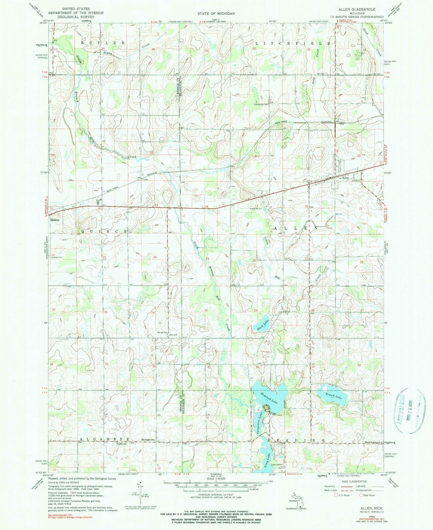
Classic USGS Allen Michigan 7.5'x7.5' Topo Map
Couldn't load pickup availability
Historical USGS topographic quad map of Allen in the state of Michigan. Map scale may vary for some years, but is generally around 1:24,000. Print size is approximately 24" x 27"
This quadrangle is in the following counties: Branch, Hillsdale.
The map contains contour lines, roads, rivers, towns, and lakes. Printed on high-quality waterproof paper with UV fade-resistant inks, and shipped rolled.
Contains the following named places: Allen, Allen Baptist Church, Allen Cemetery, Allen Historical Park, Allen Post Office, Allen Township Fire Department, Allen United Methodist Church, Bowen Creek, Camp Selah, Captain Moses Allen Historical Marker, Carpenter Lake, Dorris Cemetery, Duck Lake, Gorton Post Office, Hemlock Lake, Historic Marble Springs, Jordan School, Lake Cemetery, Layton Grave, Little Hog Creek, North Reading Cemetery, North Reading Church, Round Lake, Sand Creek Cemetery, South Allen Cemetery, South Allen Post Office, Stringtown, Todd Town Cemetery, Township of Allen, Village of Allen, ZIP Code: 49227