MyTopo
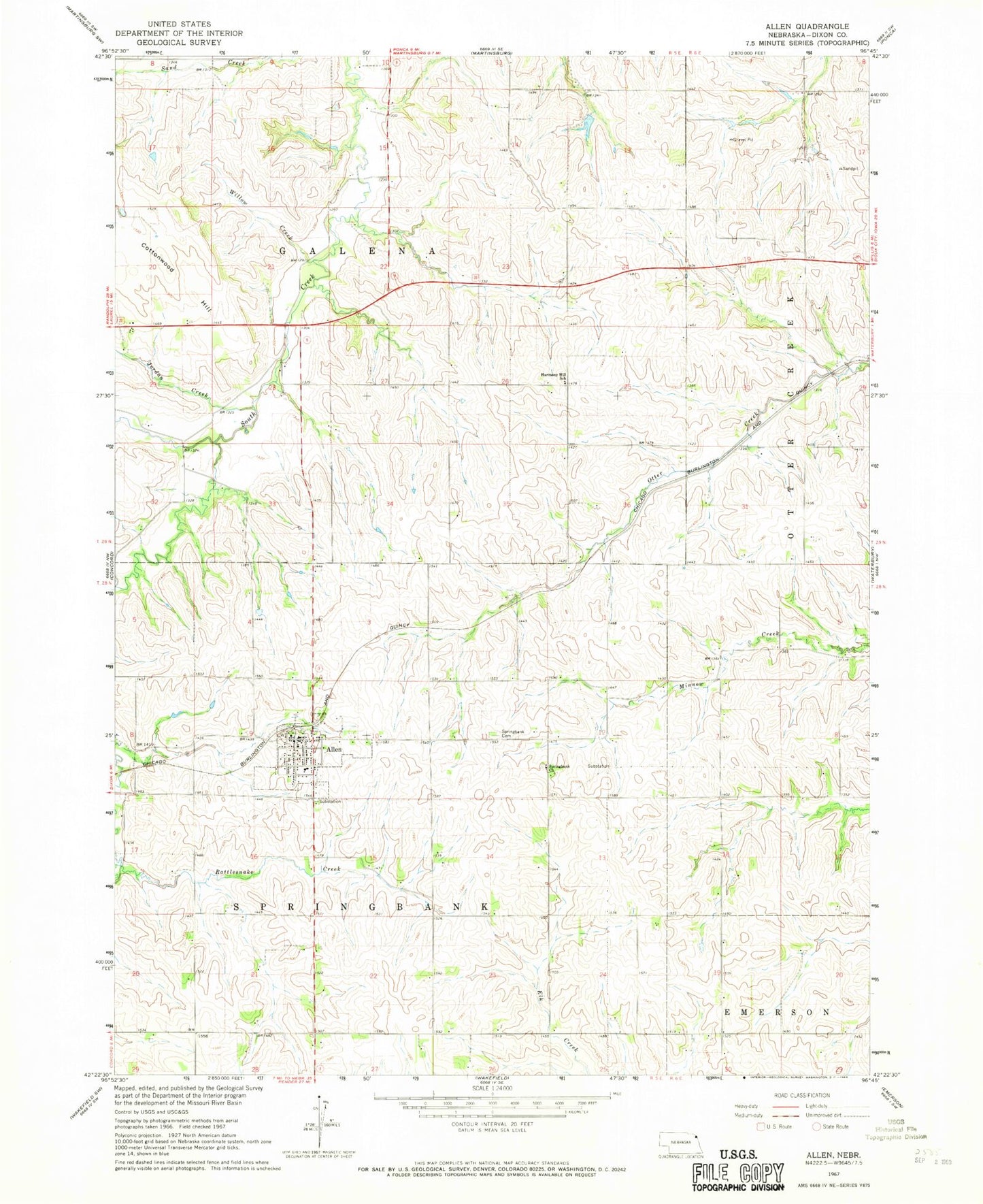
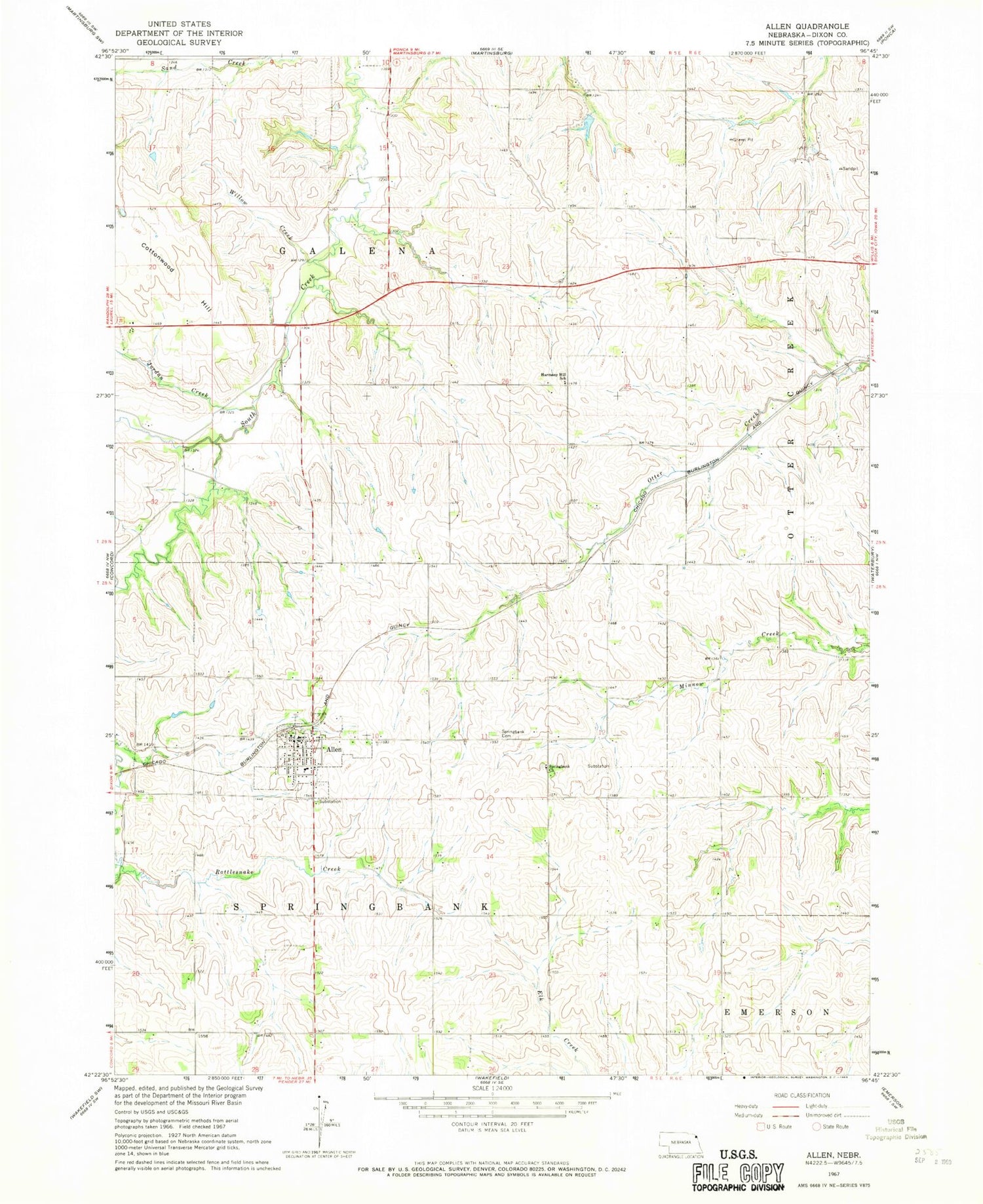
Classic USGS Allen Nebraska 7.5'x7.5' Topo Map
Couldn't load pickup availability
Historical USGS topographic quad map of Allen in the state of Nebraska. Map scale may vary for some years, but is generally around 1:24,000. Print size is approximately 24" x 27"
This quadrangle is in the following counties: Dixon.
The map contains contour lines, roads, rivers, towns, and lakes. Printed on high-quality waterproof paper with UV fade-resistant inks, and shipped rolled.
Contains the following named places: Allen, Allen - Waterbury Fire and Rescue Department, Allen Consolidated Schools, Allen Post Office, Allen RV Park, Cottonwood Hill, Dixon County, Dixon County Museum, Dohma Dam, Dohma Reservoir, Farmers Cooperative Association Elevator, First Lutheran Church, Harmony Hill School, Historical Tree Grove, Jordan Creek, Rattlesnake Creek, Sand Creek, Spring Bank Post Office, Springank Church, Springbank Friends Cemetery, Springbank Township Library, Township of Galena, Township of Ottercreek, Township of Springbank, United Methodist Church, Village of Allen, Willow Creek, ZIP Code: 68710