MyTopo
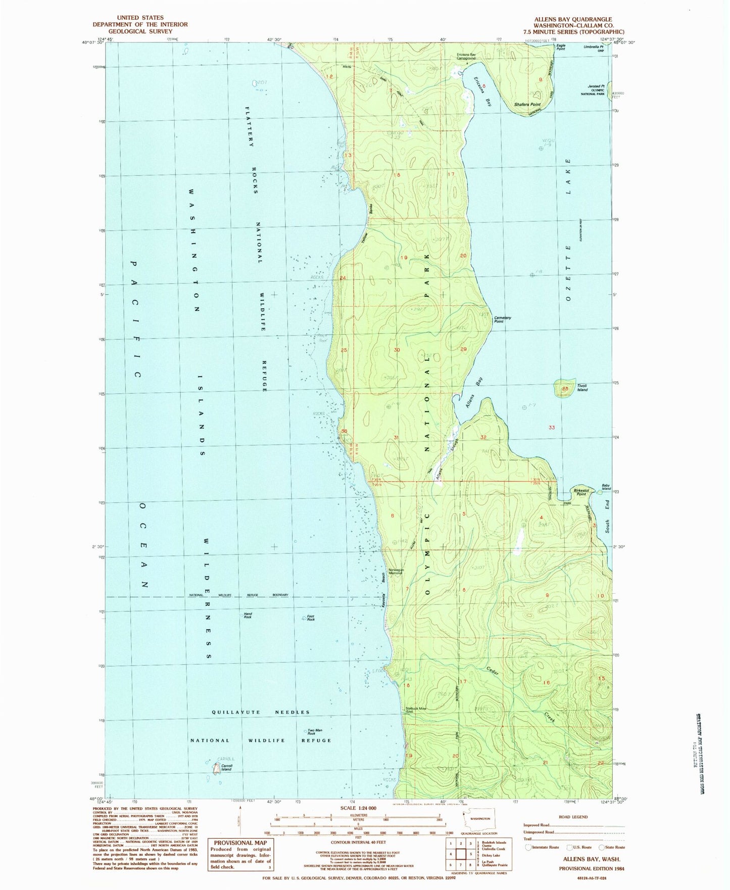
Classic USGS Allens Bay Washington 7.5'x7.5' Topo Map
Couldn't load pickup availability
Historical USGS topographic quad map of Allens Bay in the state of Washington. Typical map scale is 1:24,000, but may vary for certain years, if available. Print size: 24" x 27"
This quadrangle is in the following counties: Clallam.
The map contains contour lines, roads, rivers, towns, and lakes. Printed on high-quality waterproof paper with UV fade-resistant inks, and shipped rolled.
Contains the following named places: Allens Bay, Allens Bay Trail, Allens Slough, Baby Island, Birkestol Point, Carroll Island, Cedar Creek, Eagle Point, Ericsons Bay, Jersted Point, Kayostia Beach, Norwegian Memorial, Old Cemetery, Shafers Point, South End, South Sand Point Trail, Tivoli Island, Umbrella Point, Starbuck Mine, Ericksons Bay Campground, Wish Creek, Foot Rock, Hand Rock, Two Man Rock, Ozette Lake, Cemetery Point, Yellow Banks