MyTopo
Classic USGS Allensville Kentucky 7.5'x7.5' Topo Map
Couldn't load pickup availability
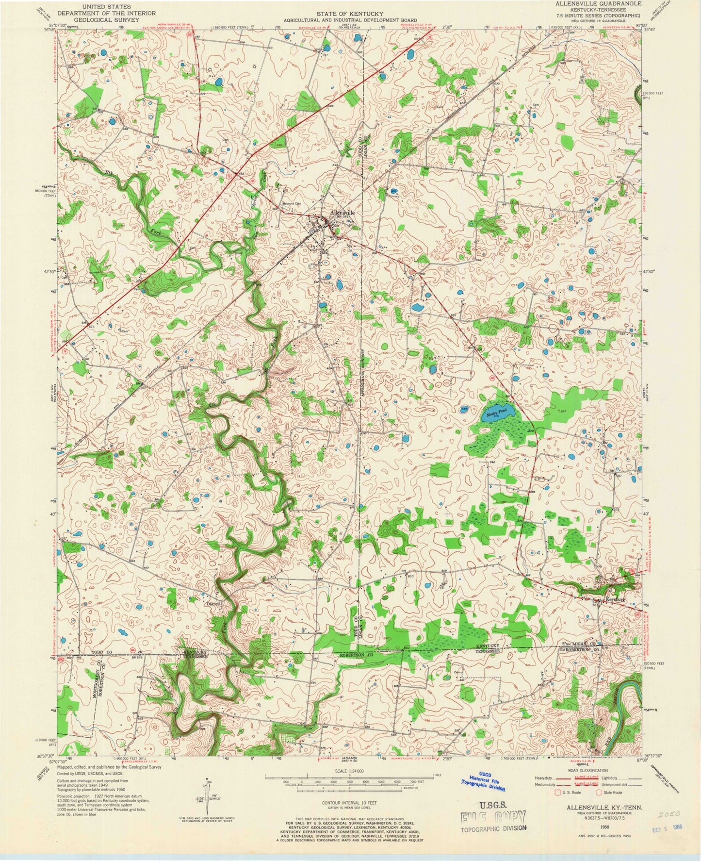
Historical USGS topographic quad map of Allensville in the states of Kentucky, Tennessee. Map scale may vary for some years, but is generally around 1:24,000. Print size is approximately 24" x 27"
This quadrangle is in the following counties: Logan, Montgomery, Robertson, Todd.
The map contains contour lines, roads, rivers, towns, and lakes. Printed on high-quality waterproof paper with UV fade-resistant inks, and shipped rolled.
Contains the following named places: Allensville, Allensville Census Designated Place, Allensville Fire Department, Allensville Post Office, Ash Spring, Belmont Cemetery, City of Allensville, Cross Cemetery, Darnell, Hill Cemetery, Kent, Keysburg, Mitchell Cemetery, Mosley Pond, Rum Spring Creek, Rural Free Delivery Historical Marker, Stainback Cemetery, Wall Cemetery, ZIP Codes: 42204, 42265