MyTopo
Classic USGS Allensville Ohio 7.5'x7.5' Topo Map
Couldn't load pickup availability
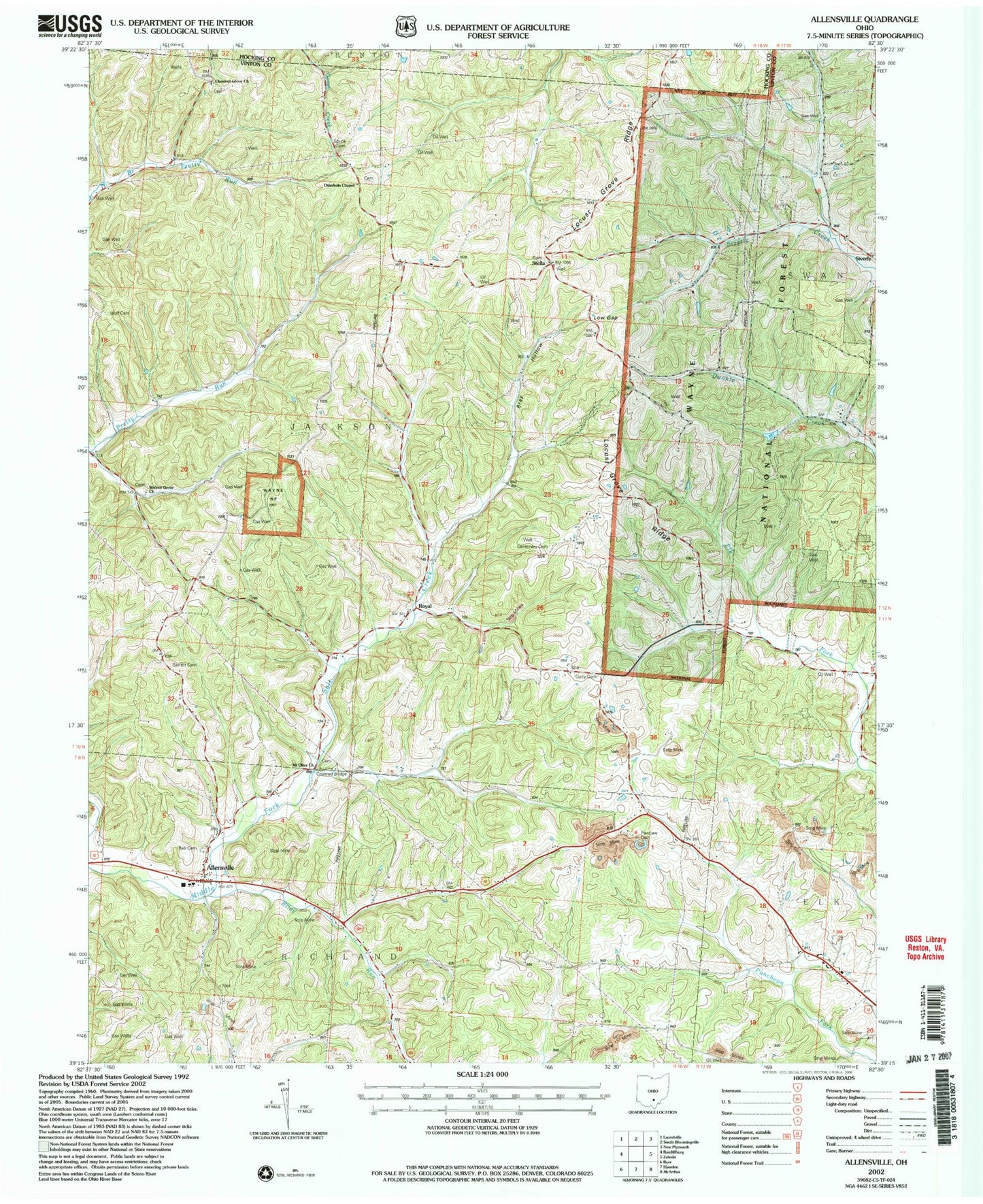
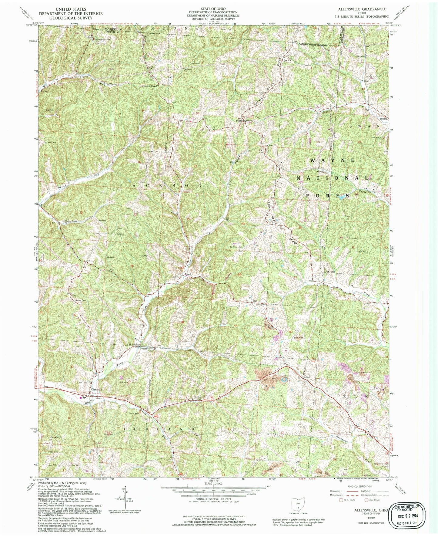
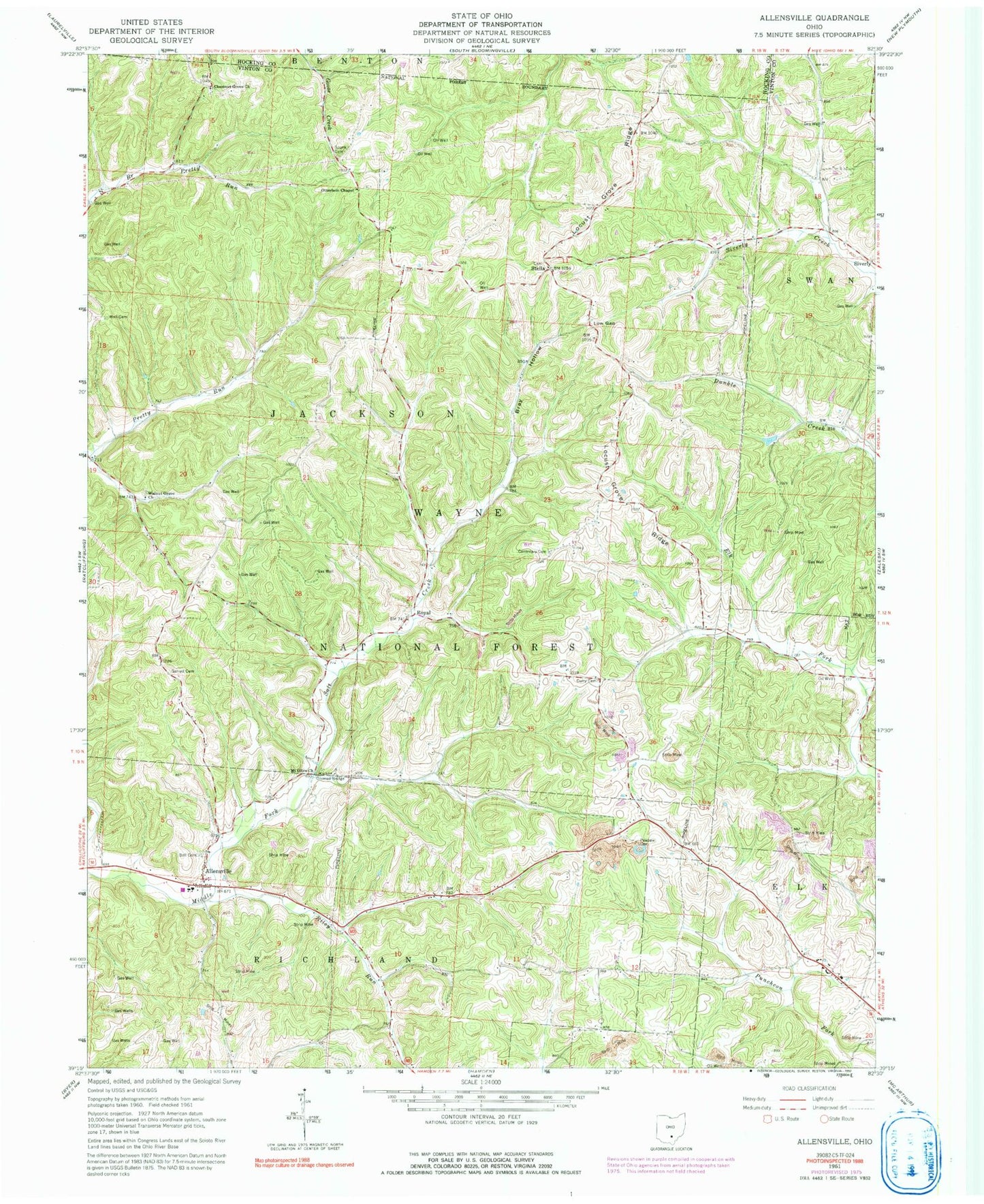
Historical USGS topographic quad map of Allensville in the state of Ohio. Typical map scale is 1:24,000, but may vary for certain years, if available. Print size: 24" x 27"
This quadrangle is in the following counties: Hocking, Vinton.
The map contains contour lines, roads, rivers, towns, and lakes. Printed on high-quality waterproof paper with UV fade-resistant inks, and shipped rolled.
Contains the following named places: Allensville Elementary School, Anderson School (historical), Browns School (historical), Centenary Church (historical), Center School (historical), Miller School (historical), Million School (historical), Papaw School (historical), Pleasant Chapel (historical), Riley School (historical), Shively School (historical), Vandiford School (historical), Goosetown (historical), Royal, Allensville, Bell Cemetery, Bray Hollow, Centenary Cemetery, Chestnut Grove Church, Curry Cemetery, Garrett Cemetery, Low Gap, Mount Olive Church, Otterbein Chapel, Pawpaw Cemetery, Riley Run, Spunk Cemetery, Stella, Walnut Grove Church, Wolf Cemetery, Middle Fork Salt Creek, Locust Grove Ridge, Mount Olive Road Covered Bridge, Township of Jackson, Curry School (historical), Greenbrier School (historical), Robb School (historical), Chestnut Grove Cemetery, Garrett Ridge, Locust Grove Cemetery, Mount Olive Cemetery, Otterbein Cemetery, Walnut Grove Cemetery, Allensville Elementary School, Anderson School (historical), Browns School (historical), Centenary Church (historical), Center School (historical), Miller School (historical), Million School (historical), Papaw School (historical), Pleasant Chapel (historical), Riley School (historical), Shively School (historical), Vandiford School (historical), Goosetown (historical), Royal, Allensville, Bell Cemetery, Bray Hollow, Centenary Cemetery, Chestnut Grove Church, Curry Cemetery, Garrett Cemetery, Low Gap, Mount Olive Church, Otterbein Chapel, Pawpaw Cemetery, Riley Run, Spunk Cemetery, Stella, Walnut Grove Church, Wolf Cemetery, Middle Fork Salt Creek, Locust Grove Ridge, Mount Olive Road Covered Bridge, Township of Jackson, Curry School (historical), Greenbrier School (historical), Robb School (historical), Chestnut Grove Cemetery, Garrett Ridge, Locust Grove Cemetery, Mount Olive Cemetery, Otterbein Cemetery, Walnut Grove Cemetery