MyTopo
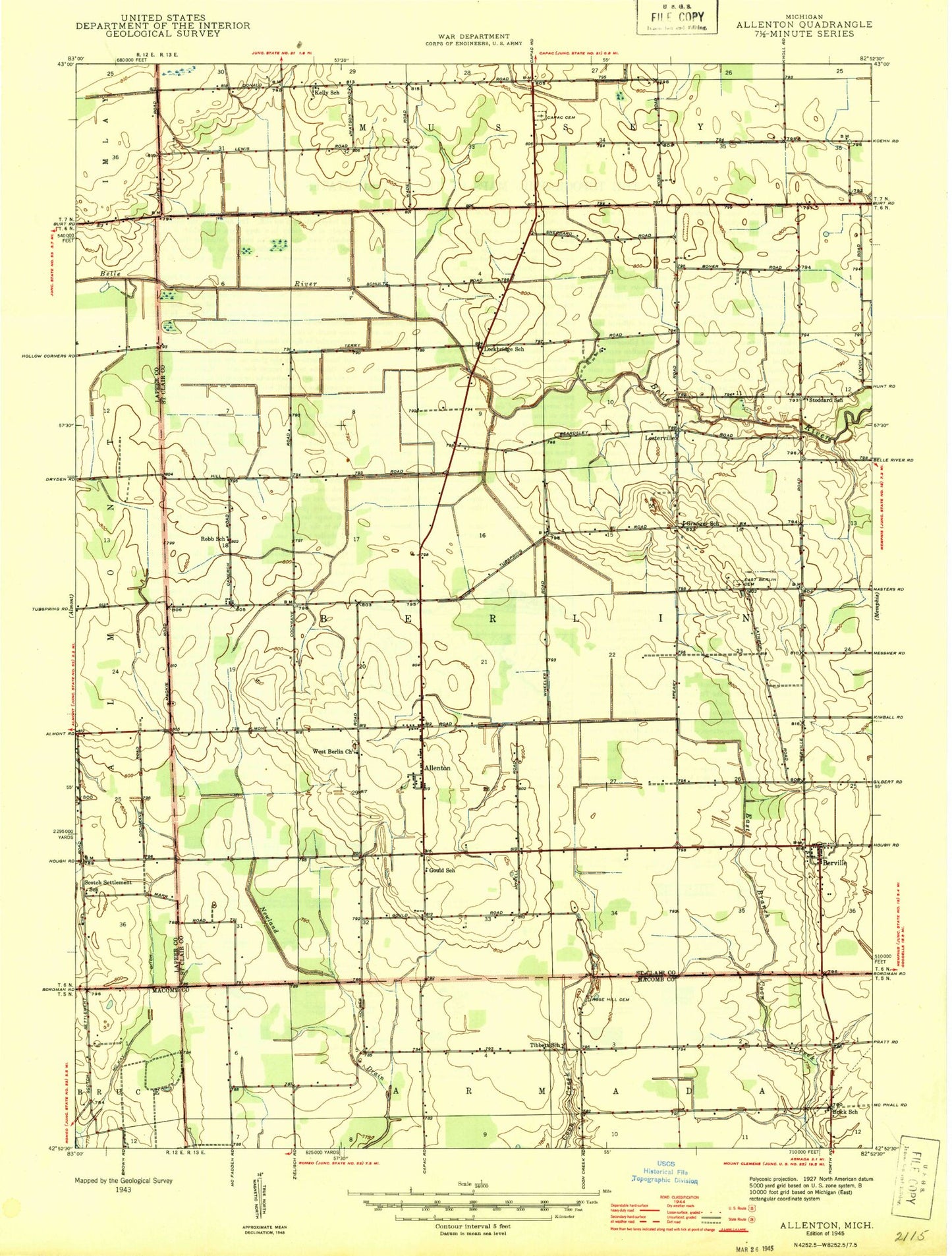
Classic USGS Allenton Michigan 7.5'x7.5' Topo Map
Couldn't load pickup availability
Historical USGS topographic quad map of Allenton in the state of Michigan. Map scale may vary for some years, but is generally around 1:24,000. Print size is approximately 24" x 27"
This quadrangle is in the following counties: Lapeer, Macomb, St. Clair.
The map contains contour lines, roads, rivers, towns, and lakes. Printed on high-quality waterproof paper with UV fade-resistant inks, and shipped rolled.
Contains the following named places: Allenton, Allenton Post Office, Almont Camp, Almont Society of the New Church, Almont Society of the New Church Historical Marker, Belle River Post Office, Berlin Oil Field, Berlin Township Fire Department, Berville, Berville Post Office, Berville Station, Capac Cemetery, Capac Drain, Capac Rest Area, Doty Drain, East Berlin Cemetery, Lesterville, McKay Ditch, Rose Hill Cemetery, Saint Johns Catholic Church, Scotch Settlement Cemetery, Smith's Station, Townline Drain, Township of Berlin, West Berlin Cemetery, West Berlin Church, ZIP Code: 48002