MyTopo
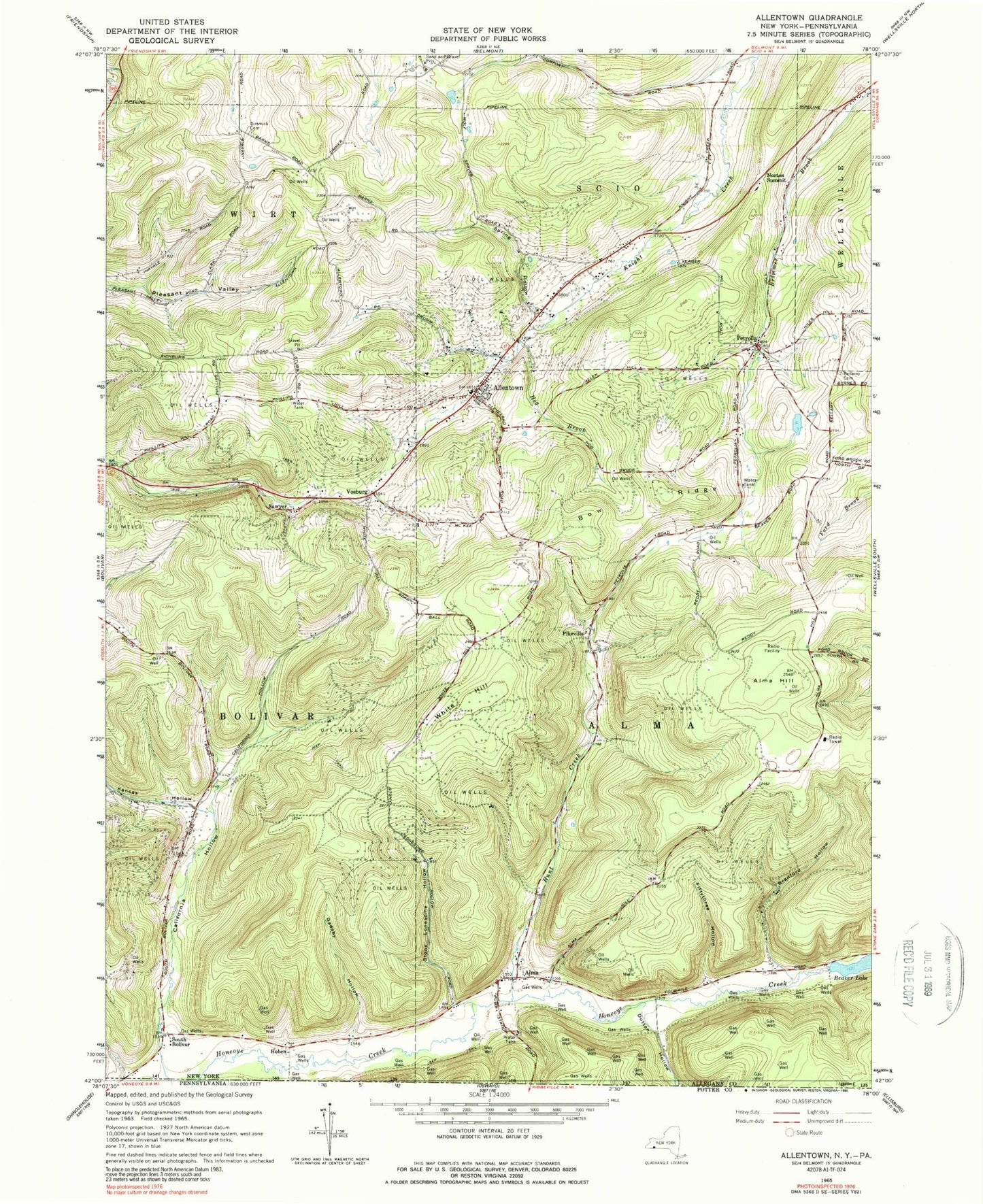
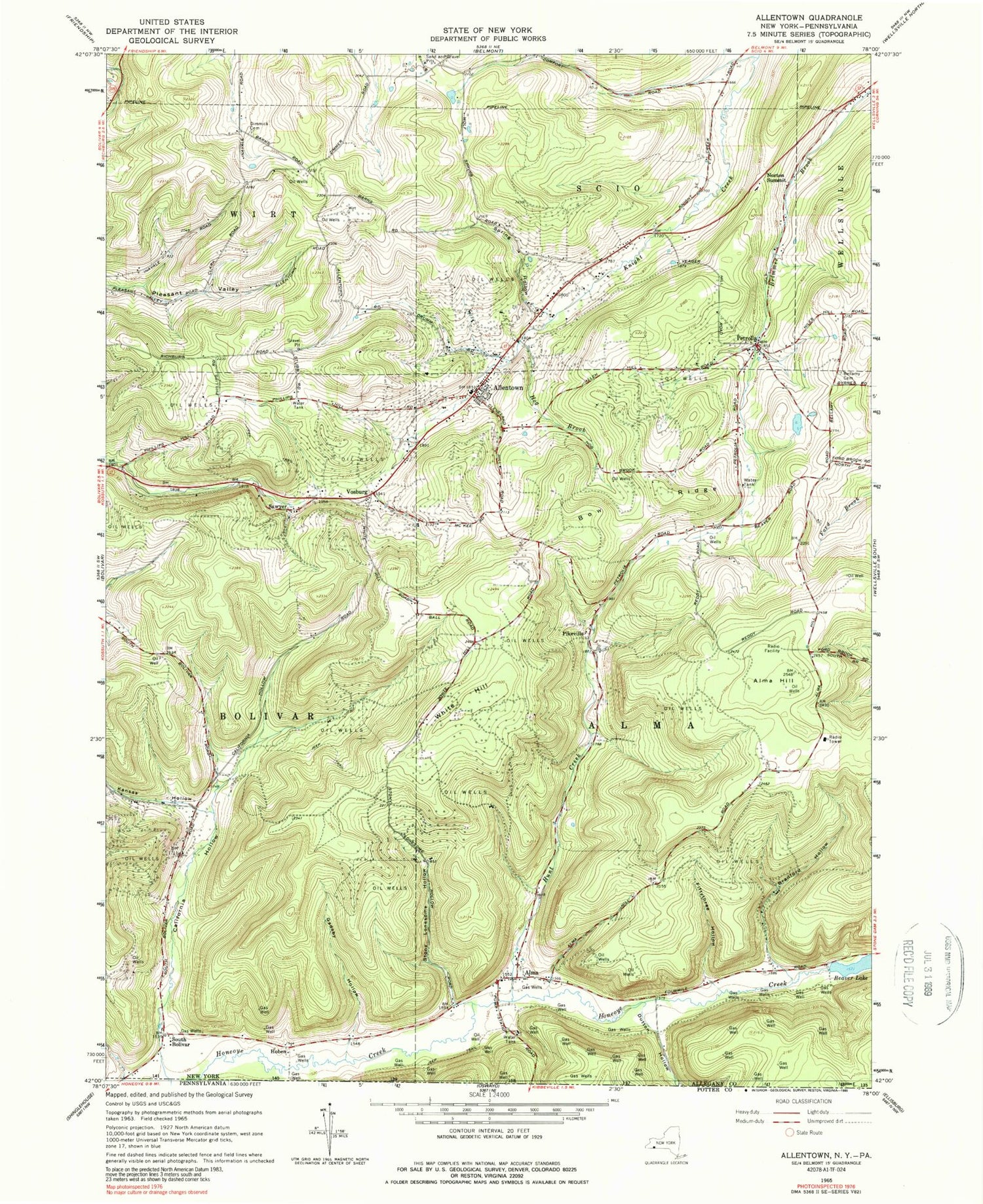
Classic USGS Allentown New York 7.5'x7.5' Topo Map
Couldn't load pickup availability
Historical USGS topographic quad map of Allentown in the state of New York. Typical map scale is 1:24,000, but may vary for certain years, if available. Print size: 24" x 27"
This quadrangle is in the following counties: Allegany, Potter.
The map contains contour lines, roads, rivers, towns, and lakes. Printed on high-quality waterproof paper with UV fade-resistant inks, and shipped rolled.
Contains the following named places: Allentown, Alma, Alma Hill, Bellamy Cemetery, Bow Ridge, Bradford Hollow, California Hollow, Dimick Cemetery, Dutton Hollow, Fiftythree Hollow, Gadsby Hollow, Hog Brook, Hunt Creek, Kansas Hollow, Petrolia, Spring Hollow, Stony Lonesome Hollow, Beaver Lake, White Hill, Hoben, Norton Summit, Pikeville, Sawyer, South Bolivar, Vosburg, Town of Alma, Allentown Cemetery, Babcock School (historical), Dimmick School (historical), Norton School (historical), Phillips Hill School (historical), Pleasant Valley School (historical), School Number 5 (historical), White Hill School (historical), Sunnyside Cemetery, Breezy Point Campground, Allentown Post Office, Allentown Volunteer Fire Department, Alma Fire Department