
MyTopo
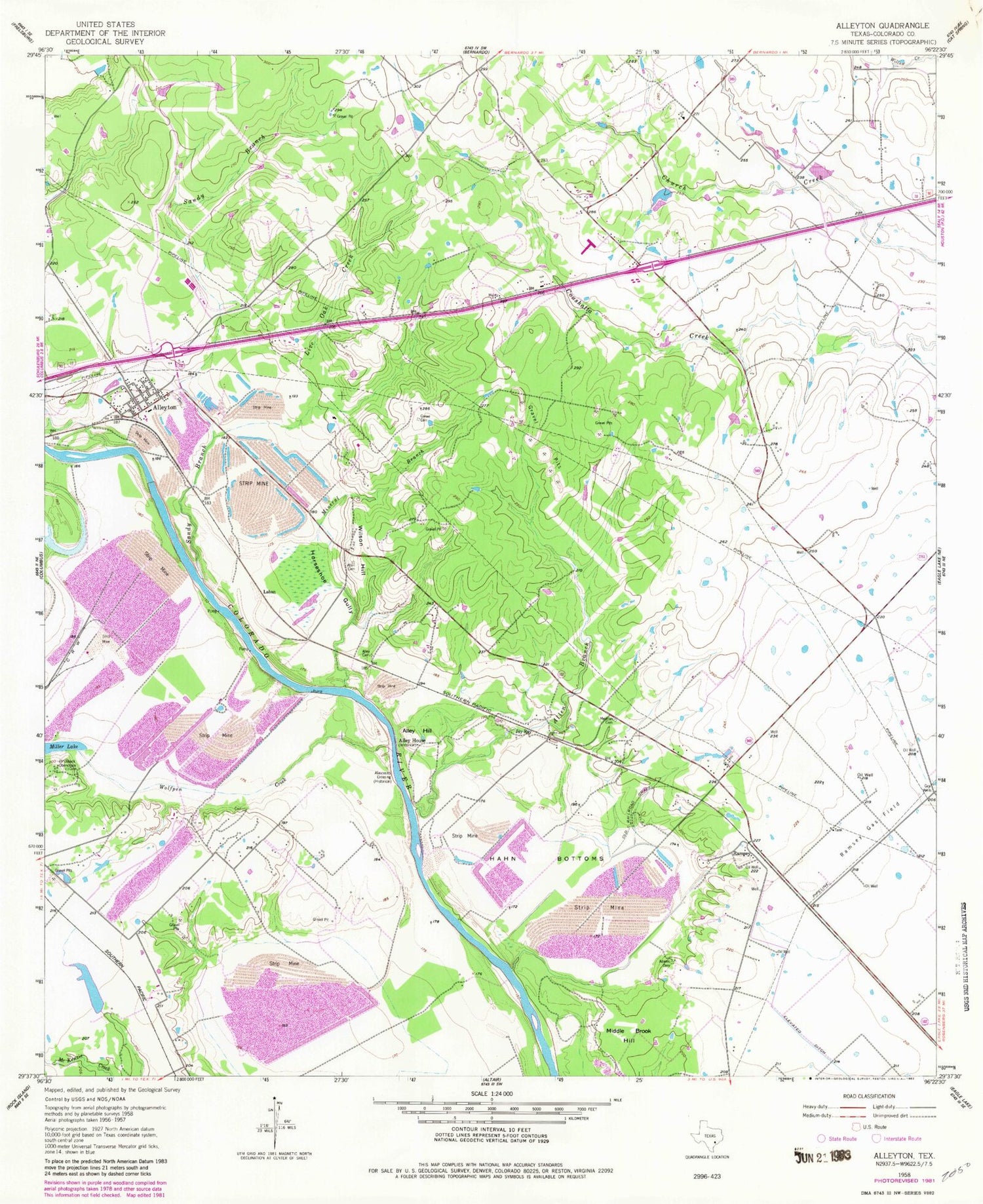
Classic USGS Alleyton Texas 7.5'x7.5' Topo Map
Couldn't load pickup availability
Historical USGS topographic quad map of Alleyton in the state of Texas. Map scale may vary for some years, but is generally around 1:24,000. Print size is approximately 24" x 27"
This quadrangle is in the following counties: Colorado.
The map contains contour lines, roads, rivers, towns, and lakes. Printed on high-quality waterproof paper with UV fade-resistant inks, and shipped rolled.
Contains the following named places: Adams Cemetery, Allen Branch, Allen Cemetery, Alley Cemetery, Alley Hill, Alley House, Alleyton, Atascosito Crossing, Grewe Cemetery, Hahn Bottoms, Horseshoe Gully, Jay Ray, Laban, Live Oak Creek, Mexican Cemetery, Middle Brook Hill, Mineral Branch, Pinchback Obenchain Cemetery, Ramsey, Ramsey Gas Field, Sandy Branch, Wilson Hill, Wolfpen Creek, ZIP Code: 78935


