MyTopo
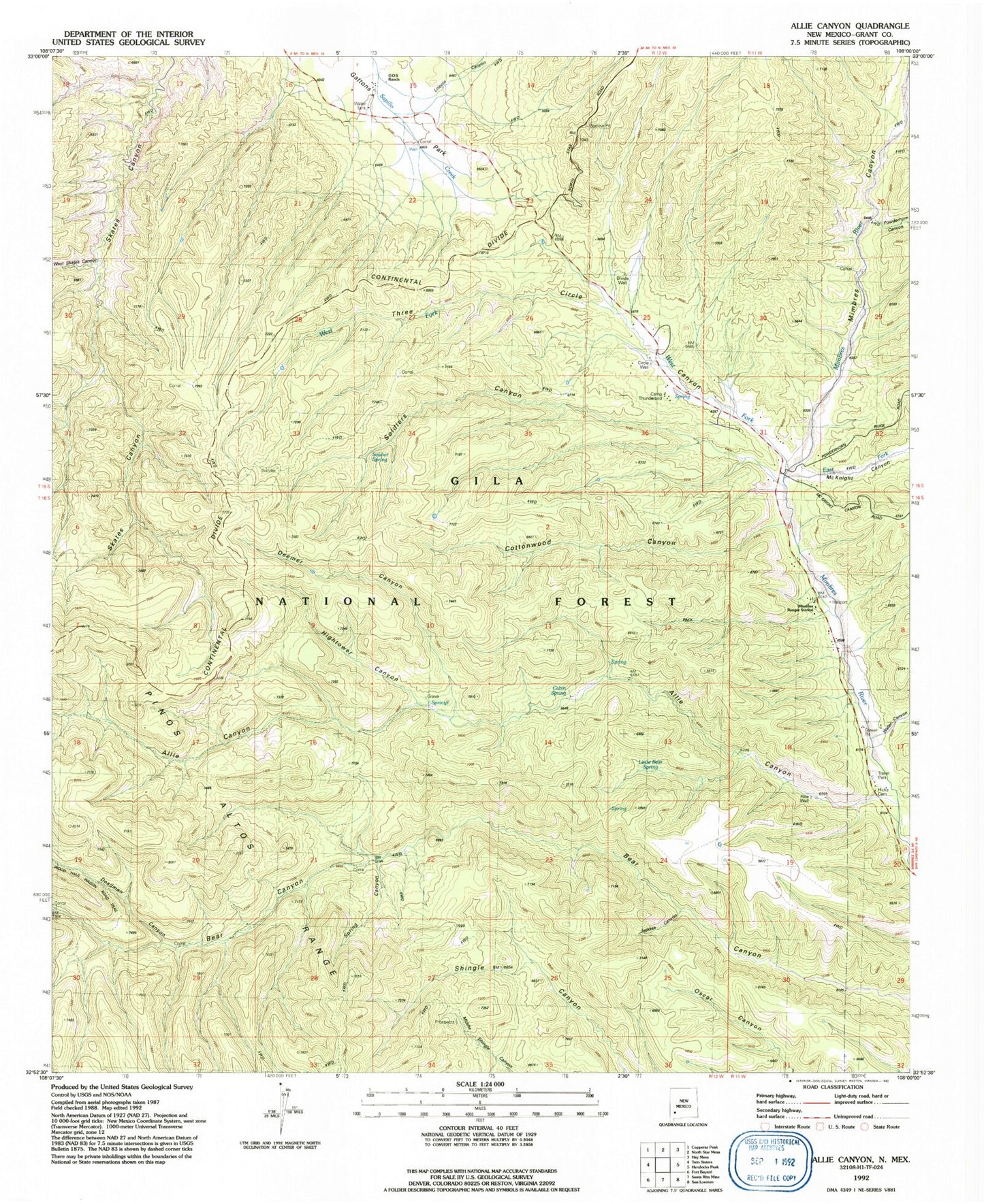
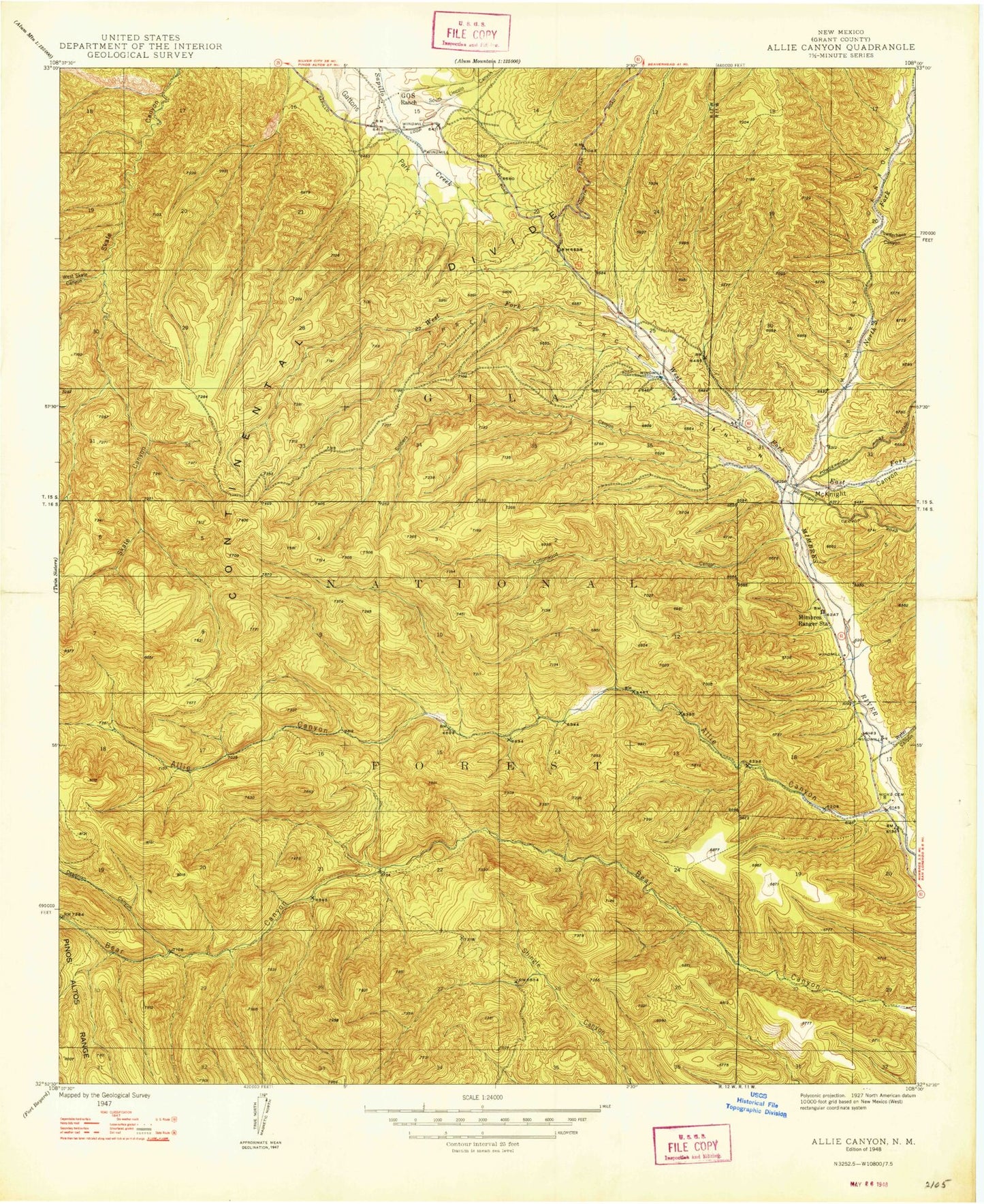
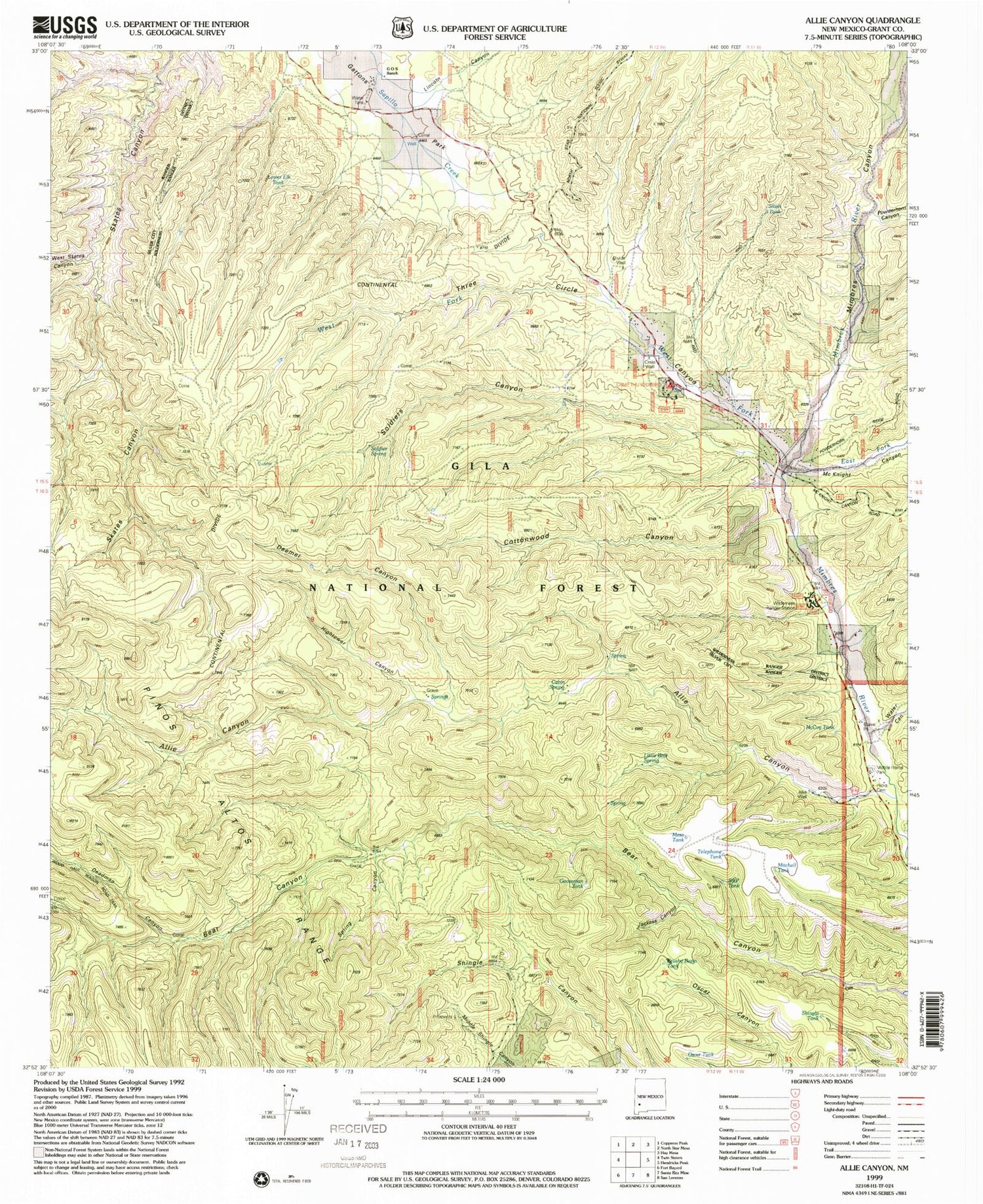
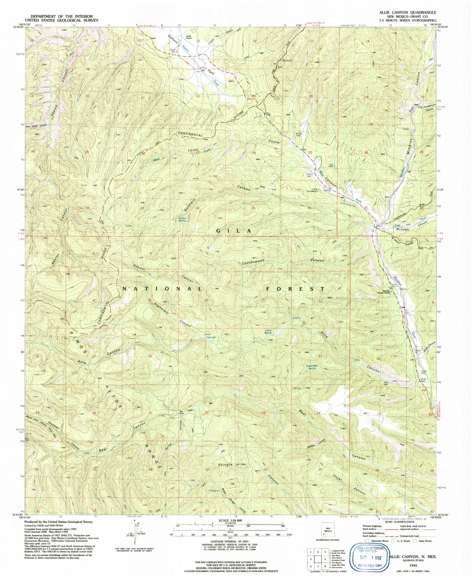
Classic USGS Allie Canyon New Mexico 7.5'x7.5' Topo Map
Couldn't load pickup availability
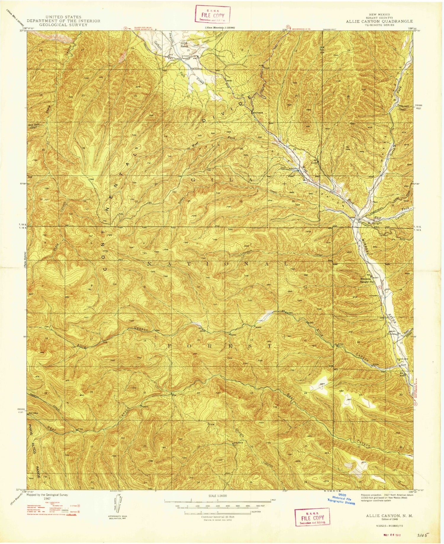
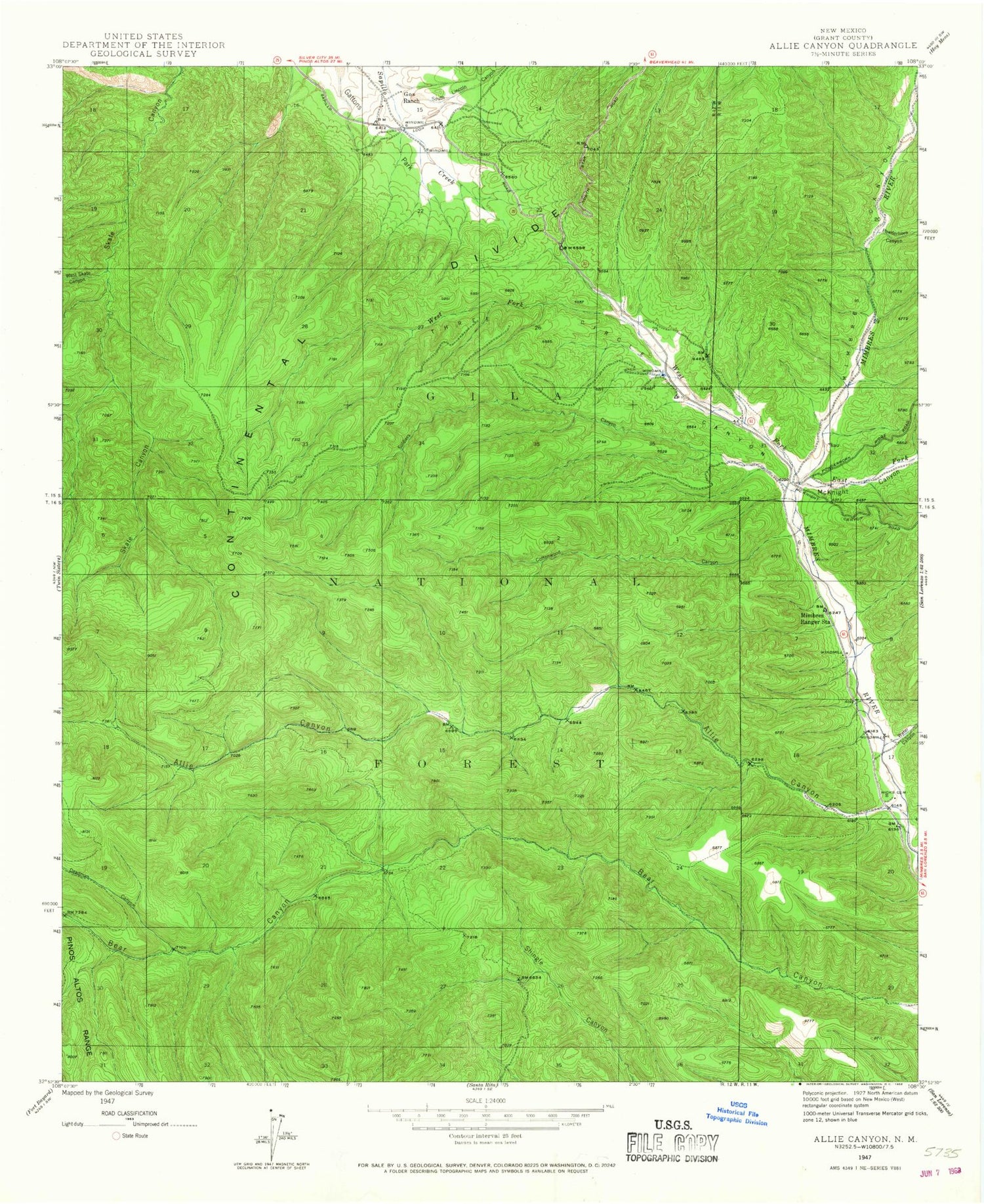
Historical USGS topographic quad map of Allie Canyon in the state of New Mexico. Typical map scale is 1:24,000, but may vary for certain years, if available. Print size: 24" x 27"
This quadrangle is in the following counties: Grant.
The map contains contour lines, roads, rivers, towns, and lakes. Printed on high-quality waterproof paper with UV fade-resistant inks, and shipped rolled.
Contains the following named places: Mesa Tank, Gooseman Tank, Mitchell Tank, Telephone Tank, Gos Organizational Site, Continental Tank, Slash Tank, T-Eleven Tank, Elk Pasture Tank, Corner Spring, Steer Tank, Camp Thunderbird Campground, Unknown Tank, Deemer Canyon, Cottonwood Tank, Redgate Corral, Shingle Tank, Brushy Basin Tank, Allie Well, Cabin Spring, Camp Thunderbird, Hightower Canyon, Jackass Canyon, Little Bear Spring, Spring Canyon, Allie Canyon, Cottonwood Canyon, Deadman Canyon, East Canyon, East Fork Mimbres River, Gattons Park, G O S Ranch, Hicks Cemetery, Lincoln Canyon, McKnight Canyon, Mimbres District Ranger Station, Mimbres Canyon, Powderhorn Canyon, Soldiers Canyon, Three Circle Canyon, Water Canyon, West Fork Mimbres River, West Skates Canyon, Laney Spring, NMBS RG ST Water Well, 00011 Water Well, 00009 Water Well, 00010 Water Well, 00012 Water Well, Divide Well, First Water Spring, Circle Well, Soldier Spring, Upper Cottonwood Spring, B and P Tank, Divide Well, Lower Elk Tank, McCoy Tank, Oscar Tank, Camp Thunderbird Upper Mimbres Substation 2 Volunteer Fire Station, Mesa Tank, Gooseman Tank, Mitchell Tank, Telephone Tank, Gos Organizational Site, Continental Tank, Slash Tank, T-Eleven Tank, Elk Pasture Tank, Corner Spring, Steer Tank, Camp Thunderbird Campground, Unknown Tank, Deemer Canyon, Cottonwood Tank, Redgate Corral, Shingle Tank, Brushy Basin Tank, Allie Well, Cabin Spring, Camp Thunderbird, Hightower Canyon, Jackass Canyon, Little Bear Spring, Spring Canyon, Allie Canyon, Cottonwood Canyon, Deadman Canyon, East Canyon, East Fork Mimbres River, Gattons Park, G O S Ranch, Hicks Cemetery, Lincoln Canyon, McKnight Canyon, Mimbres District Ranger Station, Mimbres Canyon, Powderhorn Canyon, Soldiers Canyon, Three Circle Canyon, Water Canyon, West Fork Mimbres River, West Skates Canyon, Laney Spring, NMBS RG ST Water Well, 00011 Water Well, 00009 Water Well, 00010 Water Well, 00012 Water Well, Divide Well, First Water Spring, Circle Well, Soldier Spring, Upper Cottonwood Spring, B and P Tank, Divide Well, Lower Elk Tank, McCoy Tank, Oscar Tank, Camp Thunderbird Upper Mimbres Substation 2 Volunteer Fire Station, Mesa Tank, Gooseman Tank, Mitchell Tank, Telephone Tank, Gos Organizational Site, Continental Tank, Slash Tank, T-Eleven Tank, Elk Pasture Tank, Corner Spring, Steer Tank, Camp Thunderbird Campground, Unknown Tank, Deemer Canyon, Cottonwood Tank, Redgate Corral, Shingle Tank, Brushy Basin Tank, Allie Well, Cabin Spring, Camp Thunderbird, Hightower Canyon, Jackass Canyon, Little Bear Spring, Spring Canyon, Allie Canyon, Cottonwood Canyon, Deadman Canyon, East Canyon, East Fork Mimbres River, Gattons Park, G O S Ranch, Hicks Cemetery, Lincoln Canyon, McKnight Canyon, Mimbres District Ranger Station, Mimbres Canyon, Powderhorn Canyon, Soldiers Canyon, Three Circle Canyon, Water Canyon, West Fork Mimbres River, West Skates Canyon, Laney Spring, NMBS RG ST Water Well, 00011 Water Well, 00009 Water Well, 00010 Water Well, 00012 Water Well, Divide Well, First Water Spring, Circle Well, Soldier Spring, Upper Cottonwood Spring, B and P Tank, Divide Well, Lower Elk Tank, McCoy Tank, Oscar Tank, Camp Thunderbird Upper Mimbres Substation 2 Volunteer Fire Station