
MyTopo
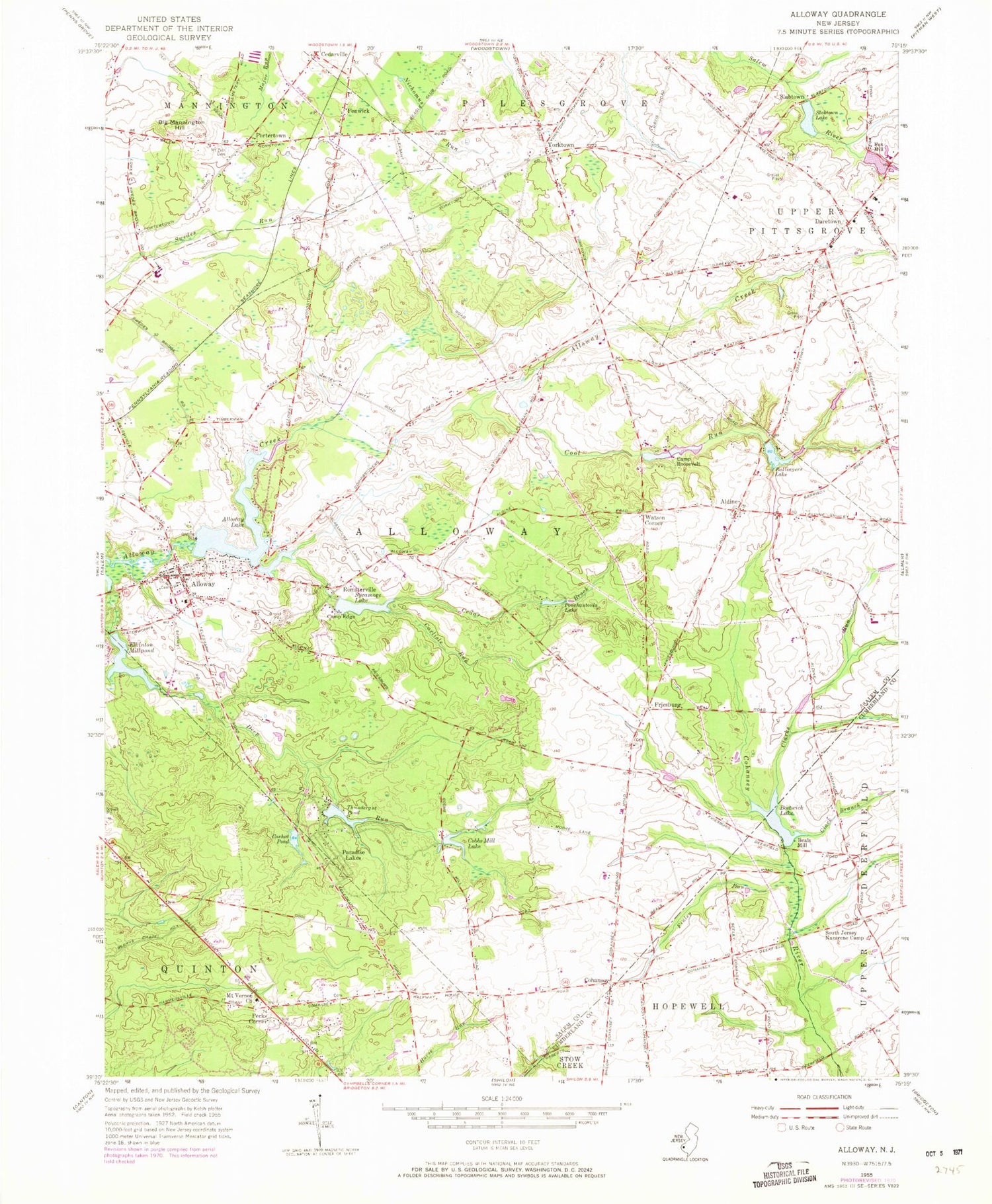
Classic USGS Alloway New Jersey 7.5'x7.5' Topo Map
Couldn't load pickup availability
Historical USGS topographic quad map of Alloway in the state of New Jersey. Map scale may vary for some years, but is generally around 1:24,000. Print size is approximately 24" x 27"
This quadrangle is in the following counties: Cumberland, Salem.
The map contains contour lines, roads, rivers, towns, and lakes. Printed on high-quality waterproof paper with UV fade-resistant inks, and shipped rolled.
Contains the following named places: Aldine, Aldine United Methodist Cemetery, Alloway, Alloway Airfield, Alloway Baptist Cemetery, Alloway Census Designated Place, Alloway Junction, Alloway Lake, Alloway Lake Dam, Alloway Post Office, Alloway Township Ambulance Corporation, Alloway Township Fire Company, Alloway Township School, Ballingers Lake, Ballingers Mill, Ballingers Mill Pond Dam, Beals Mill, Big Mannington Hill, Bostwick Lake, Bostwicks Pond Dam, Camp Edge, Camp Roosevelt, Carlisle Run, Cedar Brook, Cedarville, Clark Branch, Clarks Run, Cobbs Mill, Cobbs Mill Dam, Cobbs Mill Lake, Cohansey, Cohansey Seventh Day Adventist School, Cool Run, Coxhat Pond, Coxhat Pond Dam, Daretown, Daretown Fire Company, Daretown Lake, Daretown Lake Dam, Daretown School, Elkinton Millpond, Fenwick, Finley Run, Foxs Mill, Friesburg, Houses Pond, Mount Vernon Church, Mount Zion Cemetery, Mower, Oakland, Paradise Lakes, Paulding, Pecks Corner, Ponchantoula Lake, Portertown, Remsterville, Riddleton, Salem County, Slabtown, Slabtown Lake, South Jersey Nazarene Camp, Stockington, Strang School Ranch Hope for Boys, Sycamore Lake, Thundergut Pond, Thundergut Pond Dam, Township of Alloway, Watson Corner, Watsons Corner, Watsons Mill Pond, Wentzell-Wilson Dam, Wentzell-Wilson Pond, Woods Mills, Yorktown, ZIP Code: 08001


