
MyTopo
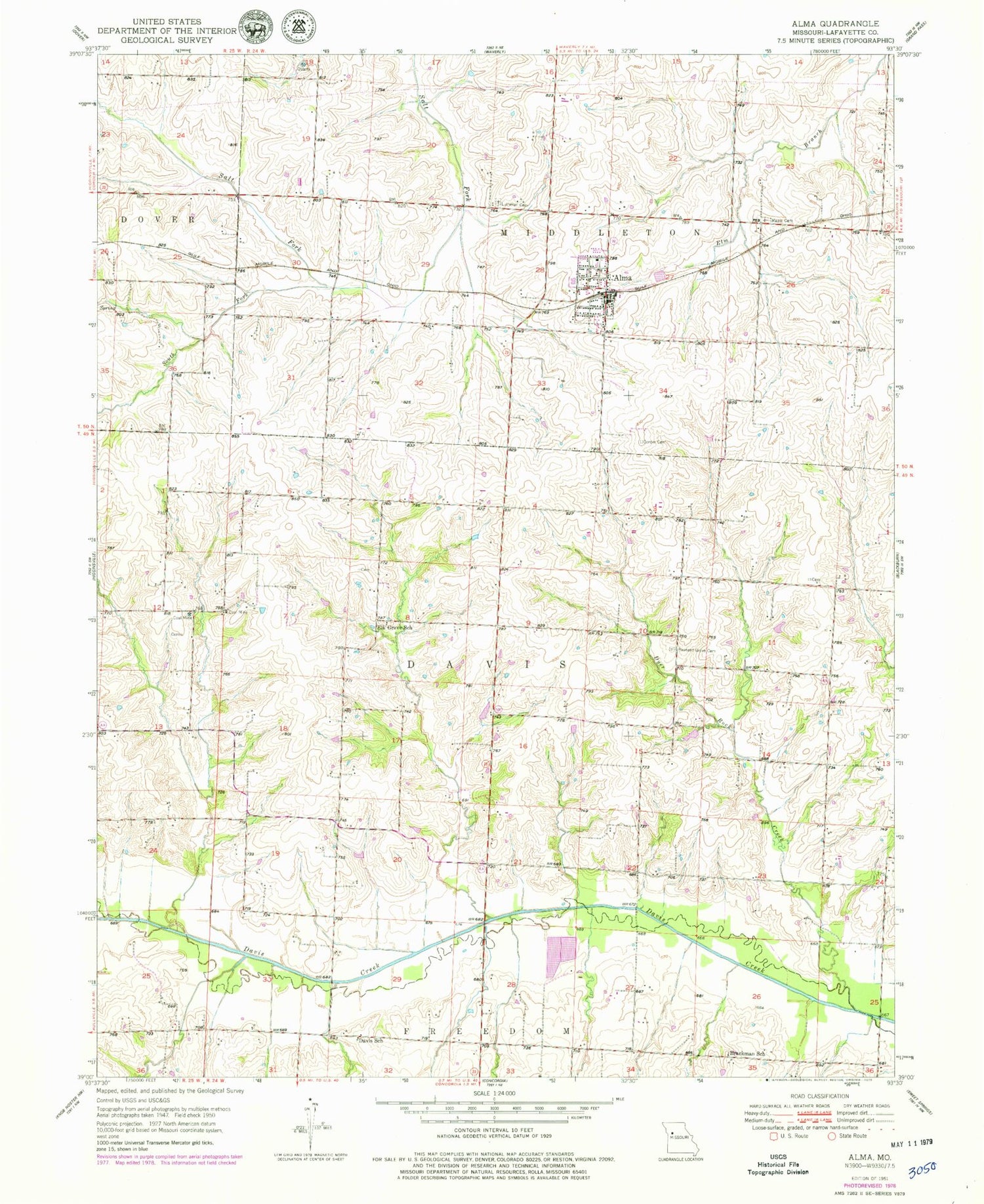
Classic USGS Alma Missouri 7.5'x7.5' Topo Map
Couldn't load pickup availability
Historical USGS topographic quad map of Alma in the state of Missouri. Map scale may vary for some years, but is generally around 1:24,000. Print size is approximately 24" x 27"
This quadrangle is in the following counties: Lafayette.
The map contains contour lines, roads, rivers, towns, and lakes. Printed on high-quality waterproof paper with UV fade-resistant inks, and shipped rolled.
Contains the following named places: Alma, Alma Fire Protection District, Alma Police Department, Alma Post Office, Brackman School, City of Alma, Corder Cemetery, Davis Lutheran School, Davis School, Dyer Rock Creek, Elk Grove School, Flora School, Hickory Grove School, Lovercamp Lake Dam, Lutheran Cemetery, Maplewood Cemetery, Nienhueser North Lake Dam, Nienhueser South Lake Dam, North Pond, Pleasant Grove Cemetery, Santa Fe High School, Schuette Lake Dam, South Fork Salt Fork, Stockman Lake Dam, Trinity Lutheran School, Wagner Lake Dam, Winters Lake Dam, ZIP Codes: 64001, 64021


