

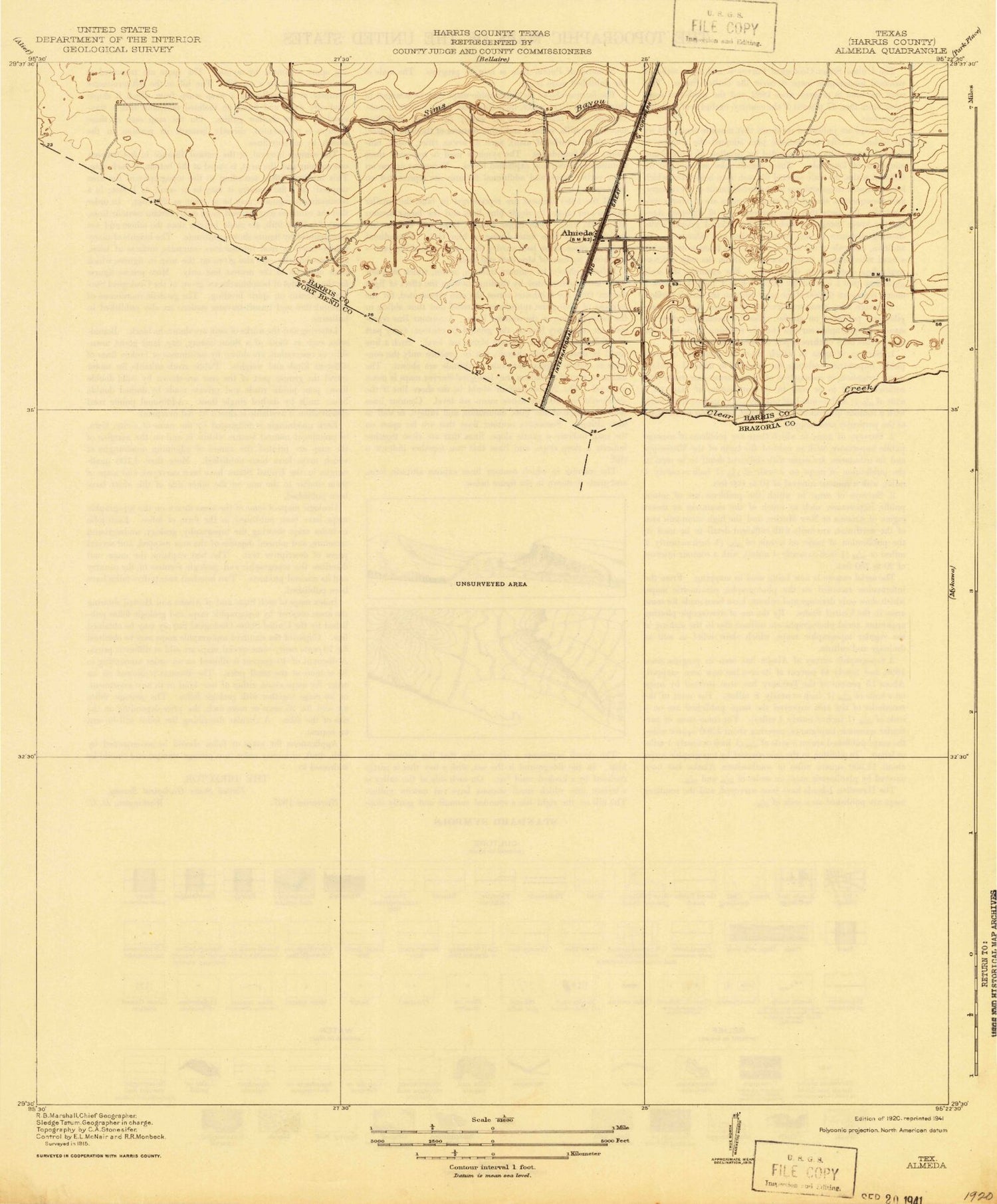
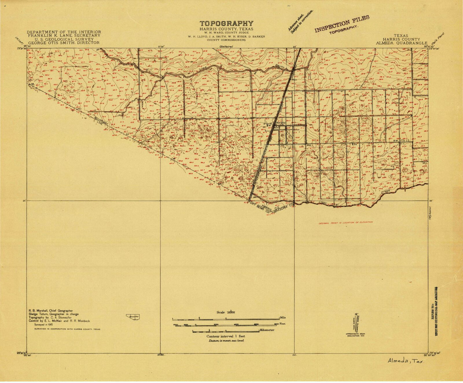
MyTopo
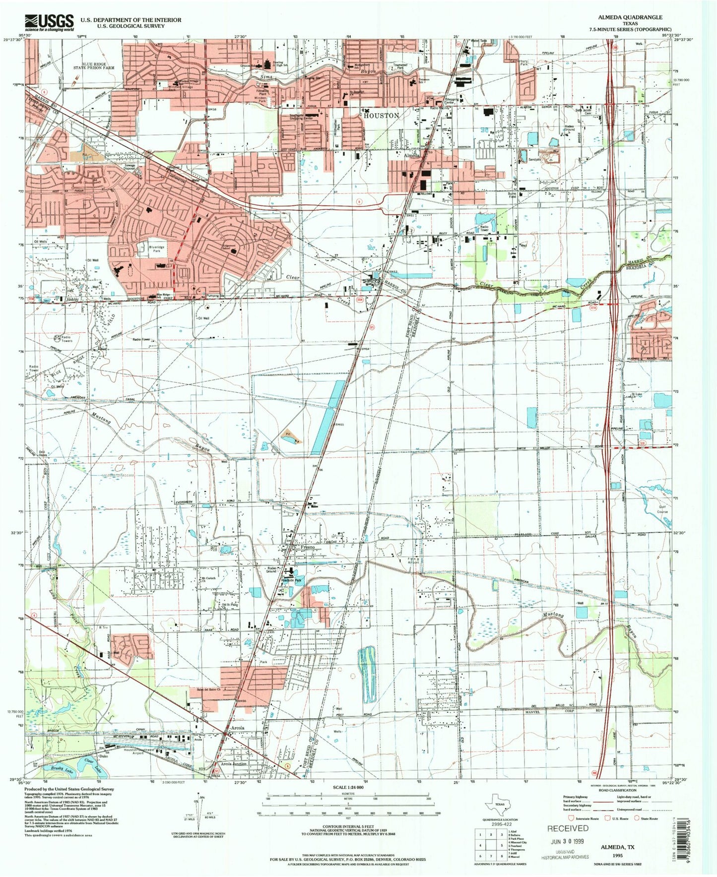
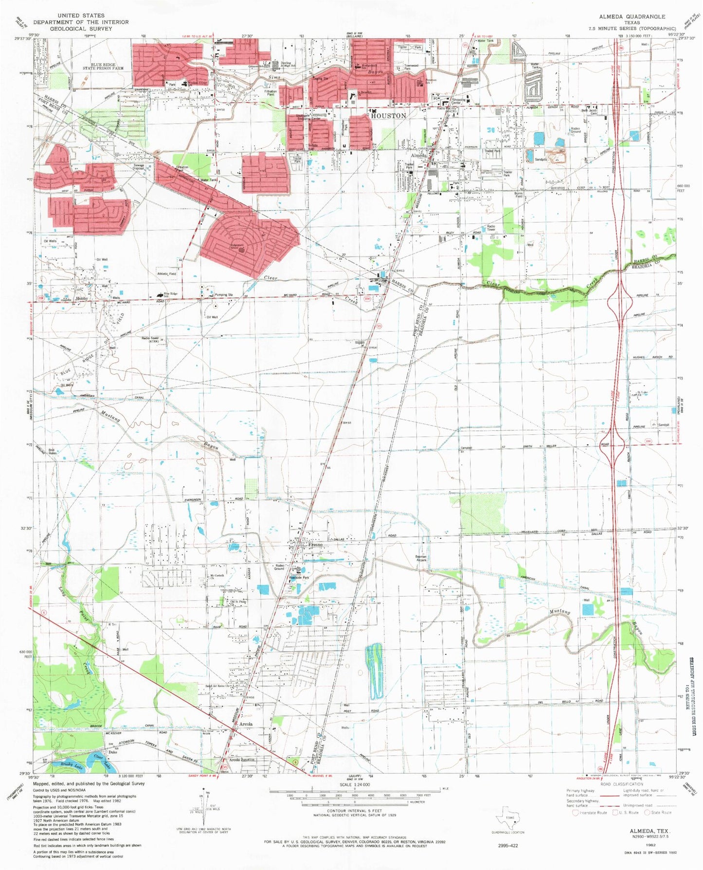
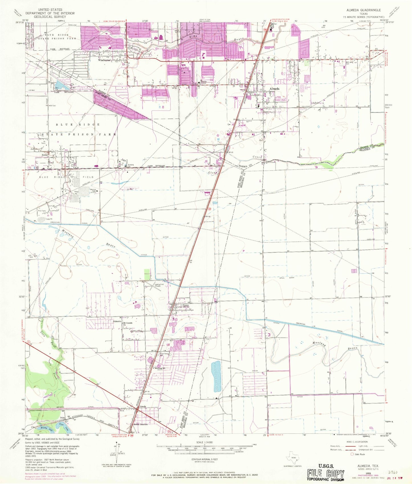
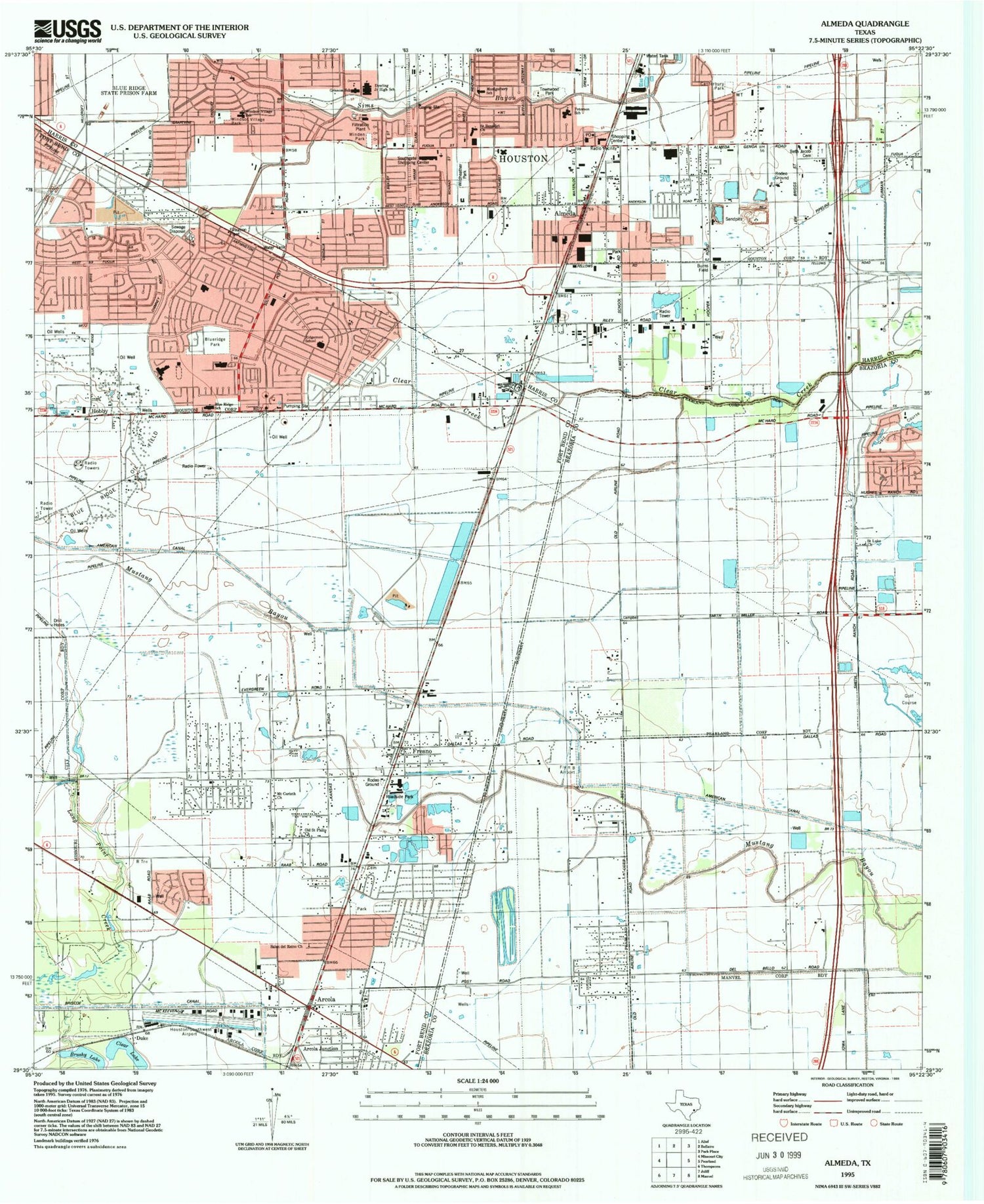
Classic USGS Almeda Texas 7.5'x7.5' Topo Map
Couldn't load pickup availability
Historical USGS topographic quad map of Almeda in the state of Texas. Map scale may vary for some years, but is generally around 1:24,000. Print size is approximately 24" x 27"
This quadrangle is in the following counties: Brazoria, Fort Bend, Harris.
The map contains contour lines, roads, rivers, towns, and lakes. Printed on high-quality waterproof paper with UV fade-resistant inks, and shipped rolled.
Contains the following named places: Abiding Missionary Baptist Church, Almeda, Almeda Baptist Church, Almeda Elementary School, Almeda Elementary SPARK Park Trail, Almeda Manor, Almeda Park, Almeda Post Office, Almeda United Methodist Church, Anderson Road Baptist Church, Arcola City Hall, Arcola Junction, Arcola Police Department, Arcola-Fresno Cemetery, Beth Jacob Cemetery, Blue Ridge Elementary School, Blue Ridge Oil Field, Blue Ridge State Prison Farm, Briar Vista, Briargate Elementary School, Briarvilla, Brookfield Baptist Church, Burton Elementary School, Canterbury Park, Canterbury Village, Christ Presbyterian Church, City of Arcola, Crossroads Pentecostal Church, Dowling Middle School, Duke, Dunbarton Oaks, Episcopal Church of the Resurrection, First Outreach Missionary Baptist Church, Flyin' B Airport, Fresno, Fresno Census Designated Place, Fresno Post Office, Fresno Volunteer Fire Department, Gospel Truth Missionary Baptist Church, Greater Holy Trinity Missionary Baptist Church, Grissom Elementary School, Grissom Elementary SPARK Park Trail, Hightower High School, Hightower High School Magnet School, Hobby, Holy Trinity Missionary Baptist Church, Houston Fire Department Station 59, Houston Fire Department Station 80, Houston Police Department - Hiram Clarke, Houston-Southwest Airport, Iglesia Bautista Townwood Church, Iglesia Evangelica Cristo Viene, Keightley Hospital, KHCB-FM (Houston), KHSH-TV (Alvin), KHTV-TV (Houston), KLTR-FM (Houston), KMJQ-FM (Houston), KPRC-TV (Houston), KRIV-TV (Houston), KTRK-TV (Houston), KUHF-FM (Houston), KUHT-TV (Houston), KZJL-TV (Houston), L B Goodman Elementary School, Life Flight/Refuel Heliport, Long Point Creek, McAuliffe Middle School, Meredeth Manor, Monarch Estates, Montgomery Elementary School, Montgomery Elementary SPARK Park Trail, Mount Cornith Church, Mustang School, New Faith Church, Palmetto, Petersen Elementary School, Petersen Elementary SPARK Park Trail, Post Oak Village, Redeemed Chapel Church, Resurrection Lutheran Church, Ridgegate, Ridgegate Elementary School, Ridgemont, Ridgemont Elementary School, Saint Mark the Evangelist Catholic Church, Saint Thomas Catholic Church, Saint Vincent de Paul Society Church of Saint Marks, South Main Plaza, South Post Oak Baptist Church, Southway Community Church, Spanish United Pentecostal Church, Tiffany Gardens, Townwood Park, Waterbury, Westbrook, Westhampton, Wildheather, Wildheather Park, Willowridge High School, Willowridge High School Baseball Field, Willowridge High School Football Field, Willowridge High School Softball Field, Winchester, Windsor Village Elementary School, Windsor Village Park, Windsor Village United Methodist Church, Word of Grace Missionary Baptist Church, ZIP Codes: 77047, 77053, 77085, 77545