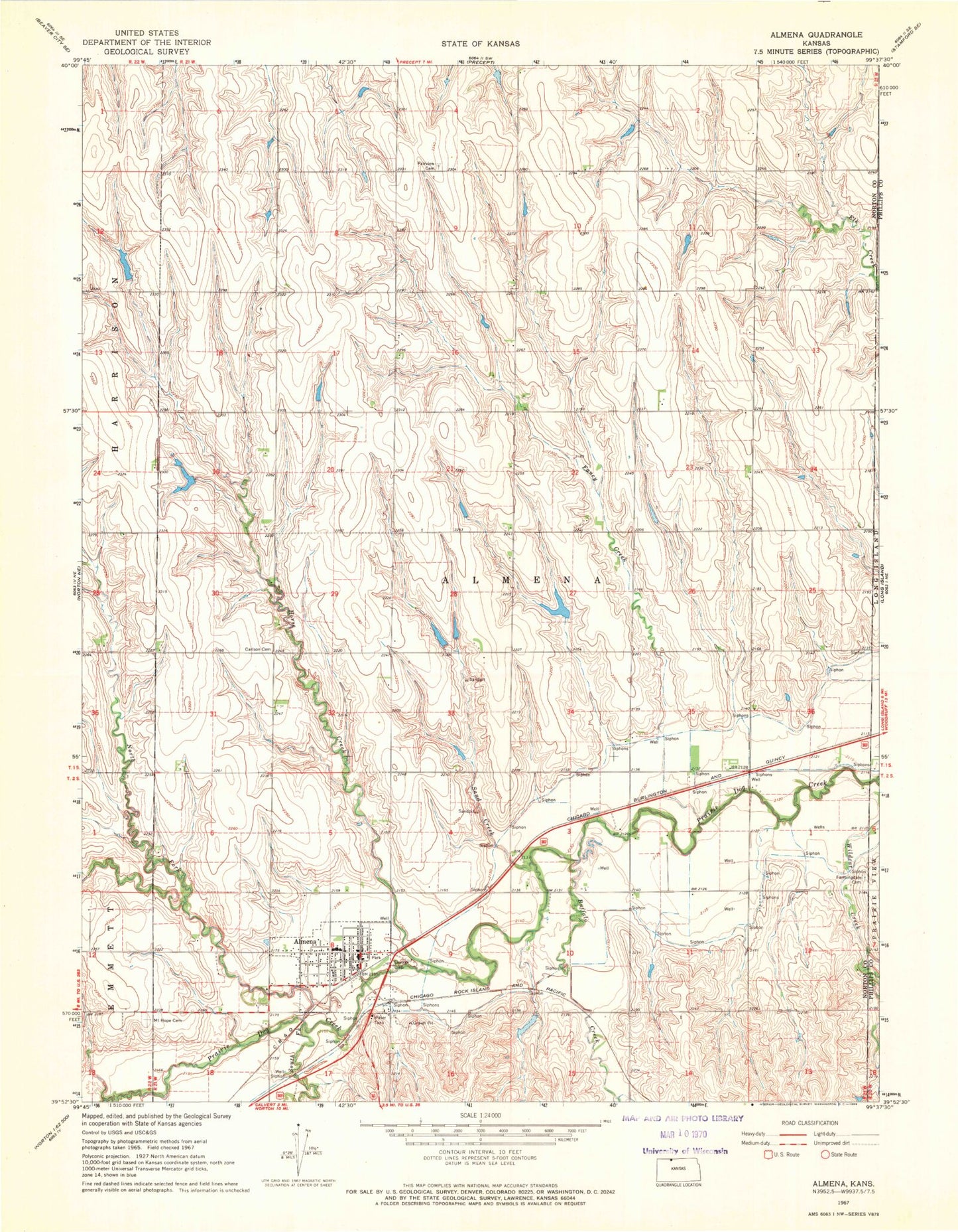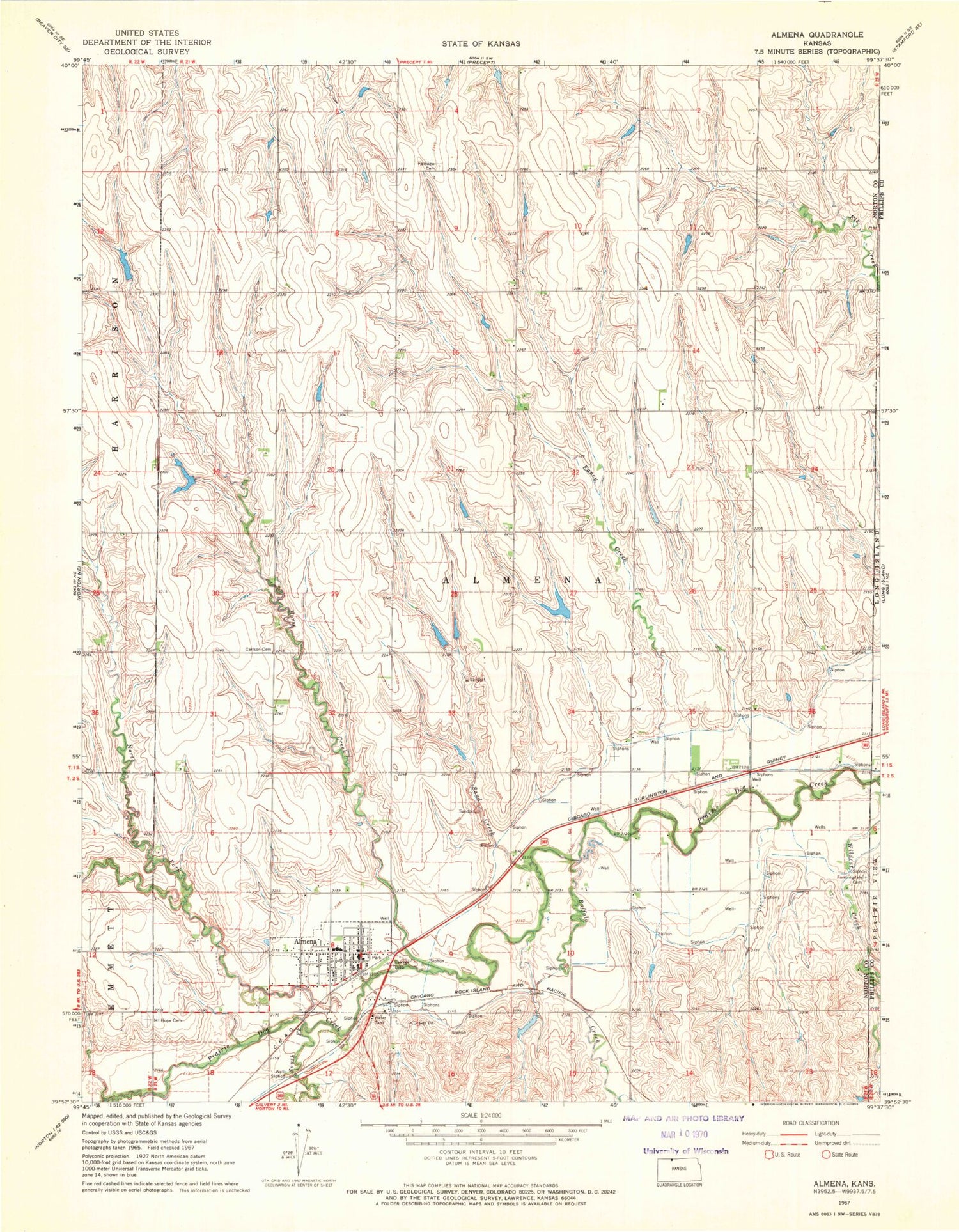
MyTopo
Classic USGS Almena Kansas 7.5'x7.5' Topo Map
Couldn't load pickup availability
Historical USGS topographic quad map of Almena in the state of Kansas. Map scale may vary for some years, but is generally around 1:24,000. Print size is approximately 24" x 27"
This quadrangle is in the following counties: Norton, Phillips.
The map contains contour lines, roads, rivers, towns, and lakes. Printed on high-quality waterproof paper with UV fade-resistant inks, and shipped rolled.
Contains the following named places: Almena, Almena Agri - Services Grain Elevator Number 1, Almena Area Fire Department, Almena City Hall, Almena City Lake, Almena City Library, Almena Congregational Church, Almena Elementary School, Almena Post Office, Almena United Methodist Church, Almena Wastewater Plant, Buffalo Creek, Carlson Cemetery, City of Almena, Fairview Cemetery, Fancy Creek, Farmingdale Cemetery, Horse Creek, Mount Hope Cemetery, North Fork Prairie Dog Creek, Northern Valley High School, Rayville, Sand Creek, South Fork Prairie Dog Creek, Township of Almena-District 4, Wildcat Creek, ZIP Code: 67622