
MyTopo
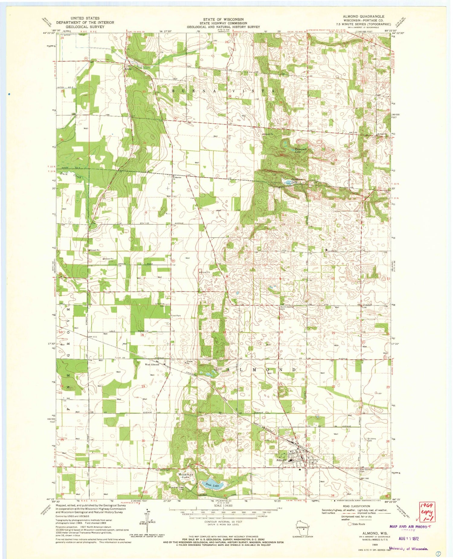
Classic USGS Almond Wisconsin 7.5'x7.5' Topo Map
Couldn't load pickup availability
Historical USGS topographic quad map of Almond in the state of Wisconsin. Map scale may vary for some years, but is generally around 1:24,000. Print size is approximately 24" x 27"
This quadrangle is in the following counties: Portage.
The map contains contour lines, roads, rivers, towns, and lakes. Printed on high-quality waterproof paper with UV fade-resistant inks, and shipped rolled.
Contains the following named places: Almond, Almond Bancroft Elementary School, Almond Bancroft High School, Almond Bancroft Middle School, Almond Post Office, Almond Volunteer Fire Department, Bass Lake, East German Cemetery, Frost Park, Guardian Angel Cemetery, Keene, Keene School, Lone Pine Cemetery, North Almond Cemetery, Patterson Lake, Saint Johns Cemetery, Saint Martins Church, Saint Pauls Church, Spiritland Cemetery, Sunnyside School, Swan Field, Tamarack Lake, Town of Almond, Town of Buena Vista, Village of Almond, Washburn Lake, West Almond


