MyTopo
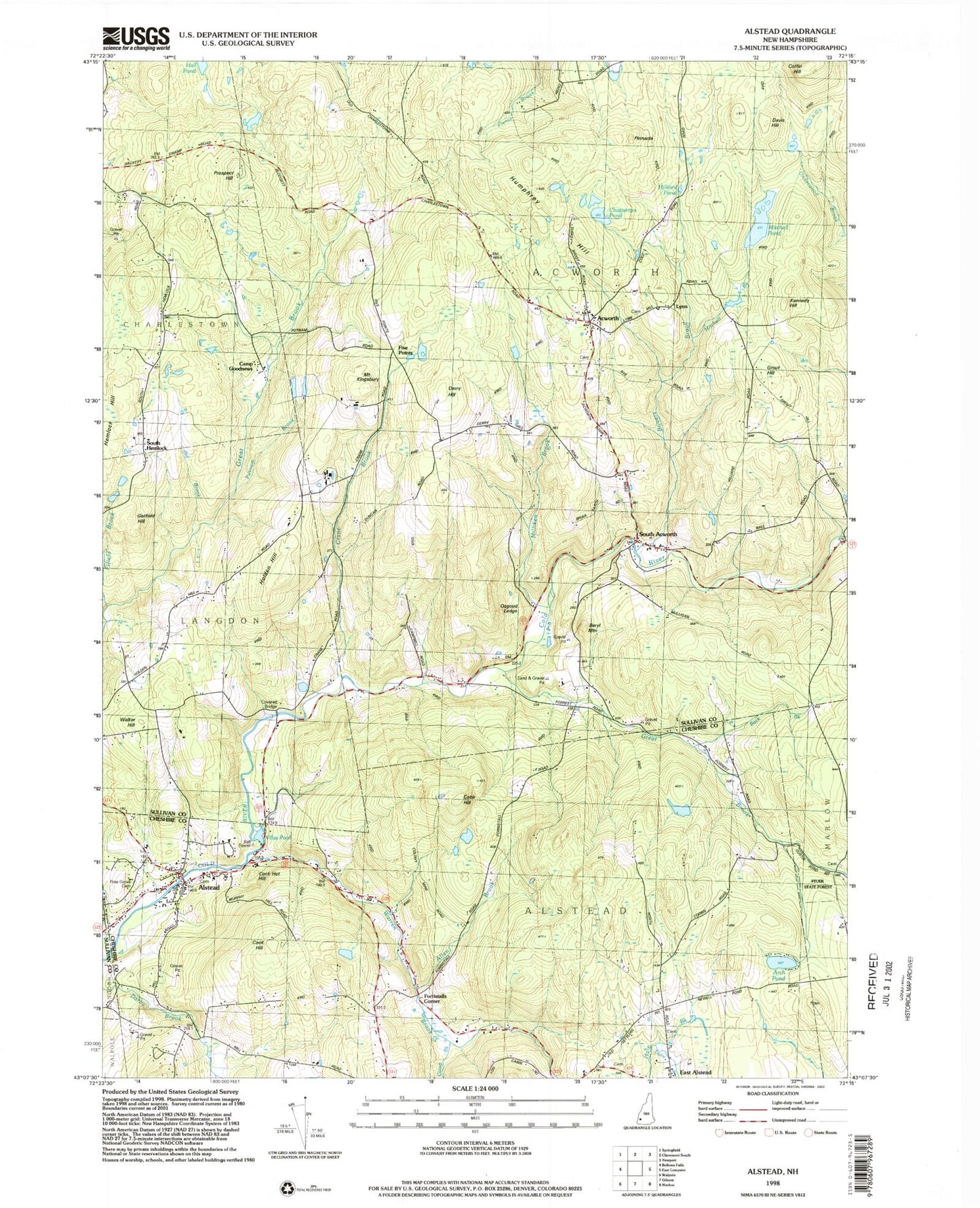
Classic USGS Alstead New Hampshire 7.5'x7.5' Topo Map
Couldn't load pickup availability
Historical USGS topographic quad map of Alstead in the state of New Hampshire. Typical map scale is 1:24,000, but may vary for certain years, if available. Print size: 24" x 27"
This quadrangle is in the following counties: Cheshire, Sullivan.
The map contains contour lines, roads, rivers, towns, and lakes. Printed on high-quality waterproof paper with UV fade-resistant inks, and shipped rolled.
Contains the following named places: Acworth, Alstead, Beryl Mountain, Bowers Brook, Camp Brook, Chatterton Pond, Cobb Hill, Cock Hat Hill, Coffin Hill, Cook Hill, Crane Brook, Davis Hill, Derry Hill, Derry Hill School, Garfield Hill, Great Brook, Grout Hill, Hilliard Pond, Holden Hill, Humphrey Hill, Kennedy Hill, Milliken Brook, Milliken Brook, Mitchell Pond, Osgood Ledge, Pinnacle, Prospect Hill, South Acworth, Walker Hill, Warren Brook, Lynn, South Hemlock, Arch Pond, Town of Acworth, Vilas Pool Dam, Vilas Pool, Acworth Post Office, South Acworth Post Office, Alstead Post Office, Acworth Congregational Church, Acworth Center School, Acworth Silsby Library, Acworth Town Common, McDermott Bridge, Alstead Primary School, Alstead Village Third Congregational Church, Baker Corner Cemetery, Church of the Good Shepherd Universalist Society, East Alstead Second Congregational Church, Shedd-Porter Memorial Library, Vilas Middle School, Alstead Fire Department Village Station, Alstead Fire Department East Station, Acworth Volunteer Fire and Rescue Company, Alstead Police Department