
MyTopo
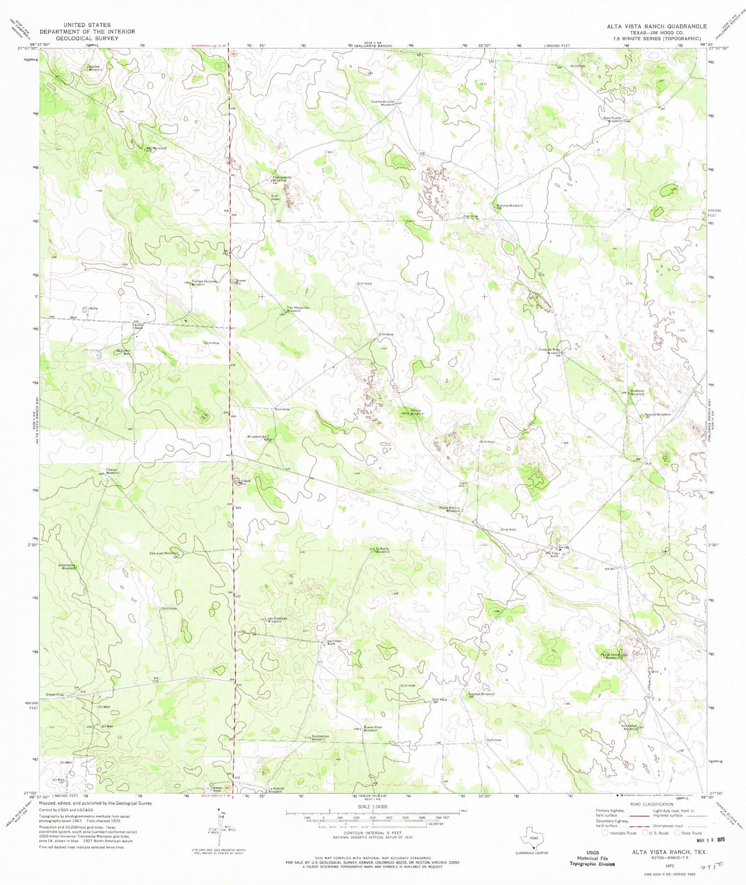
Classic USGS Alta Vista Ranch Texas 7.5'x7.5' Topo Map
Couldn't load pickup availability
Historical USGS topographic quad map of Alta Vista Ranch in the state of Texas. Map scale may vary for some years, but is generally around 1:24,000. Print size is approximately 24" x 27"
This quadrangle is in the following counties: Jim Hogg.
The map contains contour lines, roads, rivers, towns, and lakes. Printed on high-quality waterproof paper with UV fade-resistant inks, and shipped rolled.
Contains the following named places: Agapito Windmill, Alta Vista Ranch, Alto Windmill, Bueno Vista Windmill, Charco Windmill, Cinco de Mayo Windmill, Cuatro de Julio Windmill, El Cuero Well, El Norte Windmill, Golondrina Windmill, Guilita Windmill, Kaffie Ranch, La Huerta Windmill, Las Cuatas Ranch, Las Cuatitas Windmill, Mala Suerte Windmill, Medieros Windmill, Nochesitas Windmill, Palito Blanco Windmill, Pero Grande Windmill, Perrito Windmill, Posito Cerca Windmill, Puesta Del Sol Airport, Reposa Ranch, Retama Windmill, San Juan Windmill, San Rafael Windmill, Soledad Windmill, Trampa Colorado Windmill, Tres Mesquites Windmill, Windmill Number Seven


