
MyTopo
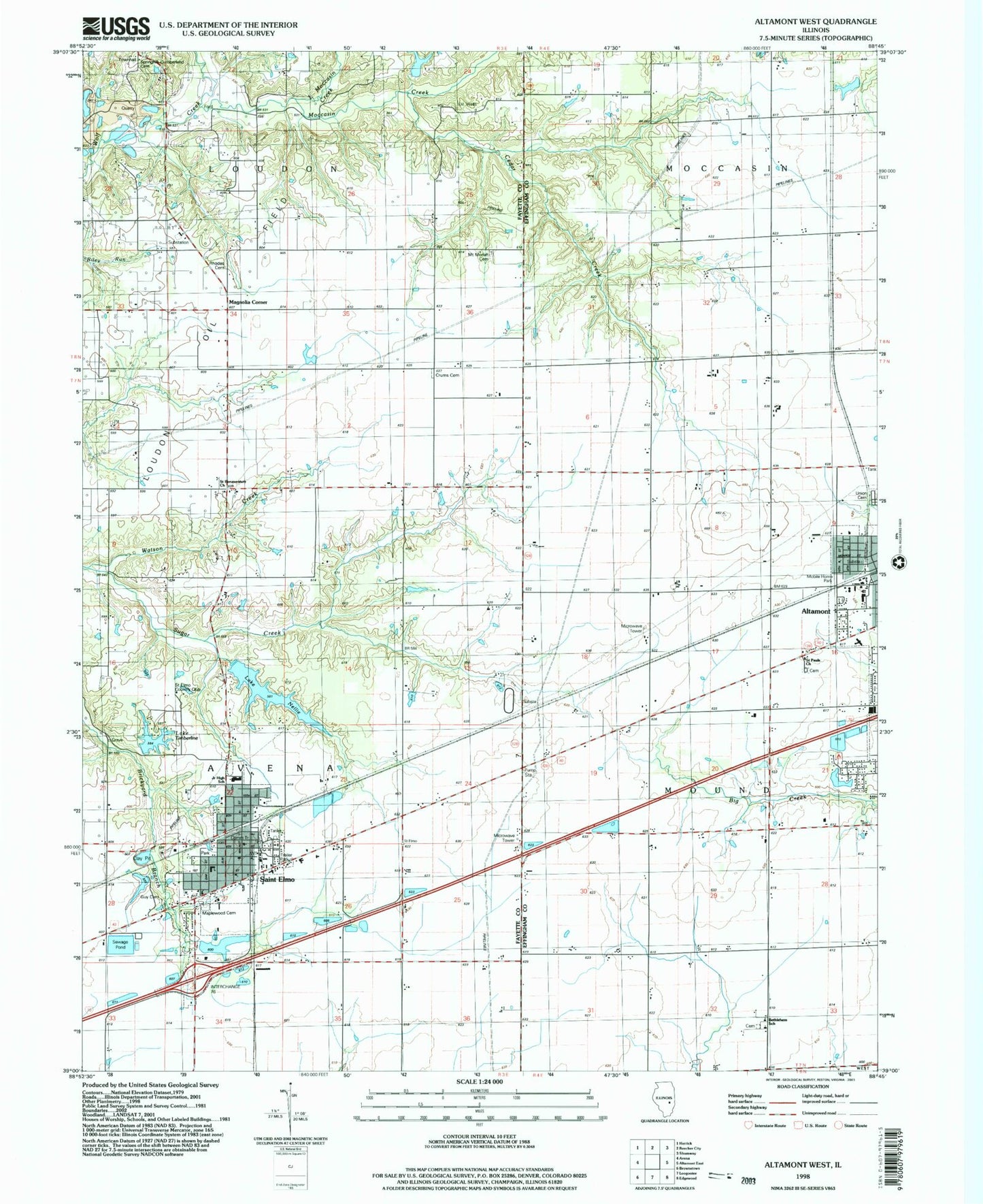
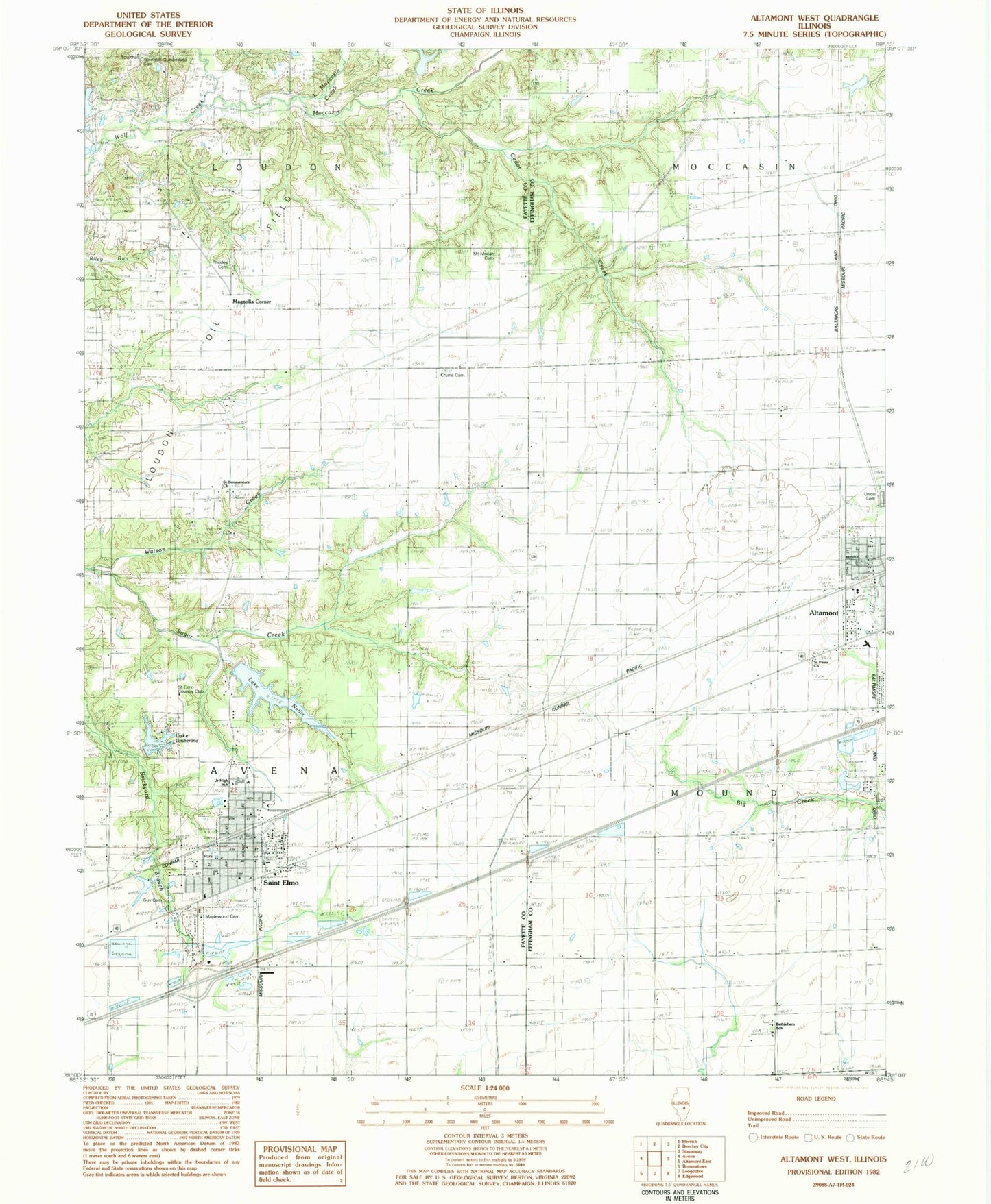
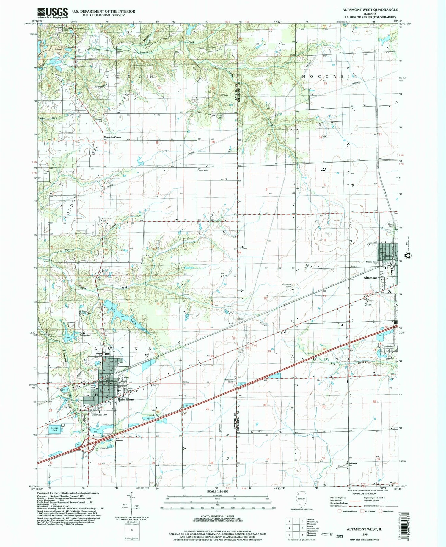
Classic USGS Altamont West Illinois 7.5'x7.5' Topo Map
Couldn't load pickup availability
Historical USGS topographic quad map of Altamont West in the state of Illinois. Map scale may vary for some years, but is generally around 1:24,000. Print size is approximately 24" x 27"
This quadrangle is in the following counties: Effingham, Fayette.
The map contains contour lines, roads, rivers, towns, and lakes. Printed on high-quality waterproof paper with UV fade-resistant inks, and shipped rolled.
Contains the following named places: Altamont Fire Protection District, Bails Timberline Lake Dam, Bethlehem Cemetery, Bethlehem School, Burrow Farms, Cedar Creek, City of Saint Elmo, Crums Chapel, Crums Chapel Cemetery, Diamond A Farms, Durbin School, Eureka School, First Assembly of God Church, First Baptist Church, First Christian Church, First Church of God, First United Methodist Church, Franklin School, Grant School, Guy Cemetery, Howards Point, Independence School, Kuebler RLA Airport, Lake Nellie, Lake Nellie Dam, Lake Timberline, Little Moccasin Creek, Loudon Townhall, Lutheran Care Center, Magnolia Corner, Maplewood Cemetery, Martin Box School, Moccasin Creek, Moll Farms, Mound School, Moundside Farm, Mount Moriah Cemetery, Prairie Cottage School, Rhodes Family Cemetery, Rock Cave Nature Preserve, Saint Bonaventure Cemetery, Saint Bonaventure Church, Saint Clares Roman Catholic Church, Saint Elmo, Saint Elmo Country Club, Saint Elmo Elementary School, Saint Elmo Fire Department, Saint Elmo Old City Reservoir, Saint Elmo Old City Reservoir Dam, Saint Elmo Police Department, Saint Elmo Post Office, Saint Elmo Senior High School, Saint Pauls Church, Spring Hill Cemetery, Star School, Sugar Creek, Township of Avena, Union Cemetery, ZIP Code: 62458